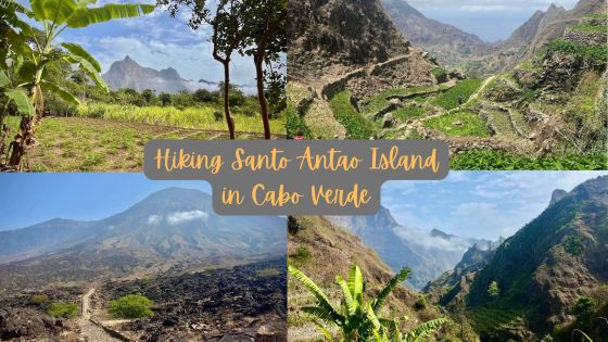
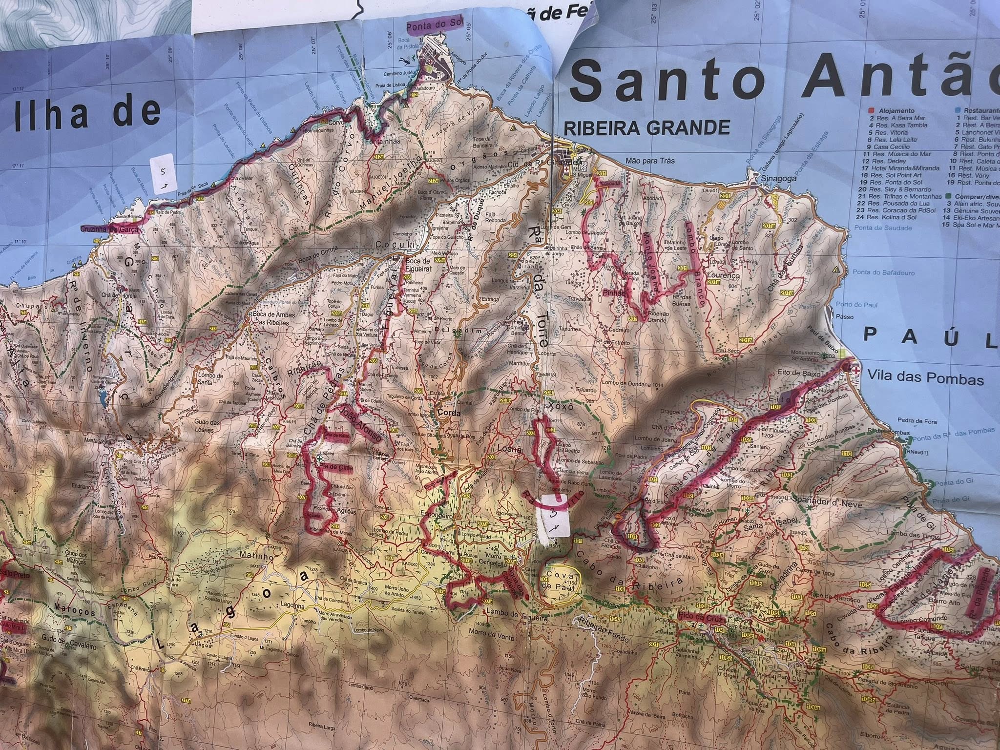
Hiking Santo Antao in Cabo Verde
I recently spent a full week exploring two islands in Cabo Verde, Sao Vicente and Santo Antao, the latter where I spent five days of hiking in paradise. If you’re up for an adventurous trekking trip with amazing scenery, check out my below description and favorite photos of the latest ‘Jan adventure’!
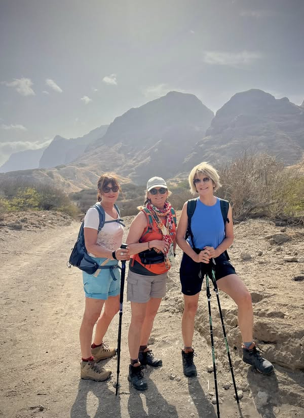
For the past few years, I’ve been doing adventure/hiking trips with girlfriends. This year we chose to go to Cabo Verde with a French touring company called Terres d’Aventure. In the past we used GAdventures for the Camino de Santiago walk and Corfu Greece hiking.
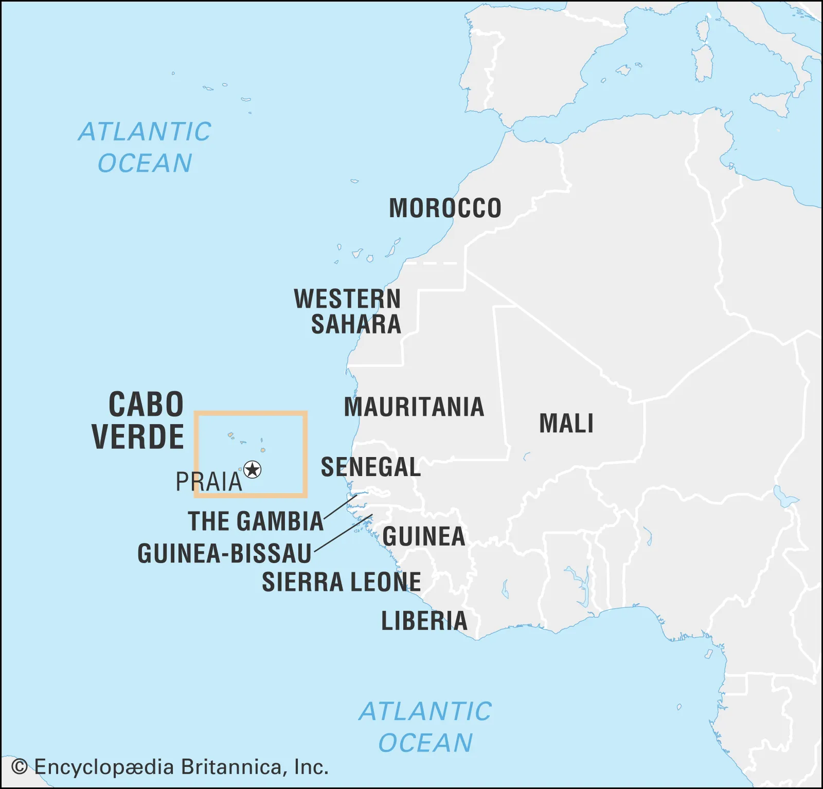
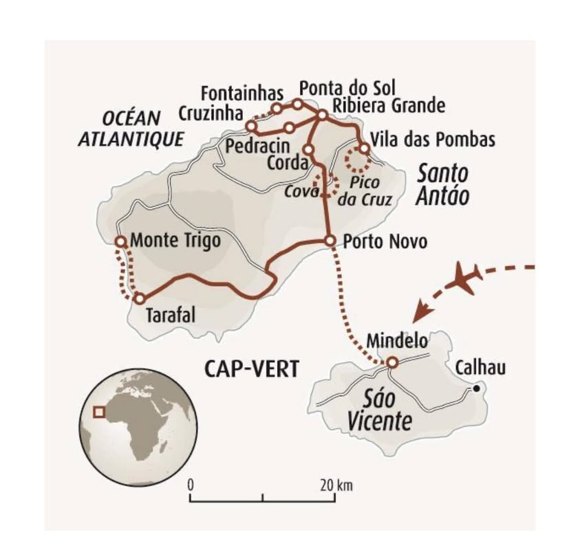
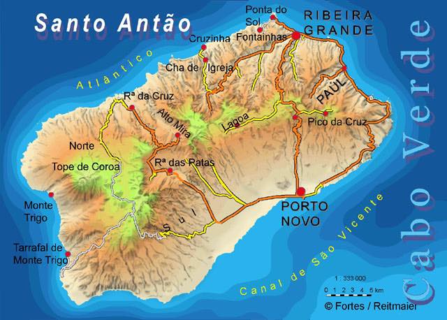
Cabo Verde or Cape Verde (Cap Vert in French) is a small Atlantic archipelago situated 385 miles (620 km) off the coast of Senegal. The 10 islands of this country, nine inhabited, represent a mixture of African, European and South American roots. The terrain of all islands is volcanic and comprise an area of 4,033 square kilometers. I visited the island of Sal several years ago for a kitesurfing and beach vacation, but this trip was very different.
Our organized tour included flights, hotels, meals, transportation (bus, ferries, fishing boat), and guided hikes. It was very well organized and a pleasure to rely on someone else to handle all the details. The French tour was called ‘Vallées luxuriantes et paradis perdu‘. If you are looking to discover an island like Santo Antao, I would highly recommend this hiking adventure!
- Day 1 – Flight to Mindelo on Sao Vicente island of Cabo Verde
- Day 2 – Ferry to Santo Antao Island and Hike near Cova Crater
- Day 3 – 2nd hike from Cruzinha to Ponta do Sol
- Day 4 – 3rd hike – Ribeira da Torre Valley
- Day 5 – 4th hike – Valley of Paul
- Day 6 – 5th hike – Tarrafal to Monte Trigo
- Day 7 – Ferry from Santo Antao to Sao Vicente
- Summary of Cabo Verde
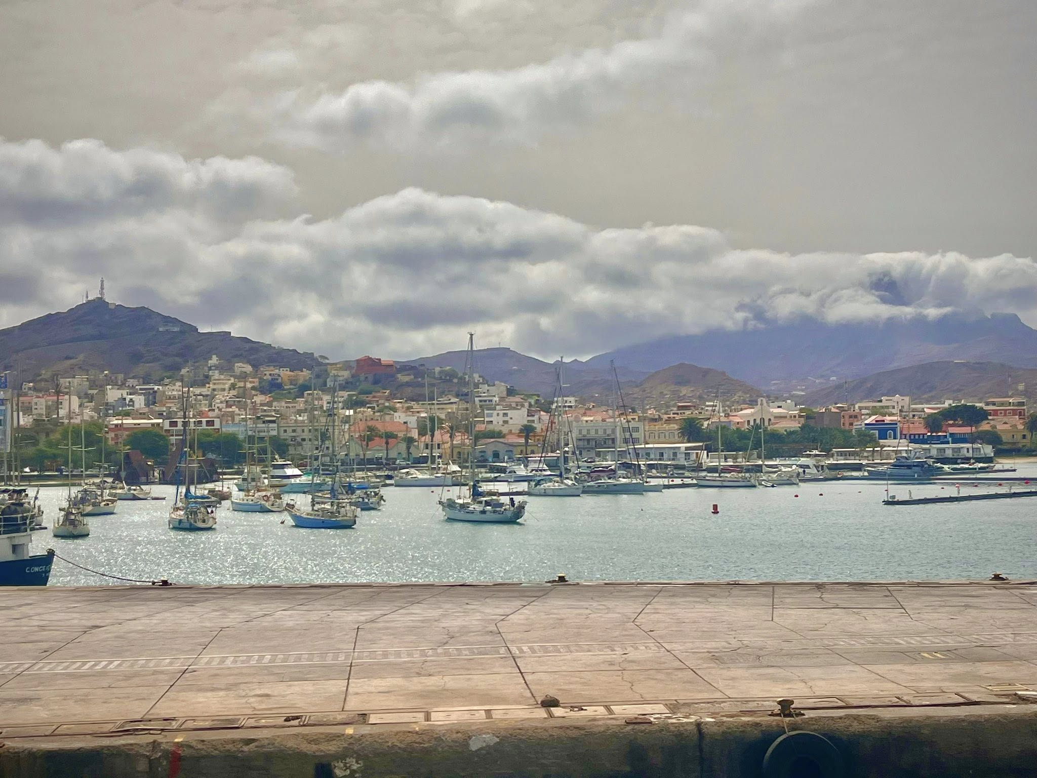
Day 1 – Flight to Mindelo on Sao Vicente island of Cabo Verde
Our first day was mostly a travel day. We woke up at 3am in a Geneva airport hotel and took the plane at 6am to Lisbon, Portugal. From there we had a 4-hour flight to Sao Vicente island and arrived at 12pm with a 3 hr earlier time difference from Switzerland.
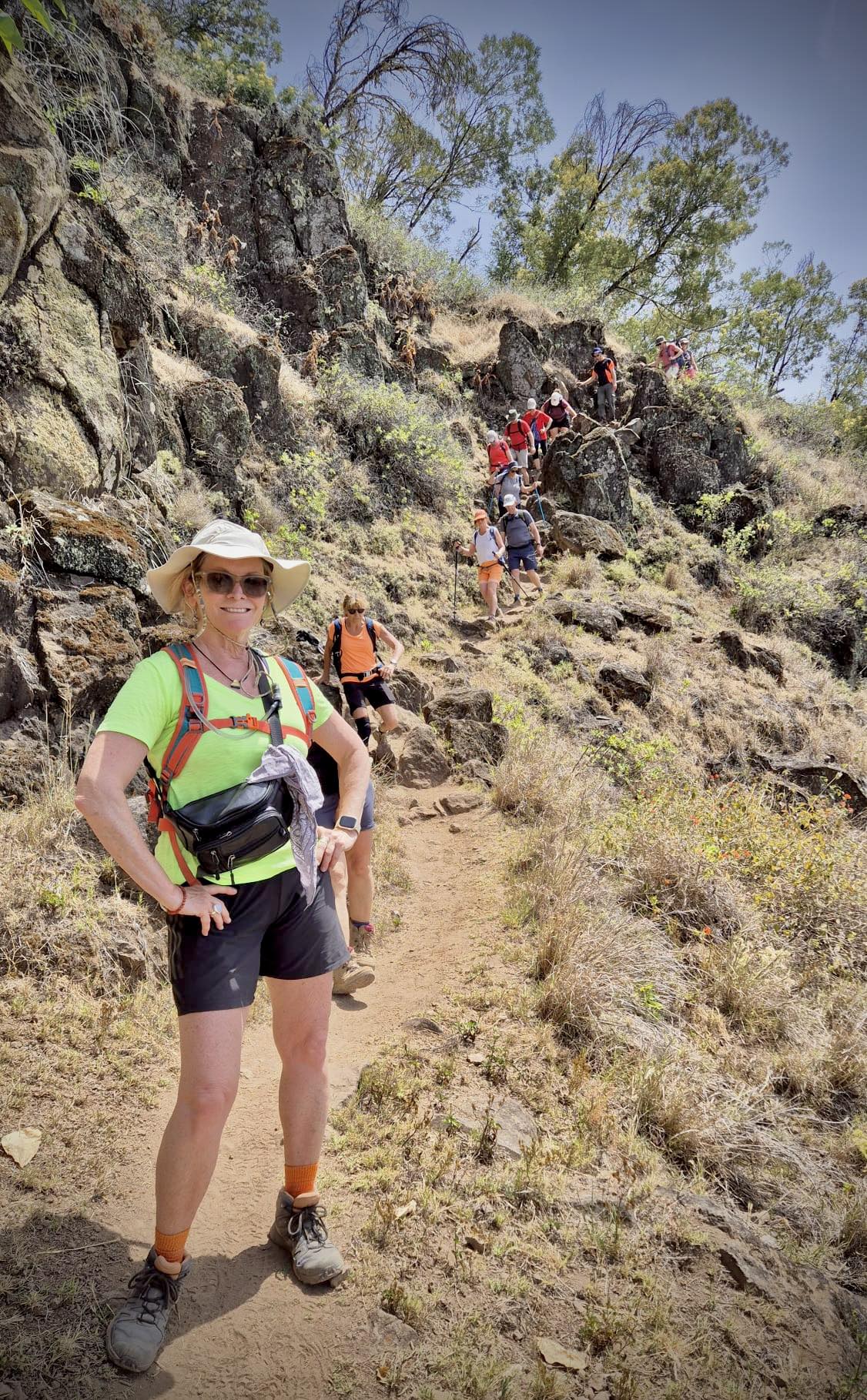
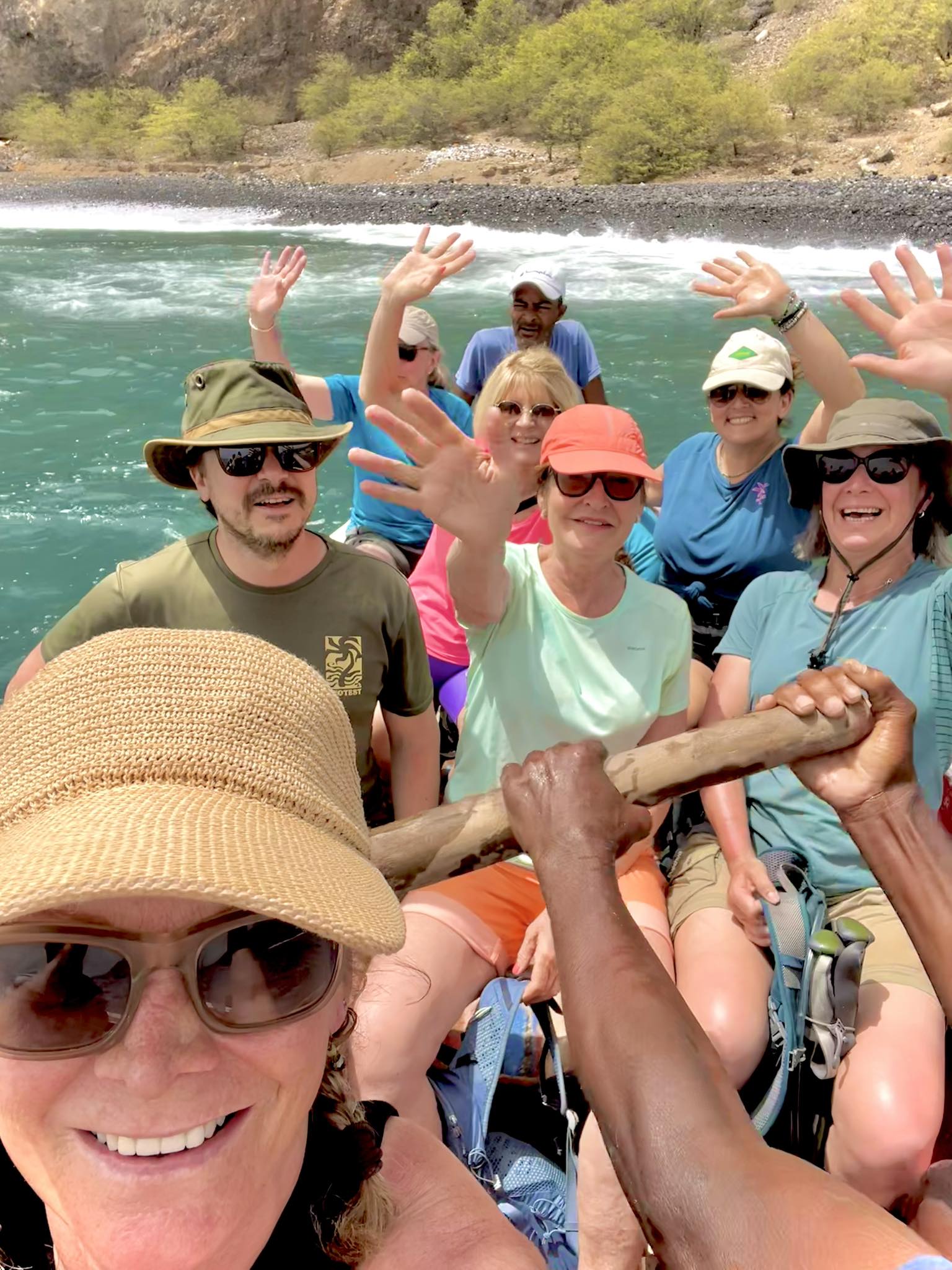
We were met at the airport by our friendly tour guide for the week, Maya. There were 15 people in our group, 2 from Belgium, 10 from different places in France, and 3 of us from Switzerland.
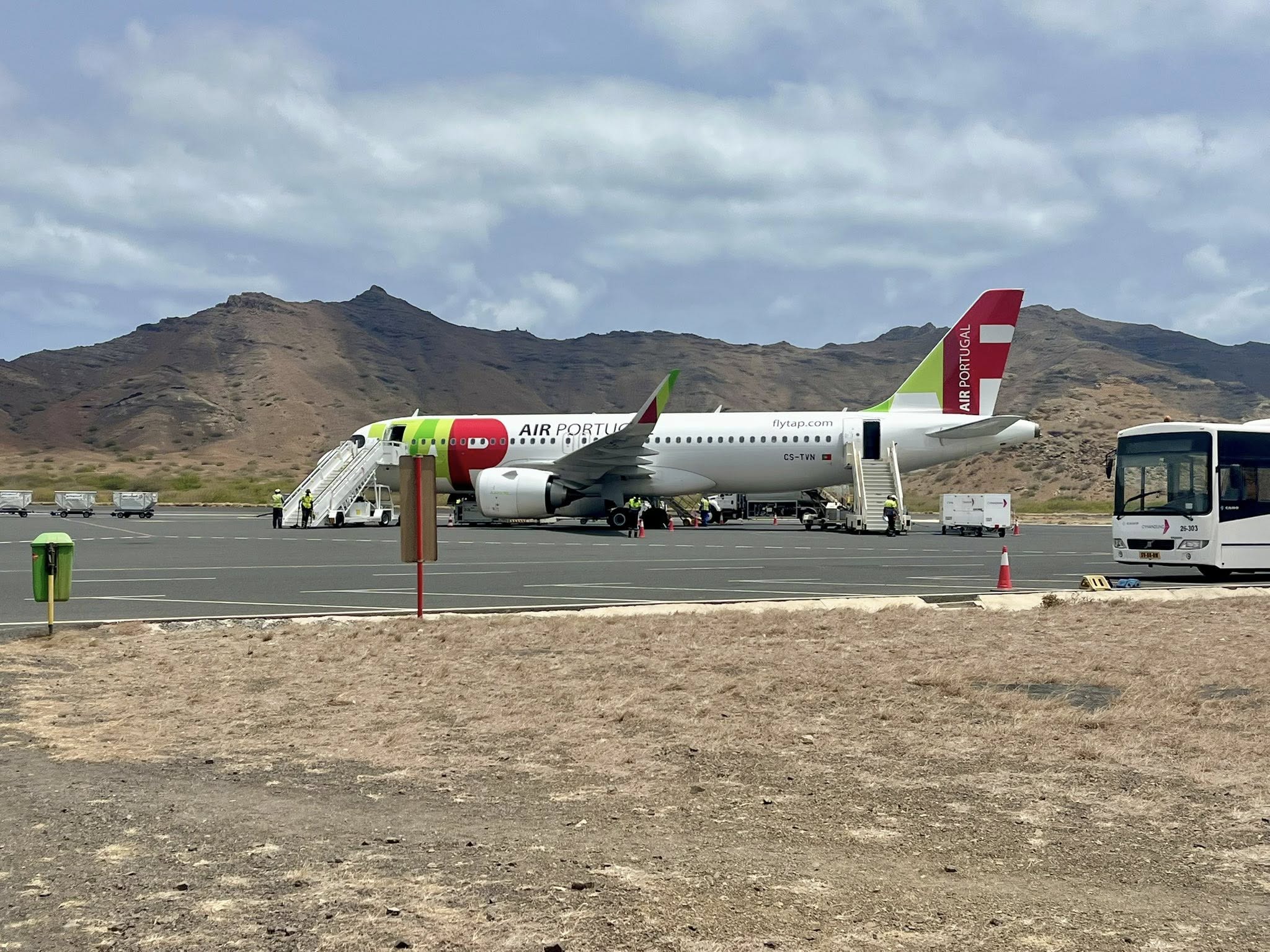
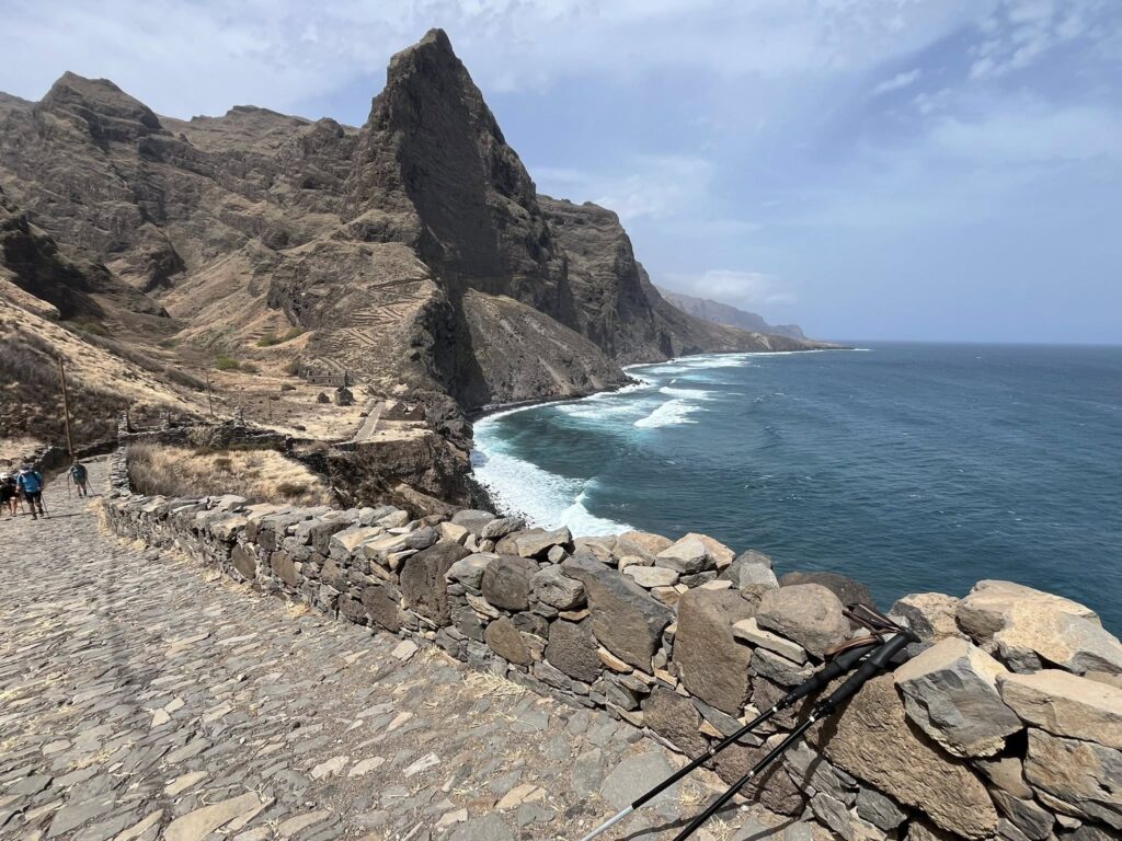
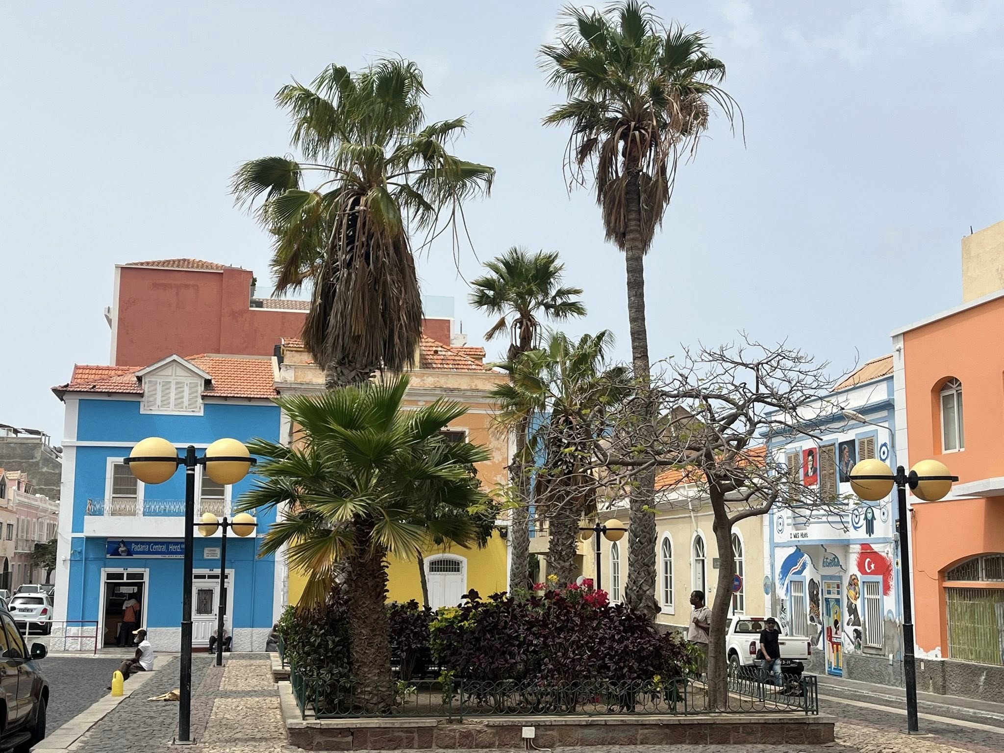
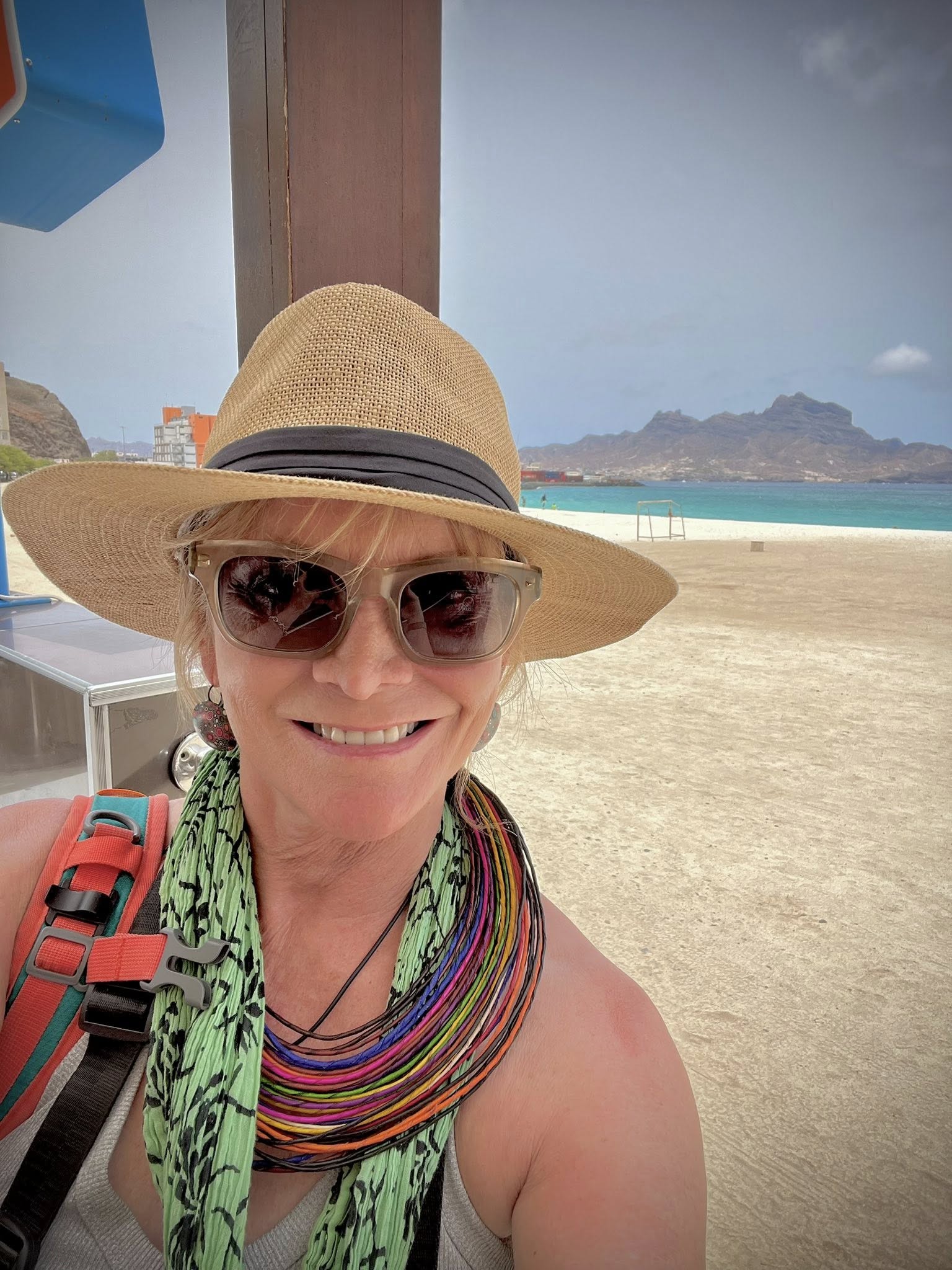
We were taken to our cute hotel in the town of Mindelo for just one night. That afternoon, we were driven outside of Mindelo to the northeast coastal area near Miradouro.
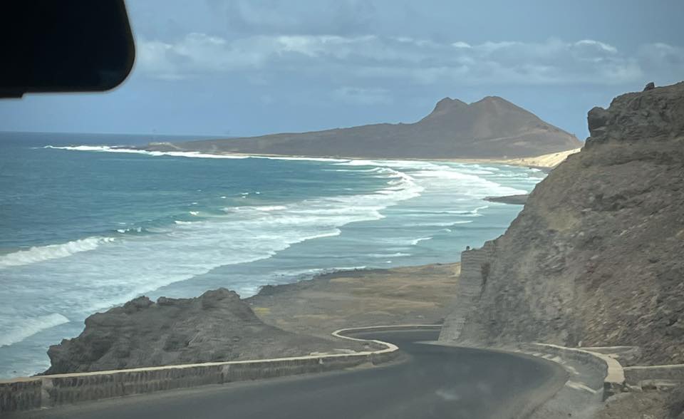
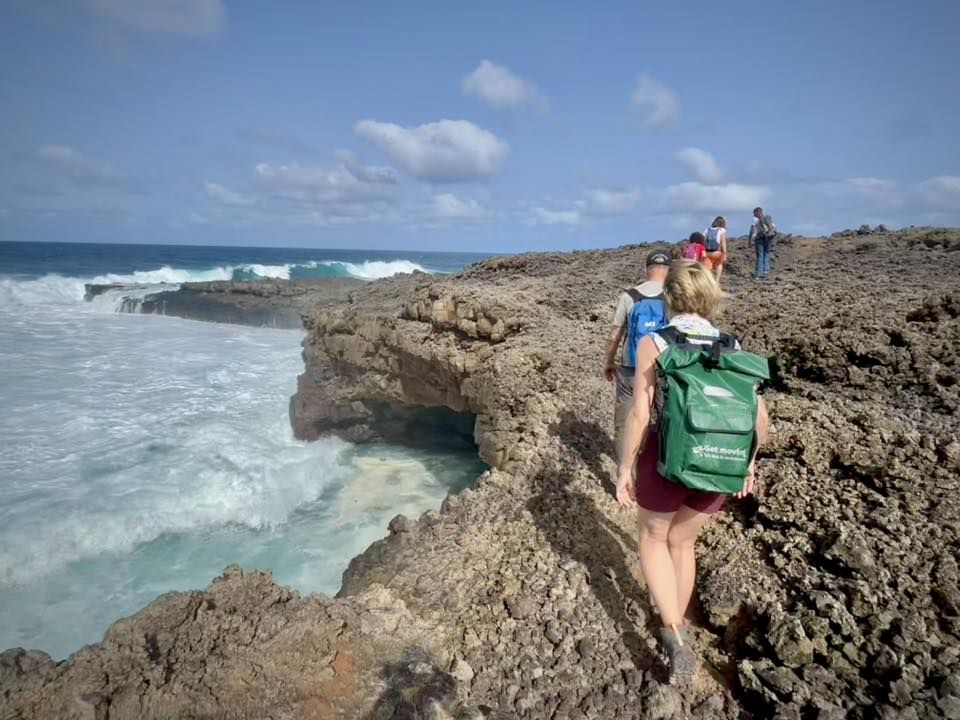
We went on a short 1.5-hr hike along the volcanic rocky terrain with huge waves and pretty turquoise colored water.
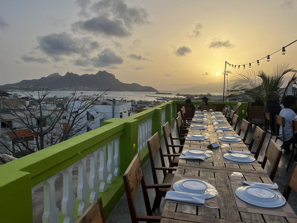
We finished our first day in Cabo Verde with a nice meal at our hotel’s outdoor terrace with a beautiful sunset and great view.
Day 2 – Ferry to Santo Antao Island and Hike near Cova Crater
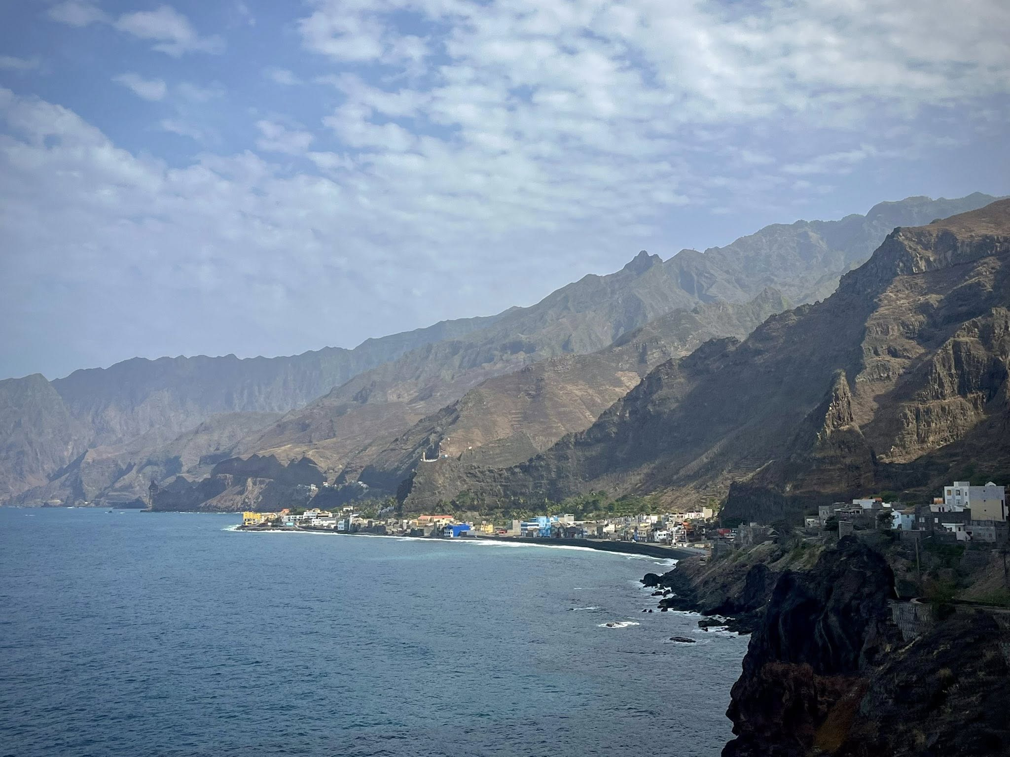
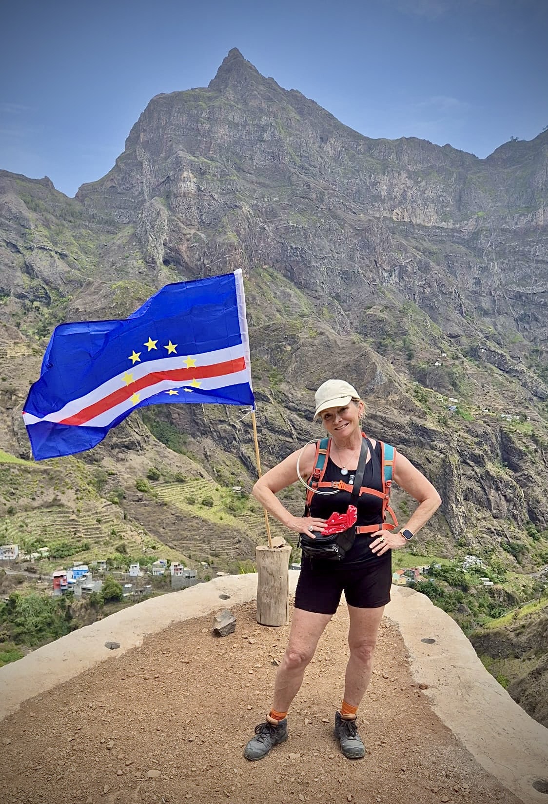
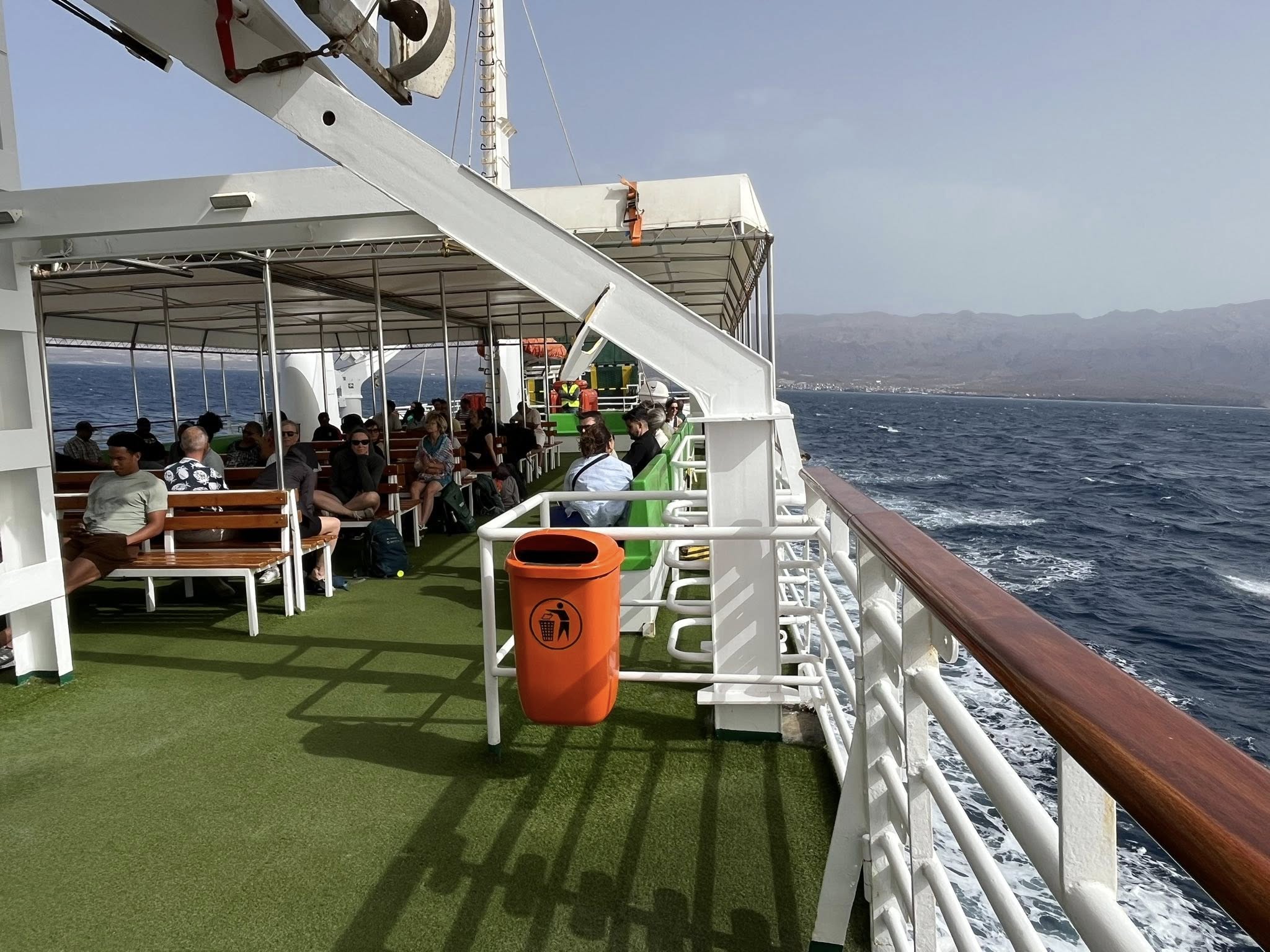
For our first full day of the week, we took the ferry from the island of Sao Vicente to the nearby island of Santo Antao. This is where we would spend the next six days, five of them hiking.
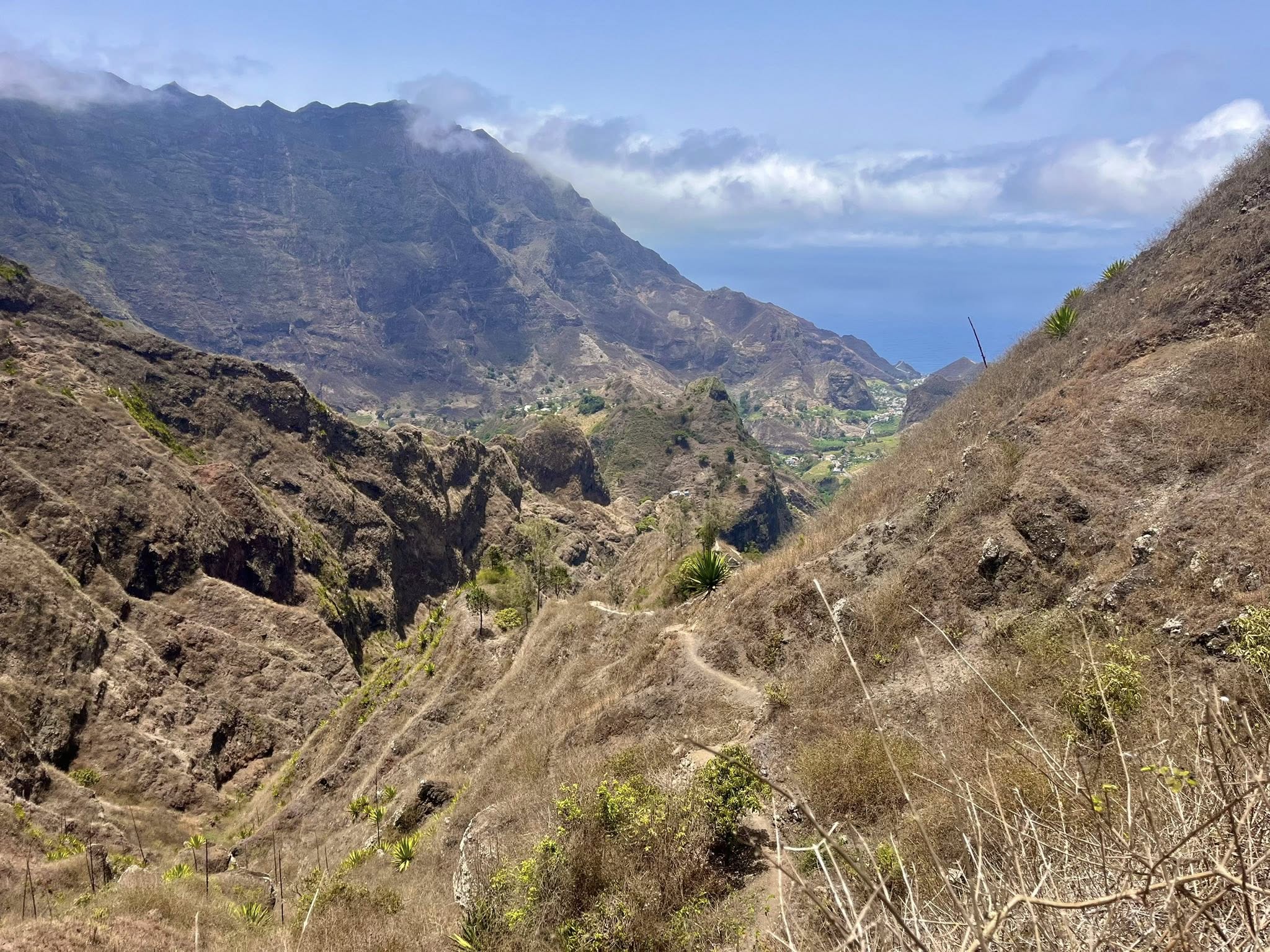
Santo Antão is the northernmost and second-largest island of Cabo Verde with its 779 km². The people of Santo Antão are primarily mountain people who live mainly from agriculture including coffee, bananas, oranges, sugarcane, and tobacco.
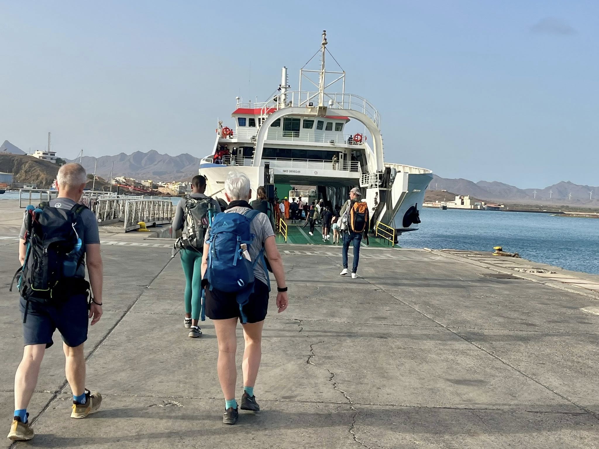
The ferry staff collected everyone’s luggage into the back of a truck before we could board. It was quite interesting to see this process and to wait to get our luggage back at the destination.
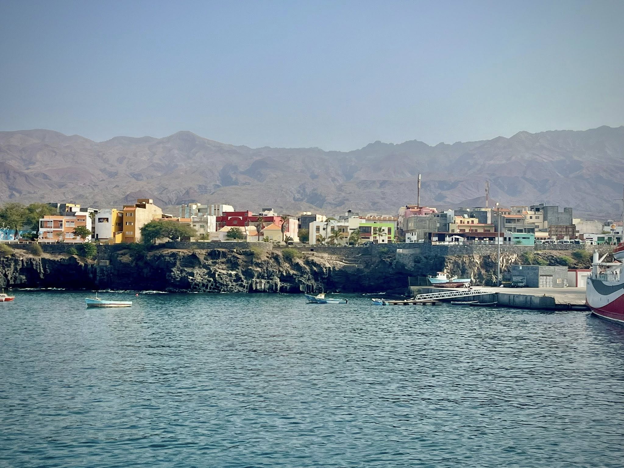
The ferry ride ride lasted one hour and was quite scenic with views of both islands. When we arrived to the town of Porto Novo, we hopped on a bus that would take us directly to our first hike near the Cova Crater. Porto Novo is the largest town on the island with 10,000 inhabitants. As the only means of reaching the island is by ferry (no airport), every visitor passes through this town.
On the way to the hike start, we passed gorgeous terrain which was initially dry and then turned to green lush with many flowering trees. Our guide was educating us about the names of all the trees. I thought the most beautiful tree was the Blue Jacaranda shown below.
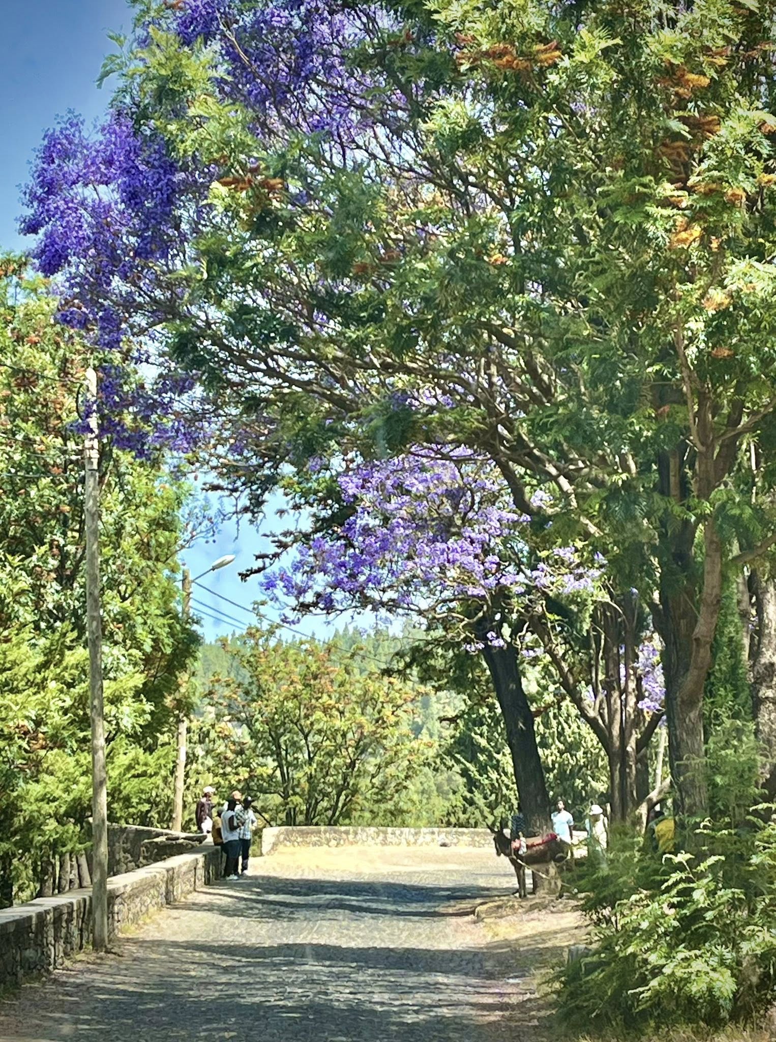
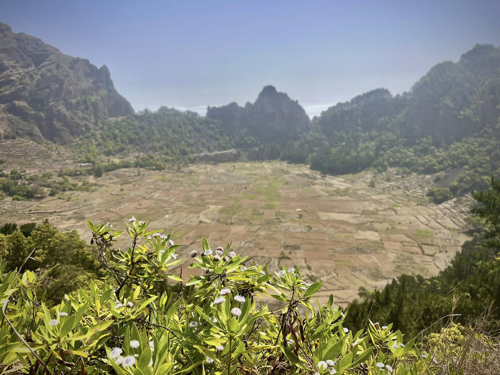
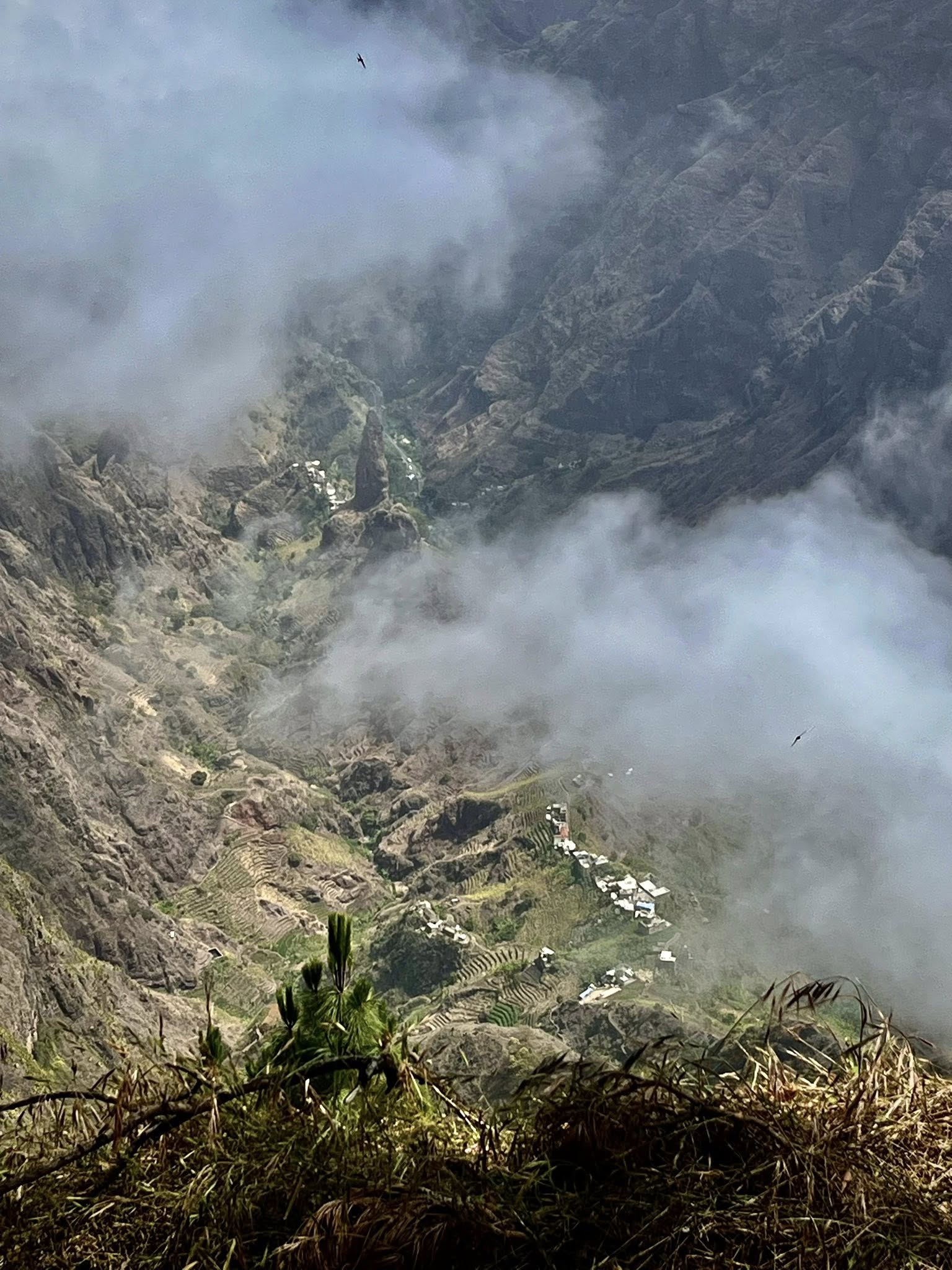
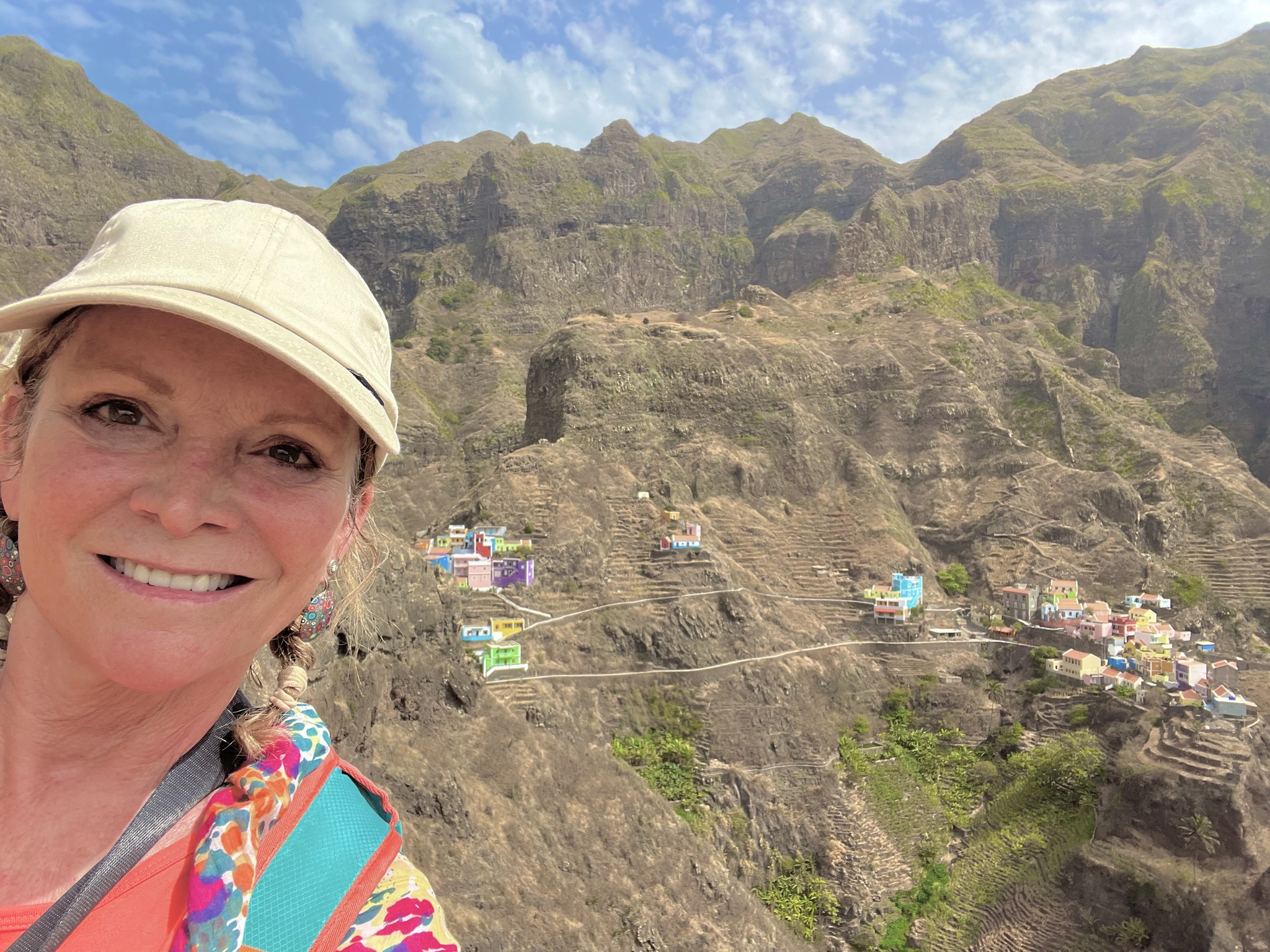
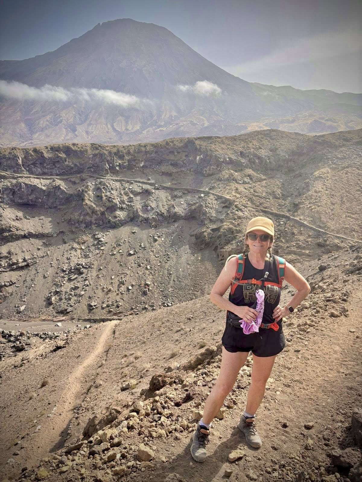
After an initial walk through a deep forest, we came to the lookout point of the Cova Crater, an extinct ancient volcano. “Cova” actually means “crater” in Portuguese. The round crater floor has walls as high as 400 feet high and is a fertile valley of potatoes, corn, cashews, and many other plants. We didn’t descend into the crater on this walk but it was fascinating to see from above.
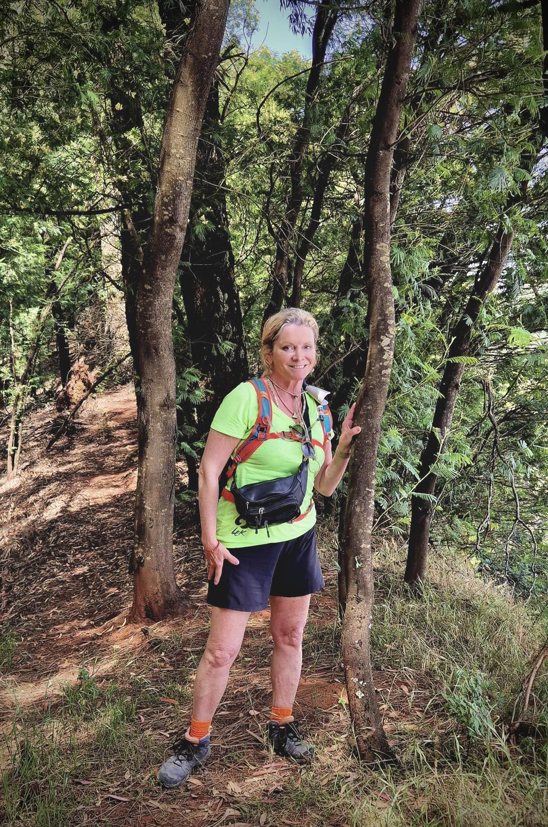
We had some morning clouds and low lying fog on our first hike which gave a mystical feel to the landscape. We had full sun for the rest of the week with temperatures between 22-29 celsius.
Hiking Stats: 10.8km, 2 hr 55 minutes, 320 meters up / 460 meters down
After our pleasurable hike, we were picked up by our van driver and taken to the coastal town of Ponta do Sol where we would spend two nights.
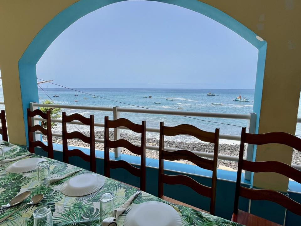
After checking into our hotel, we walked around the town and had a nice group dinner. Our guide knew the best places to eat in each town we stayed. It seemed she was friends with the owners and we got great service.
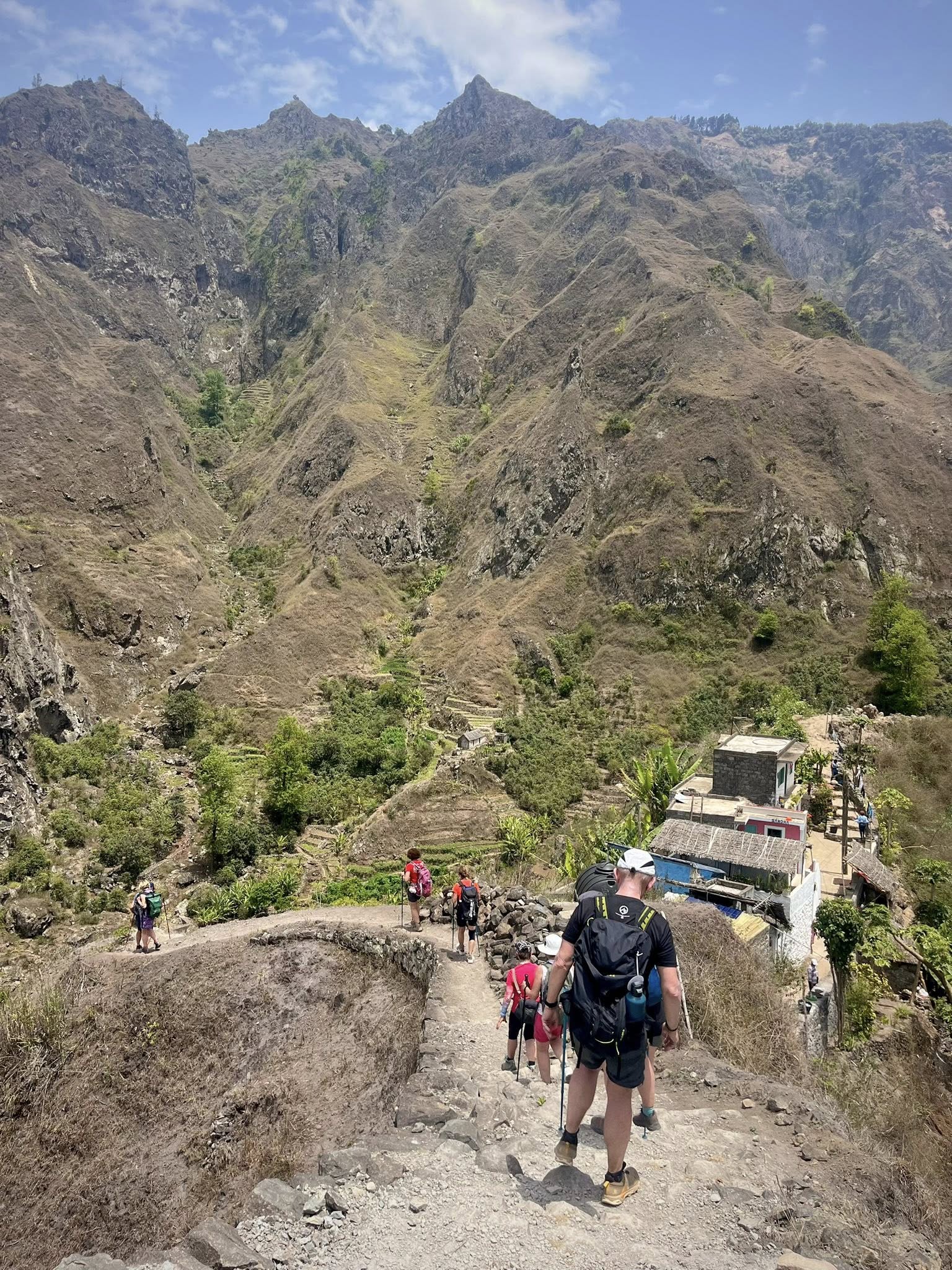
Day 3 – 2nd hike from Cruzinha to Ponta do Sol
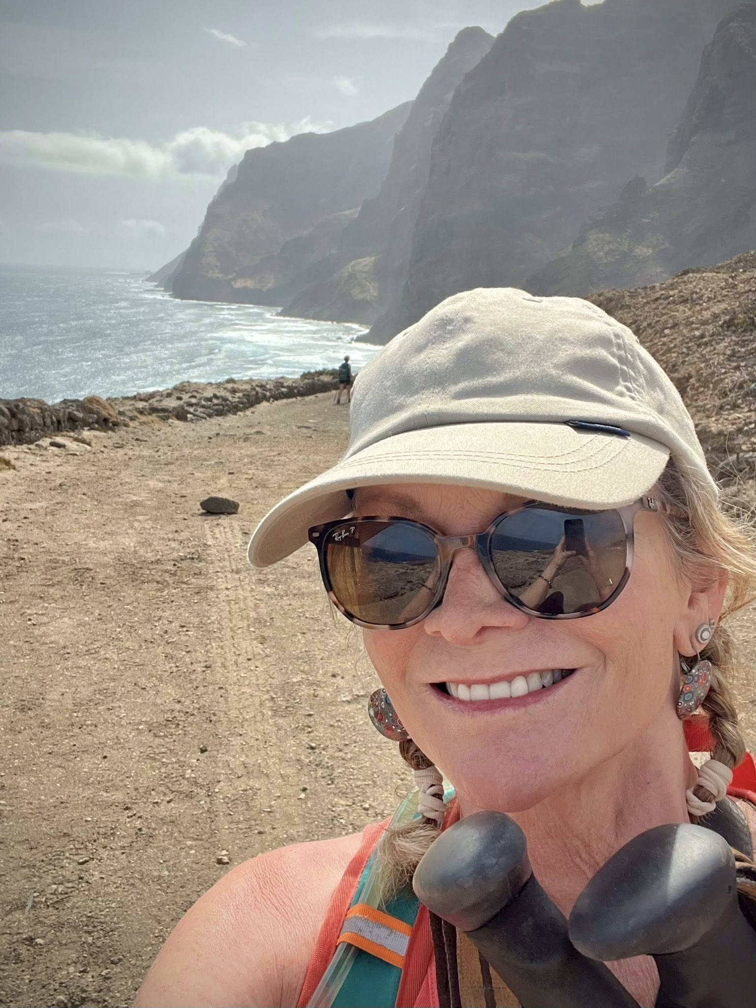
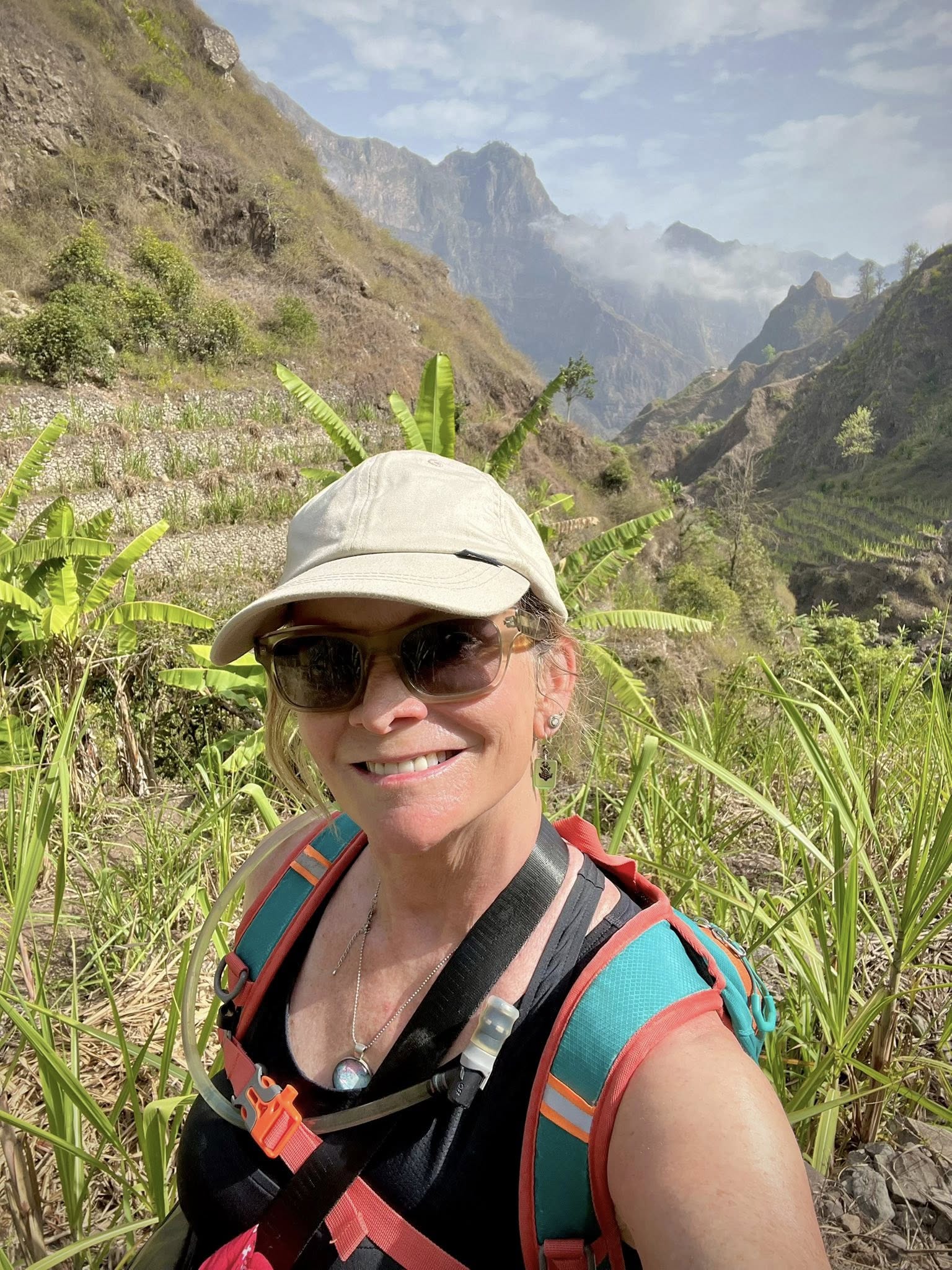
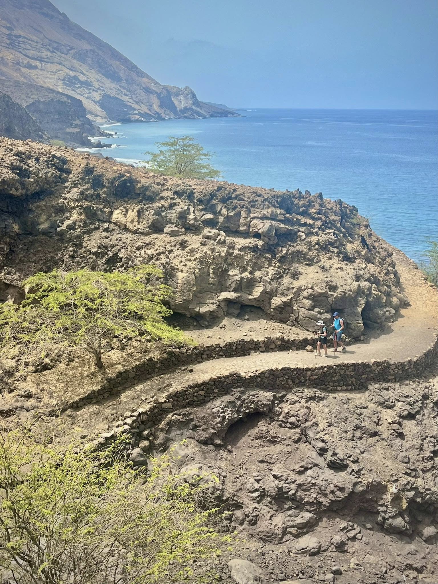
This hike was the longest and with the highest elevation gain during the week, but I found it to be my favorite trek of the week. The coastal views on this rock path were jaw dropping for the 5 hours it took to hike 15+km and 640 meters elevation difference.
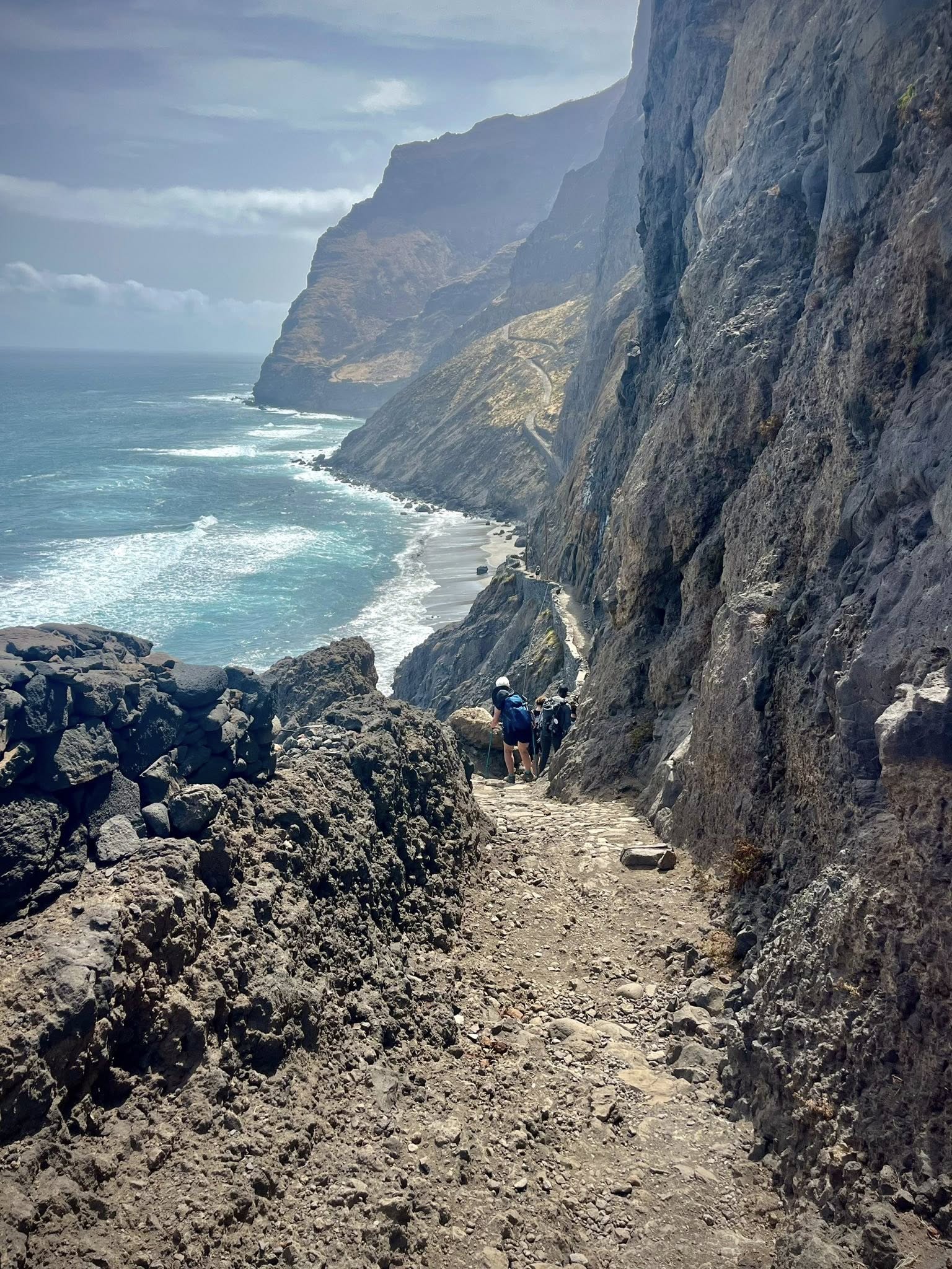
In the early morning, we were driven an hour from our hotel in Ponta do Sol to the small village of Cruzinha. From there we started our long day with many stops for photos. I couldn’t get over the beauty of the views and the nice path that was built on the cliffs.
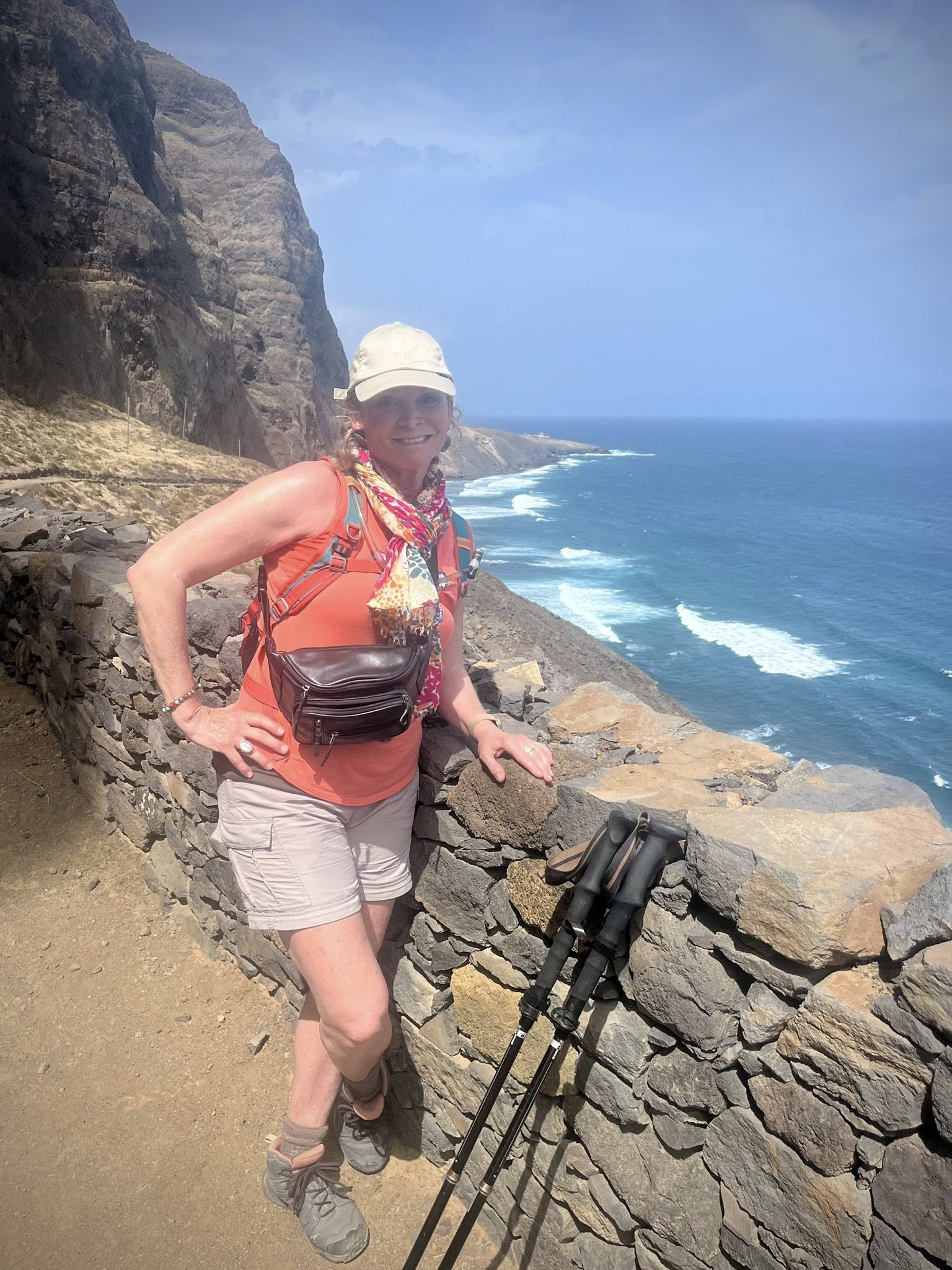
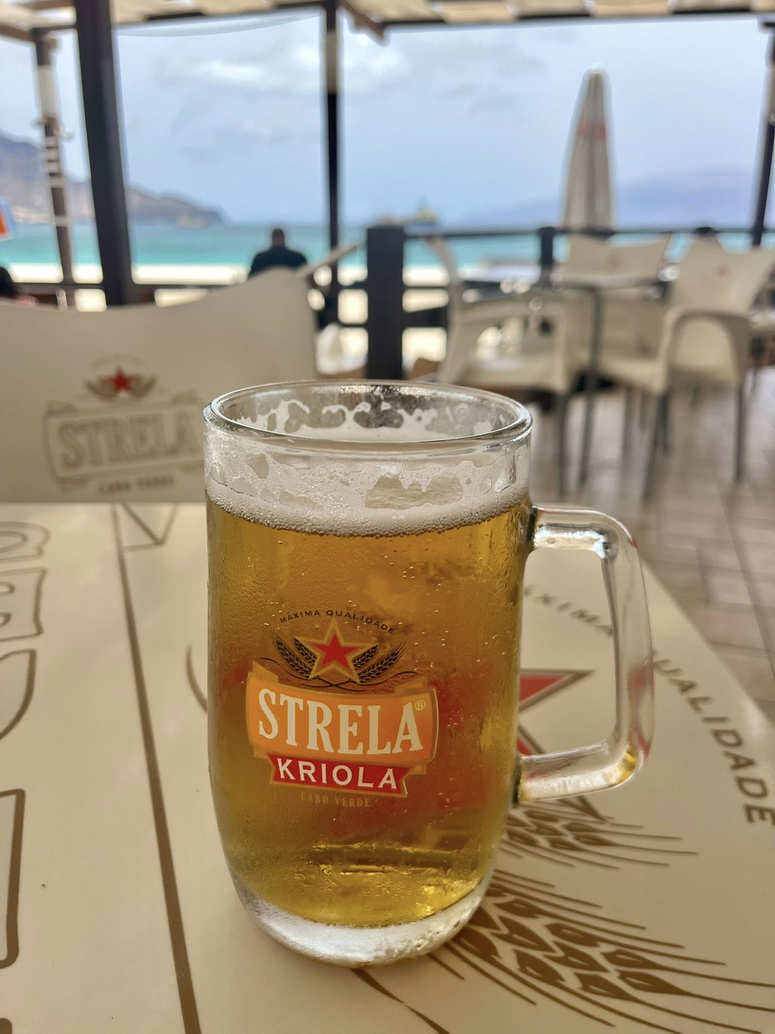
The advantage of this walk was the constant breeze from the ocean that made it seem cool and pleasant. We had our lunch stop at the mid-way point in a cute restaurant built in a home on the cliffside (Sonia’s). Thank goodness for the lunch breaks where we could relax, have a local beer or soft drink, and enjoy a delicious home-cooked meal.
After our one-hour break for lunch, we headed to the highlight of the trek… the tiny village of Fontainhas. Before reaching it, we had to walk up a steep incline where there were 14 zig-zag turns each marked by a stone marker. It was grueling but worth it for the view at the top.
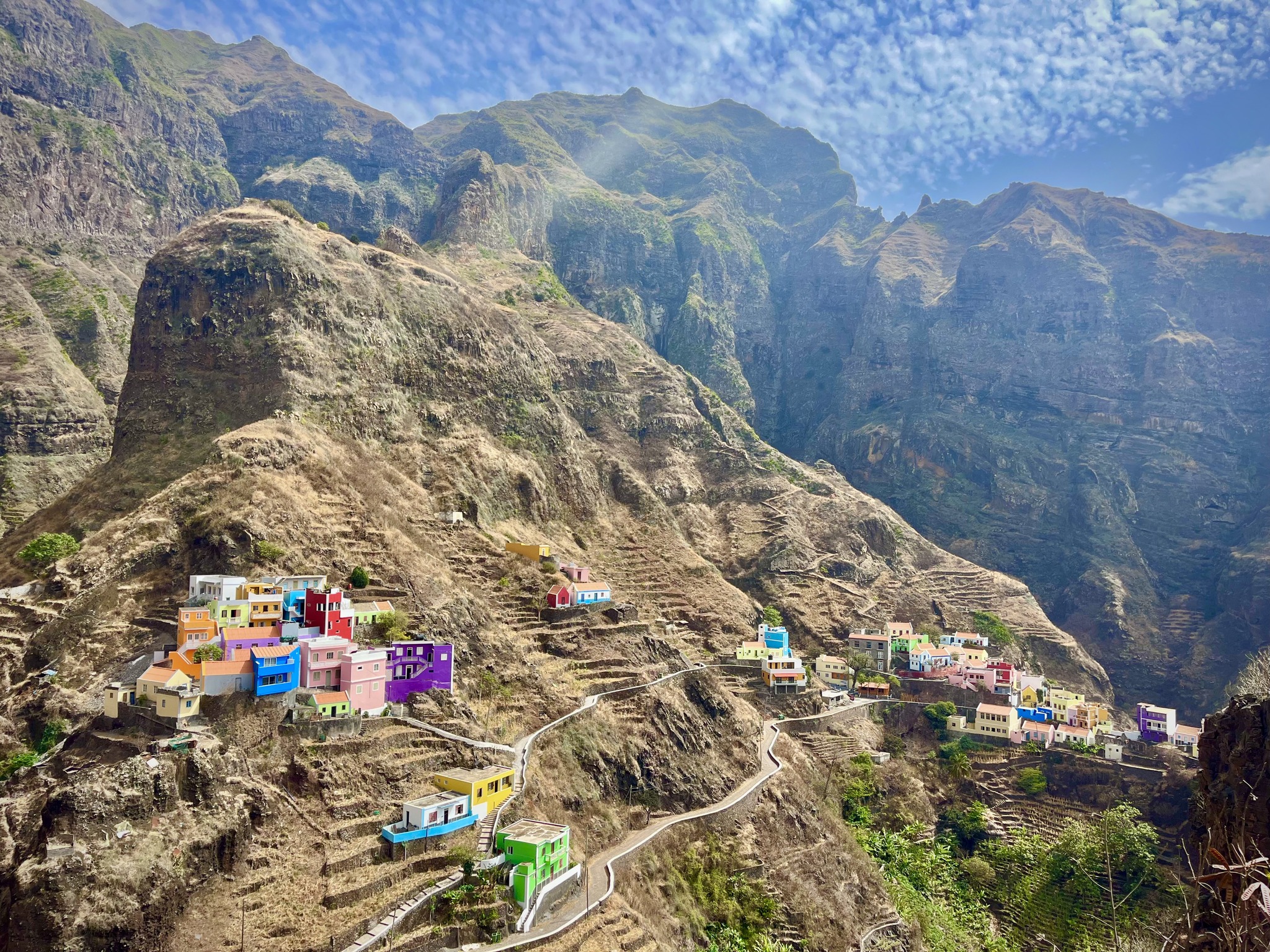
I’m not sure pictures of this village do it justice as it’s one of those places you need to see with your own eyes. People from Santo Antão have always known about this place, but the rest of the world only got to know Fontainhas back in 2015. National Geographic did a special on villages, and made a list of the villages in the world with the most beautiful views. Fontainhas was one of the places to make it to the top 3!
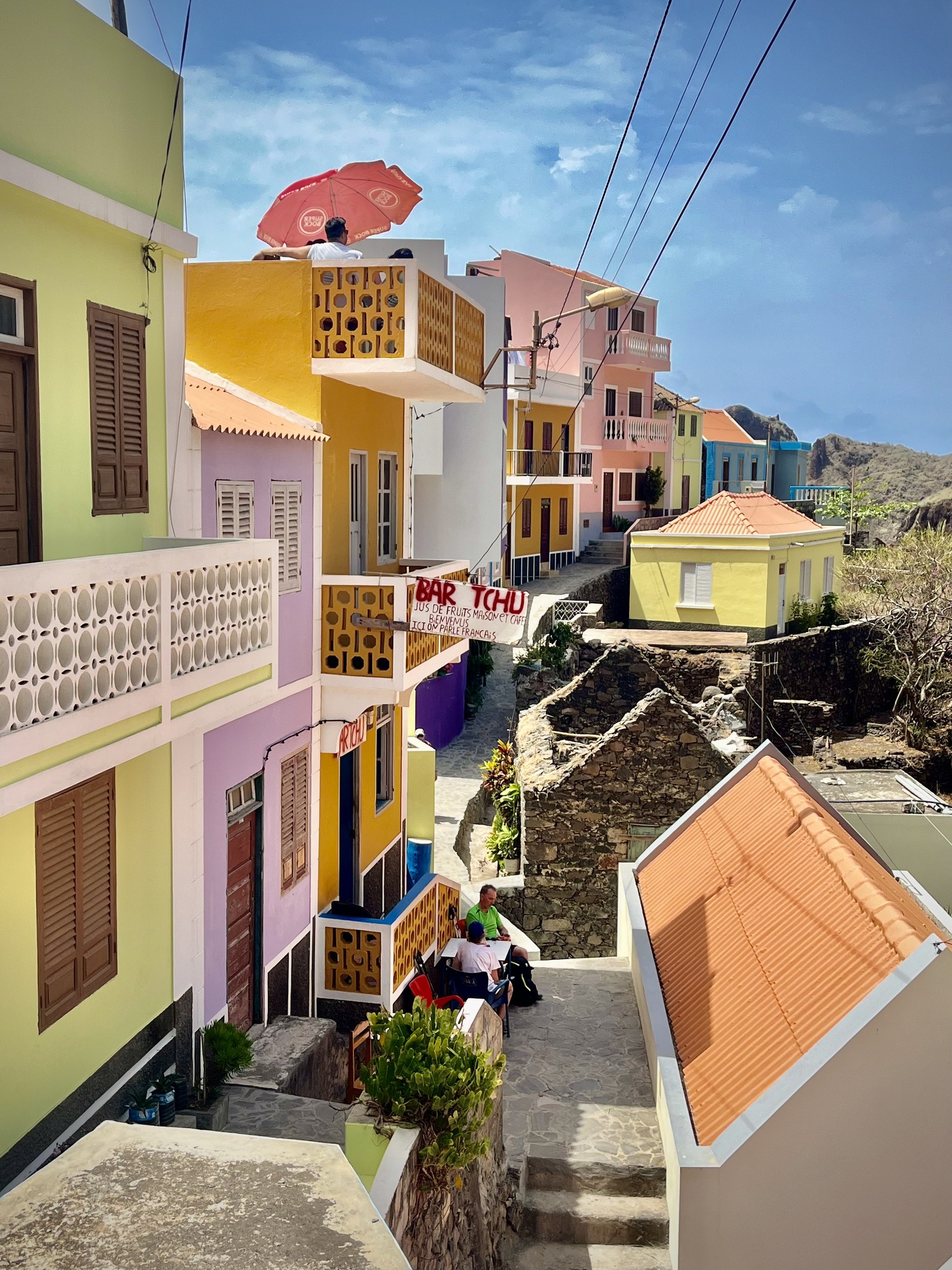
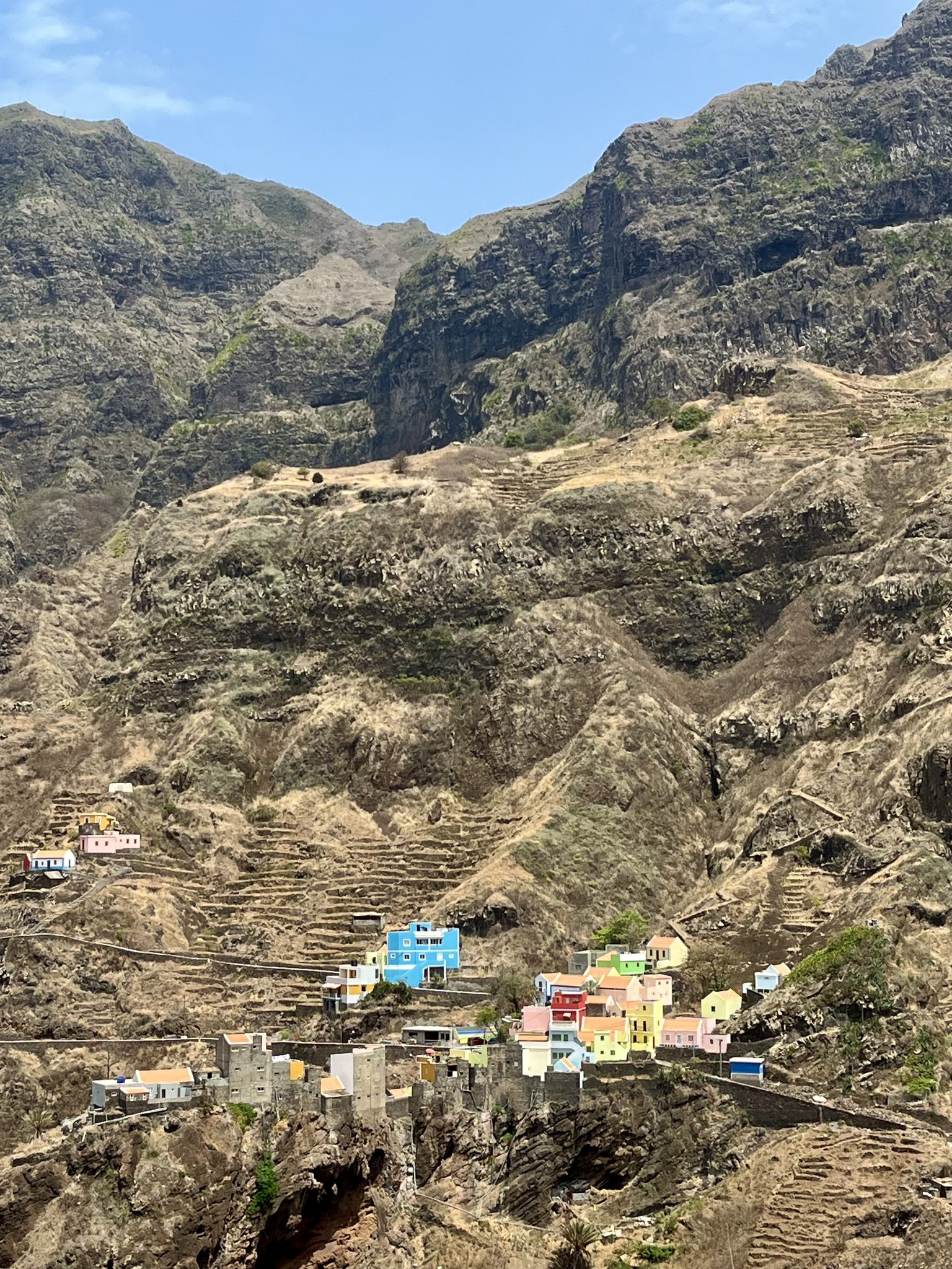
Our group met up in Fontainhas and decided to have a cold drink at a small local place. We sat in the narrow street surrounded by bright colorful buildings.
Hiking Stats: 15.7km, 4 hr 41 minutes, 640 meters up / 640 meters down
We spent the night again in Ponta do Sol after a fun evening of food and dancing at a lively restaurant.
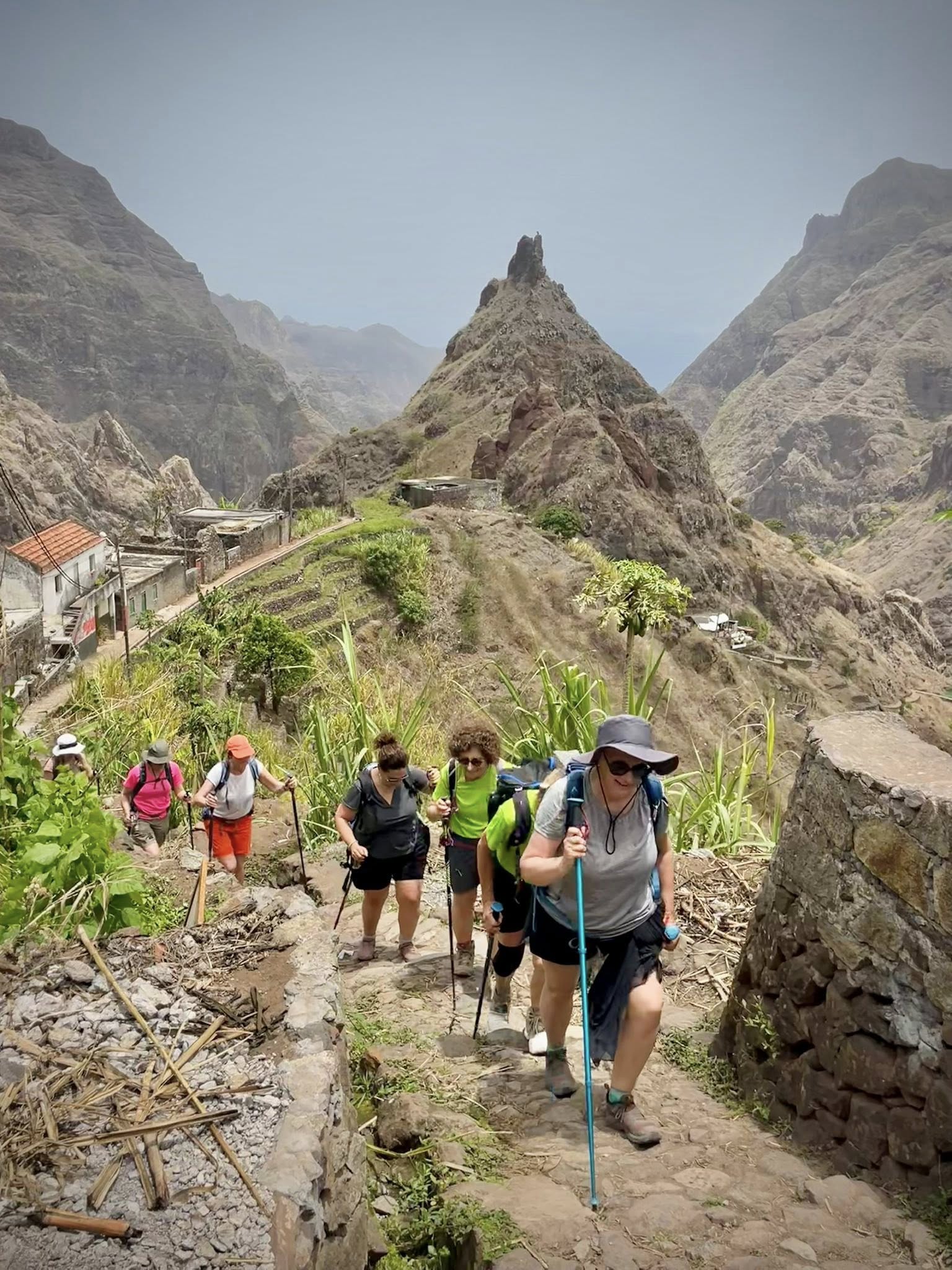
Day 4 – 3rd hike – Ribeira da Torre Valley
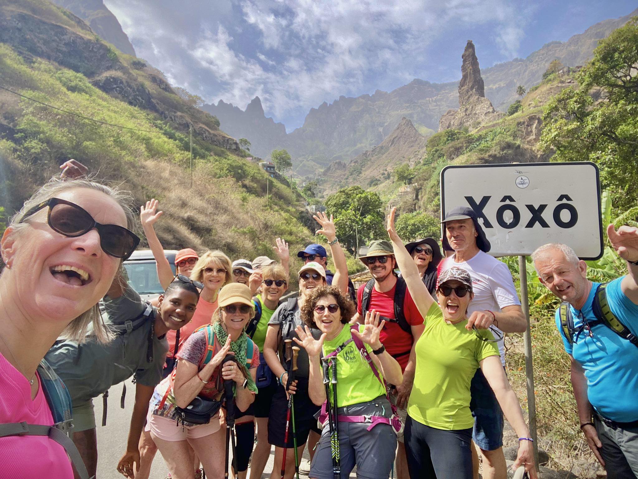
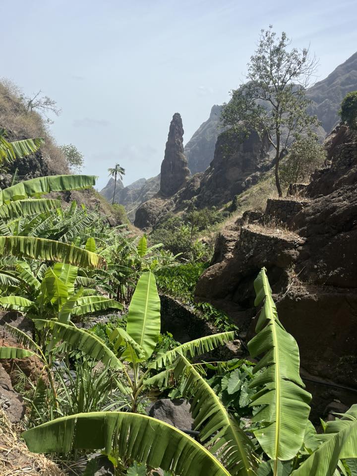
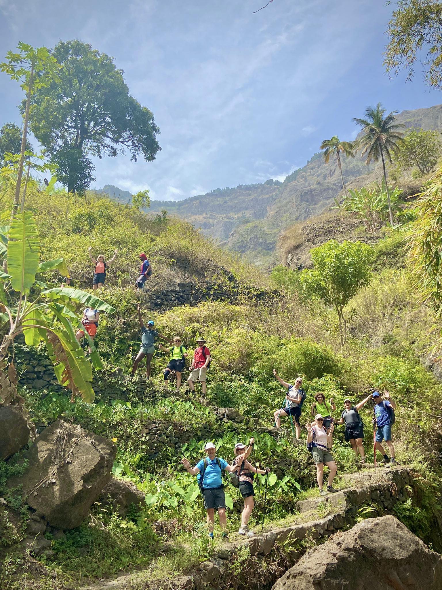
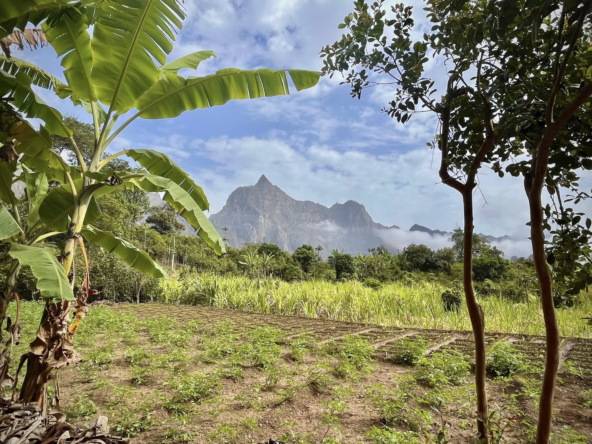
We left Ponta do Sol in the morning and were driven to the Ribeira da Torre valley where started in the village of ‘Xoxo’ (pronounced sho-sho) with the huge finger-shaped rock in the background. We saw this structure on the first hike from up above near the Cova Crater.
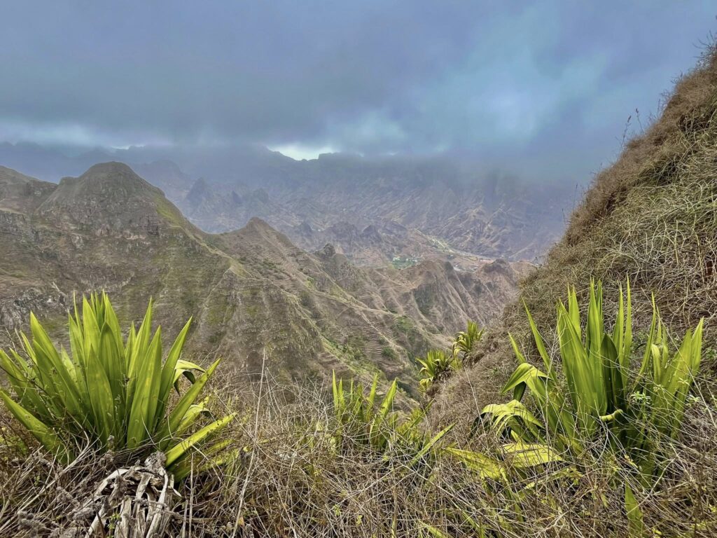
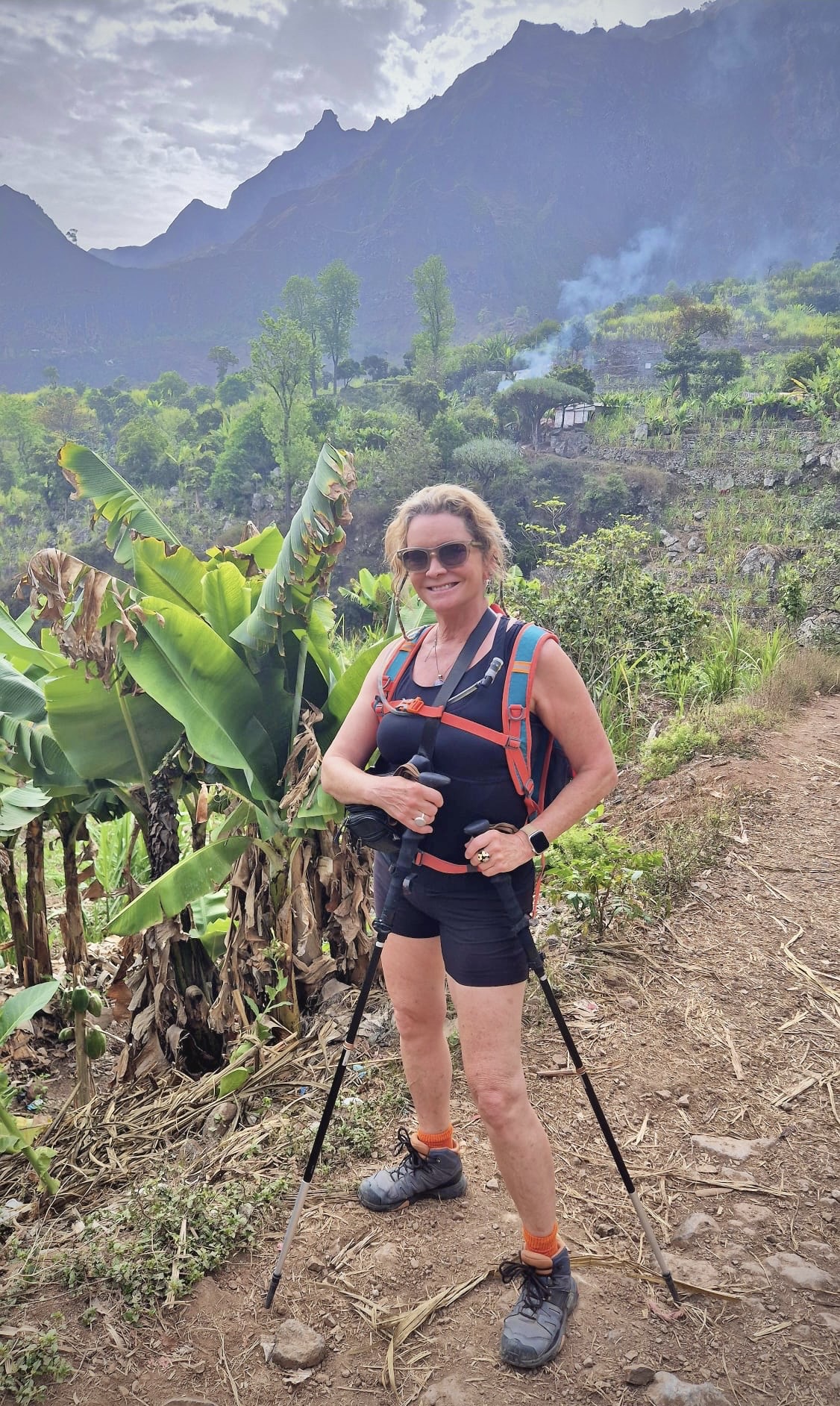
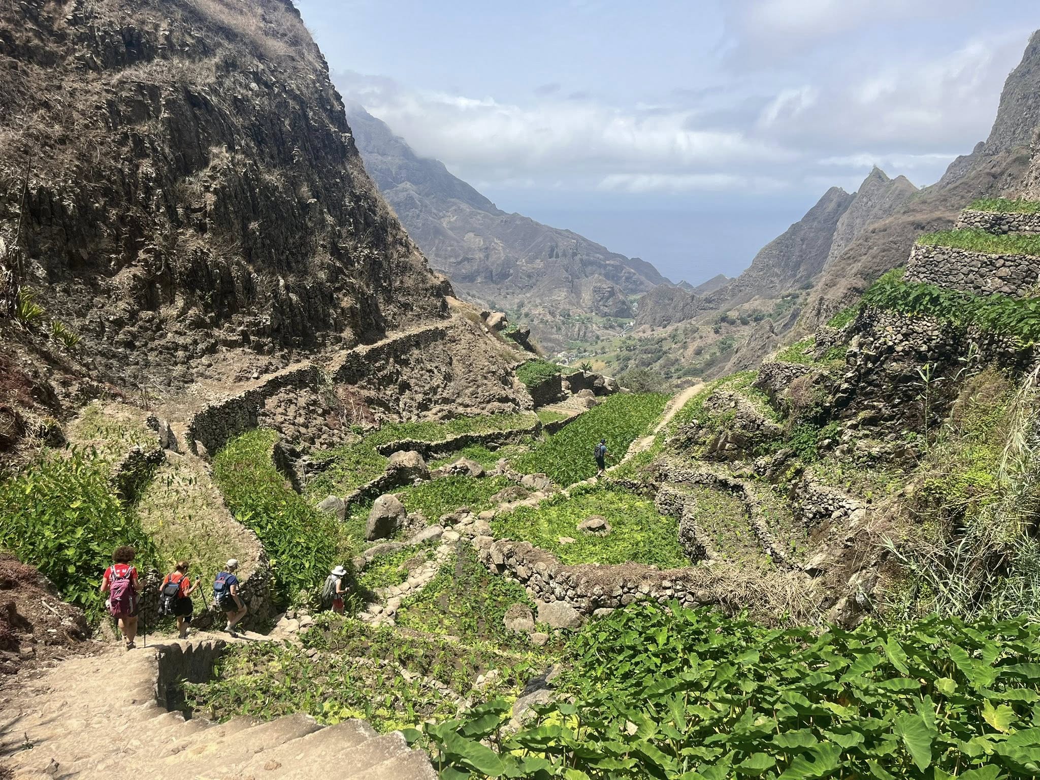
The area reminded me of Jurassic Park with its tooth-like peaks, ridges, greenery, and terraced farmland on steep slopes. This hike was not so long in distance but challenging due to the rugged mountainous terrain and steep steps to reach the top. We were distracted from the challenging path by the lush scenery, irrigation canals, and vegetable fields with sweet potatoes, corn, manioc, and beans.
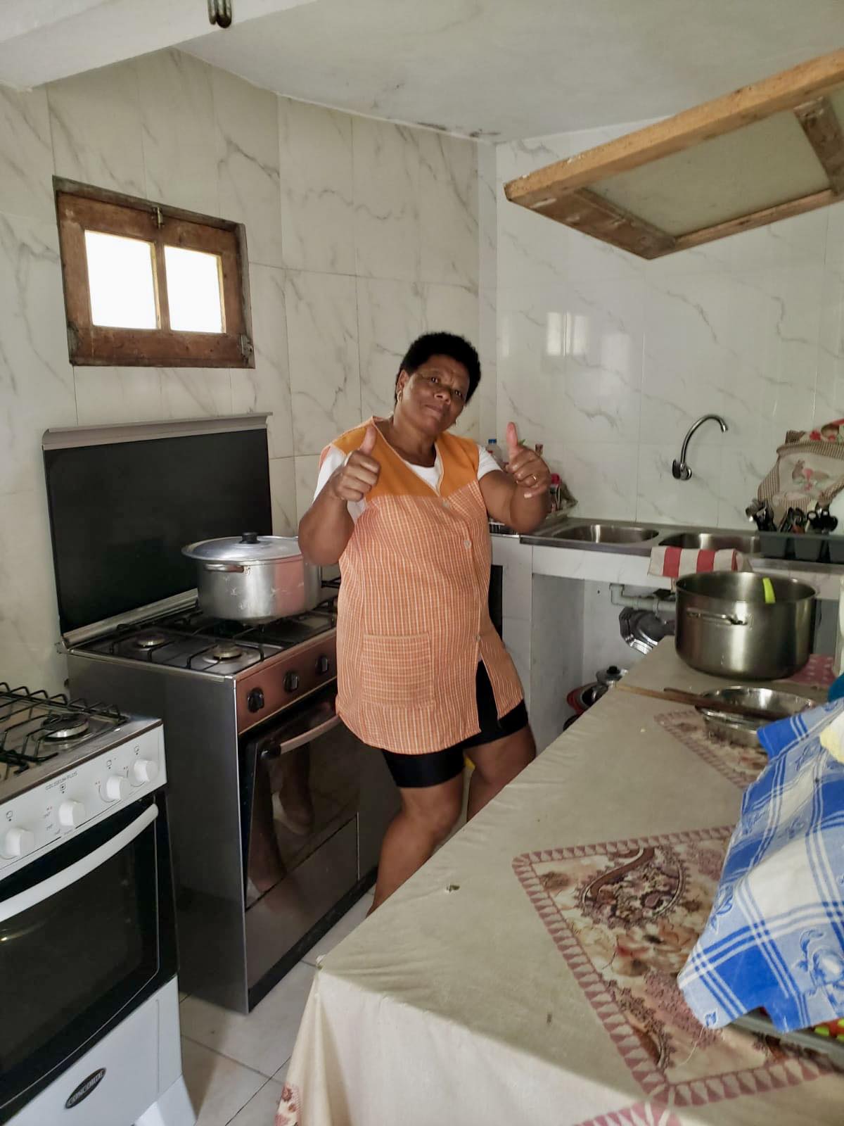
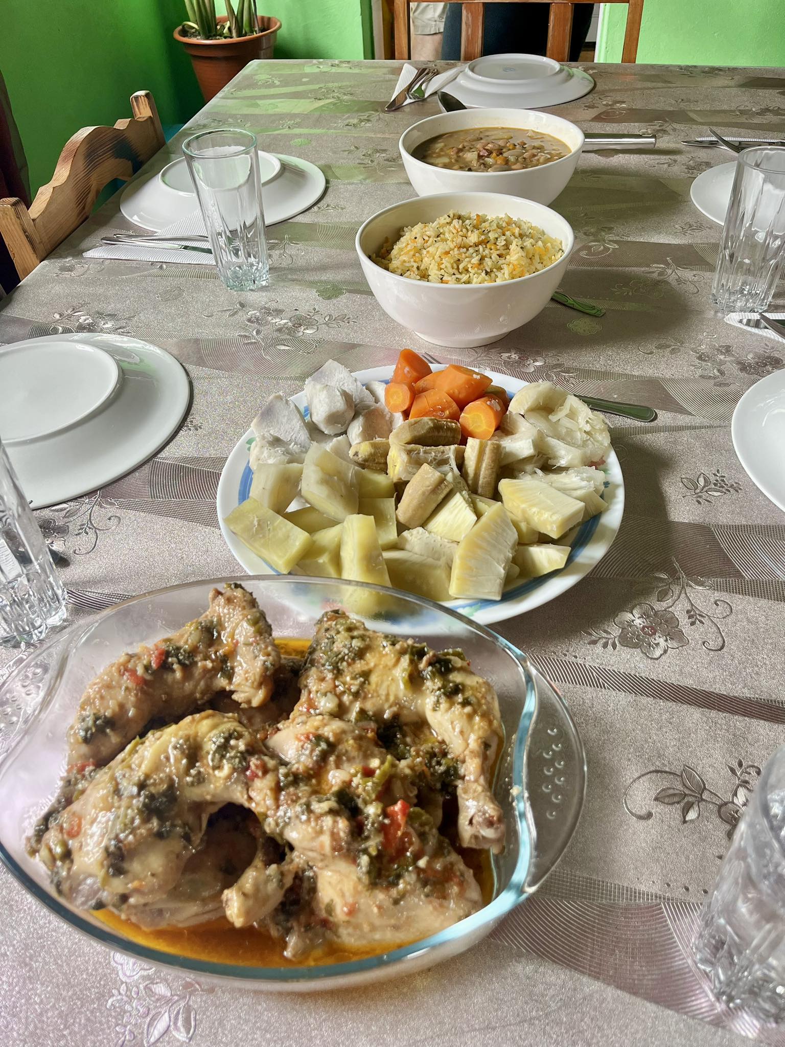
The highlight of each day’s trek was the lunch served by a local family in their home. We tasted all the traditional dishes including Cachupa. Considered the national dish of Cape Verde, It’s a stew which includes mashed maize, onions, green bananas, manioc, sweet potatoes, squash, and yams. Our lunch on this day was at Fatima’s (shown below) in the village of Rabo Curto.
After a relaxing lunch, we headed down the deep valley where our bus was waiting for us.
We passed many sugar cane fields and watched the locals cutting the stalks. After the hike, we stopped by a distillery to see how they make their national drink, grog, similar to rum.
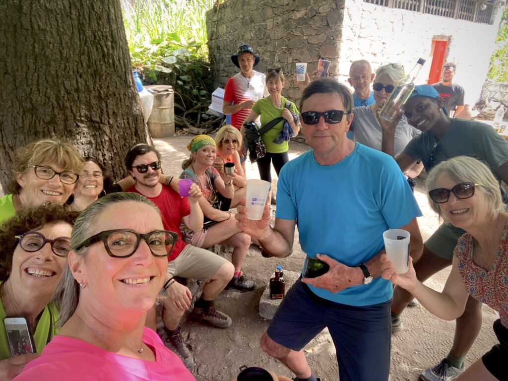
Hiking Stats: 8.3km, 2 hr 42 minutes, 320 meters up / 460 meters down
Next stop was a nice hotel on the water in the village of Pombas where we would spend one night at the Hotel Paul Mar. Our room opened up directly to the ocean with a lovely sunset view. We had a delightful group dinner in town with live music and dancing, and we even got to hear our guide sing beautifully at the rooftop Casa Maracuja restaurant.
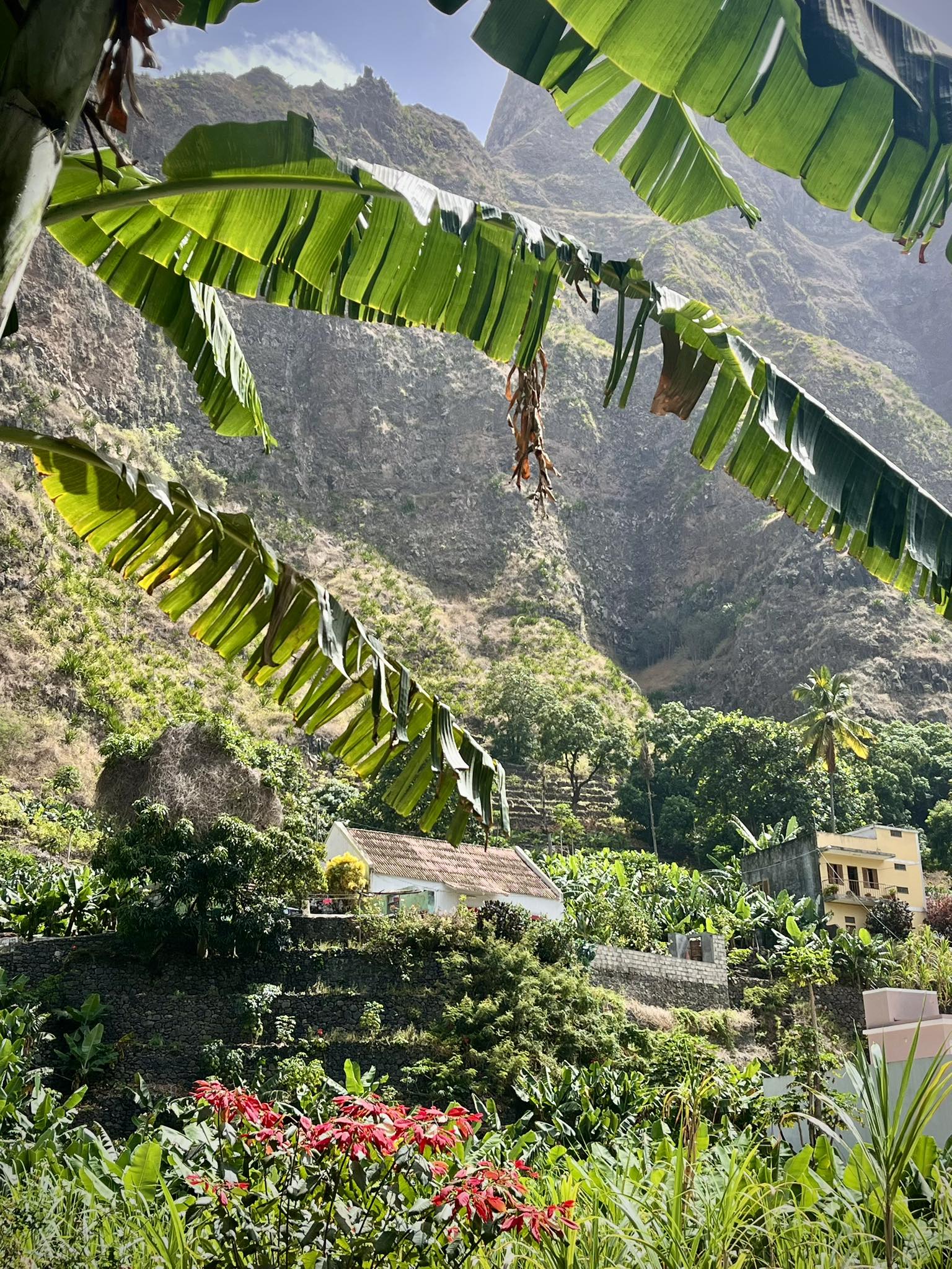
Day 5 – 4th hike – Valley of Paul
As one of the greenest and most beautiful valleys in Cape Verde, the Paúl Valley is not to be missed. The terrain was similar to the day before with lush greenery and many fruit trees (mango, papaya, lemon).
The hike was longer than the day before but easier with less ascent. During the hike In the morning, we stopped at a family house where we tasted the coffee they make from the local coffee plants. Most of these local homes and distilleries sell their own products at a much lower cost than in the stores.
Lunch break was at a perched shady hut surrounded by the mountainous landscape. What a great day to see another lush area of this island.
Hiking Stats: 8.3km, 2 hr 42 minutes, 290 meters up / 680 meters down
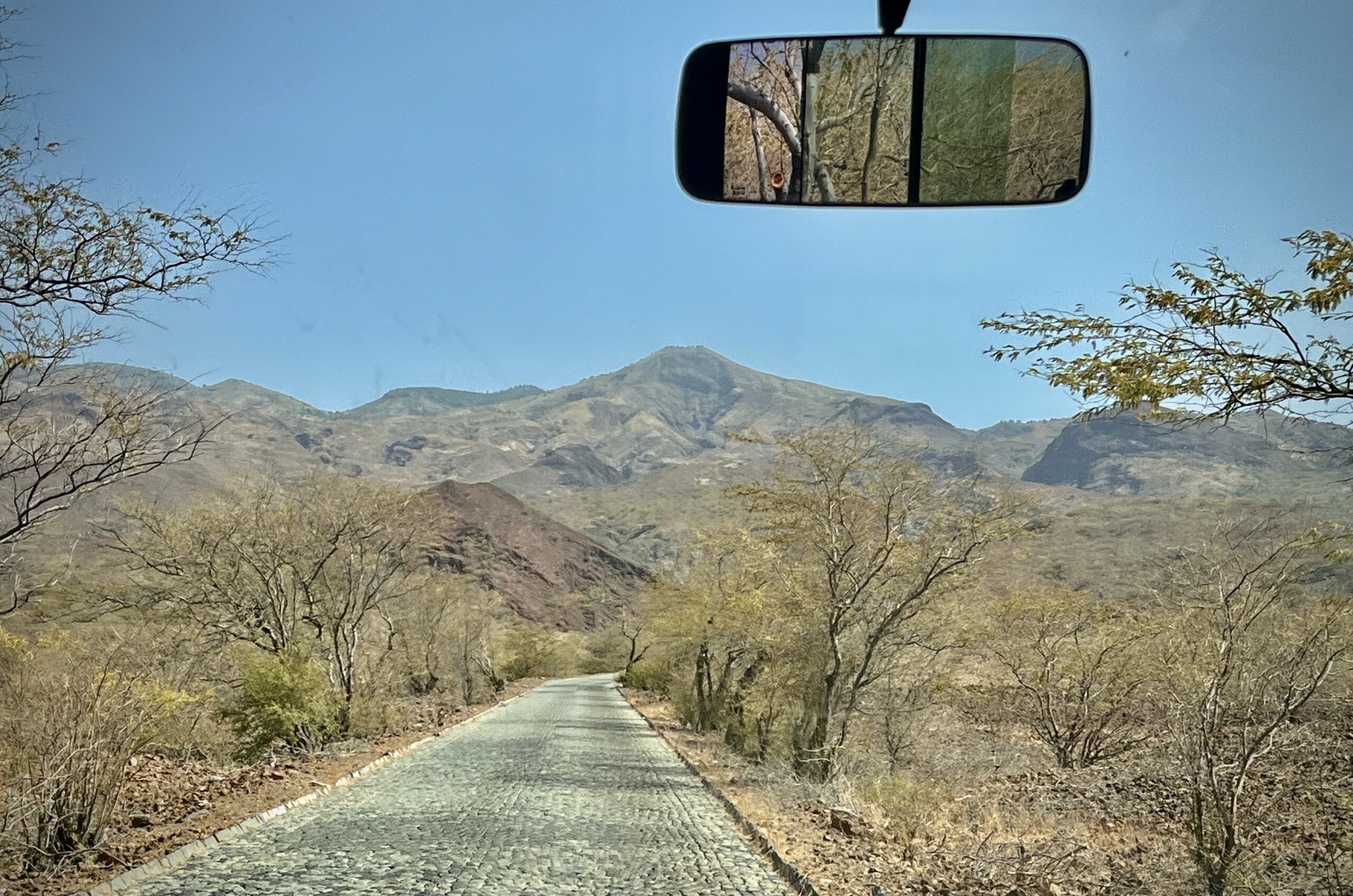
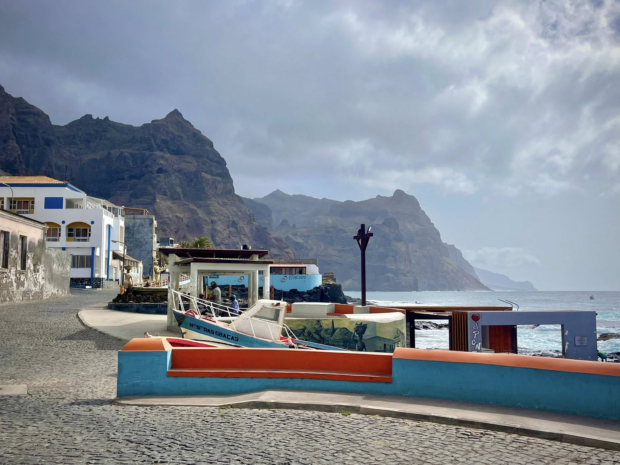
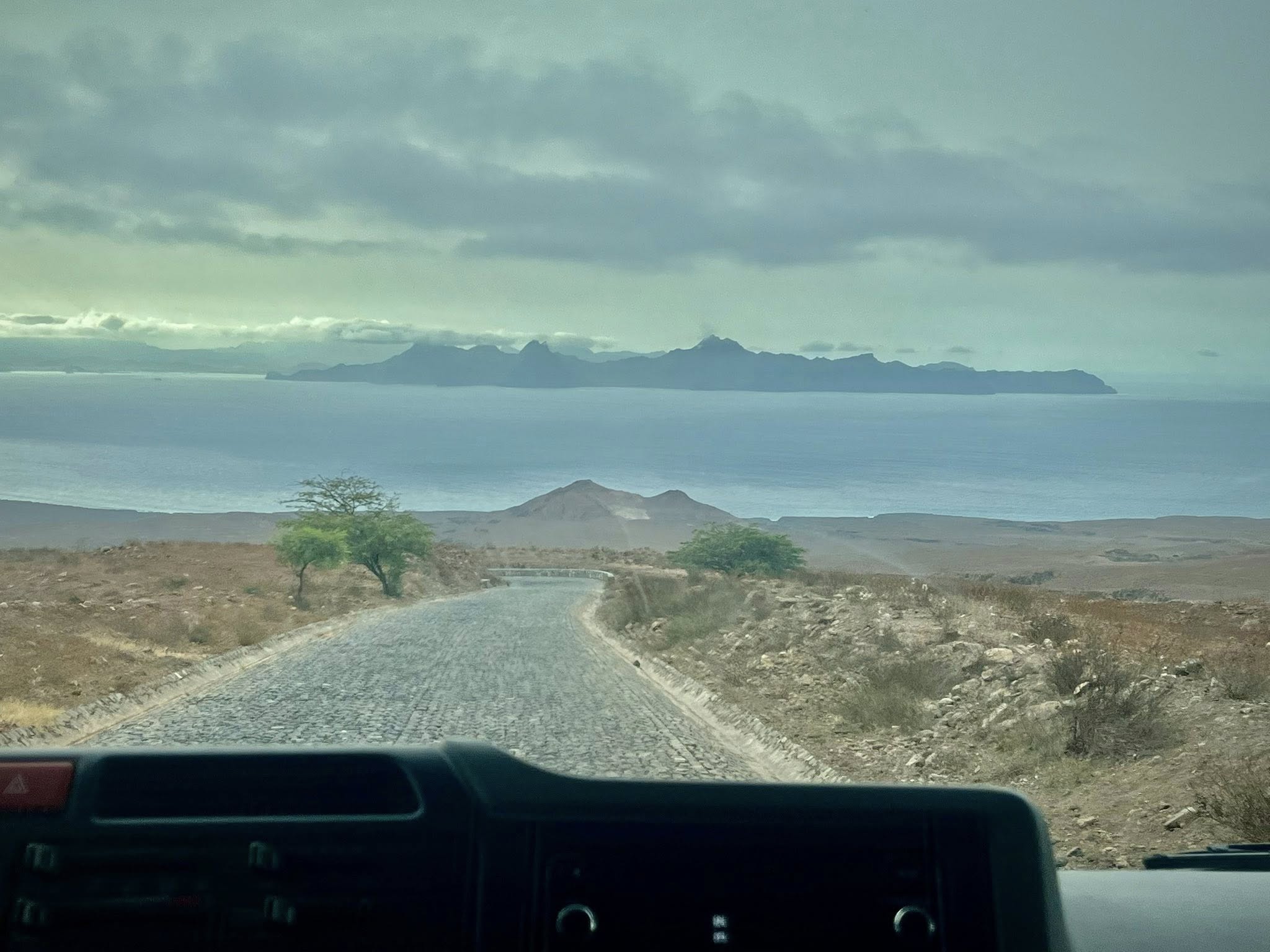
After the hike ended around 3pm, we were driven by bus for over two hours to our next destination, Tarrafal. The scenery along the drive was fantastic, especially the dry desert-like terrain as we peaked and then descended to the sea.
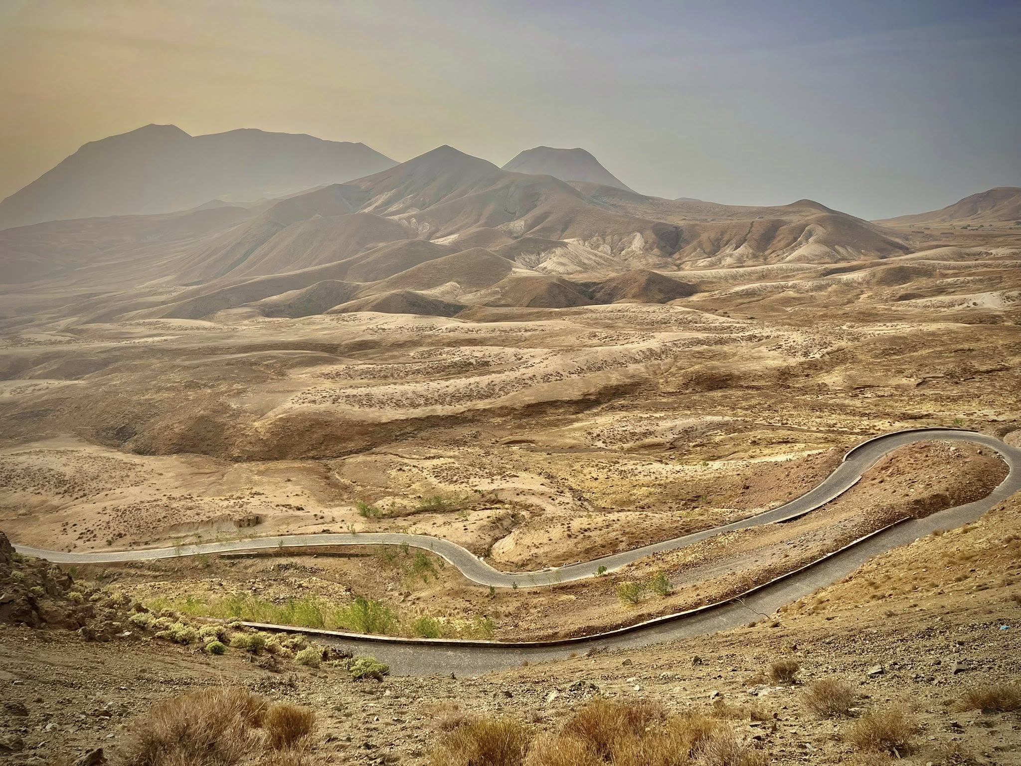
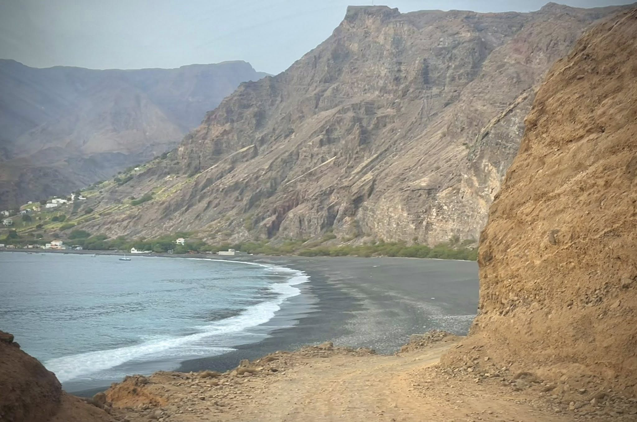
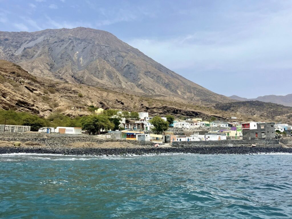
Tarrafal, situated on the far western coast of the island, is sheltered from the wind by high rocky cliffs and had a large black lava beach. We had to drive along a narrow dirt road to reach the remote village.
We settled into our hotel where we also had dinner that night. I can tell you I slept very well again after our 4th day of hiking!
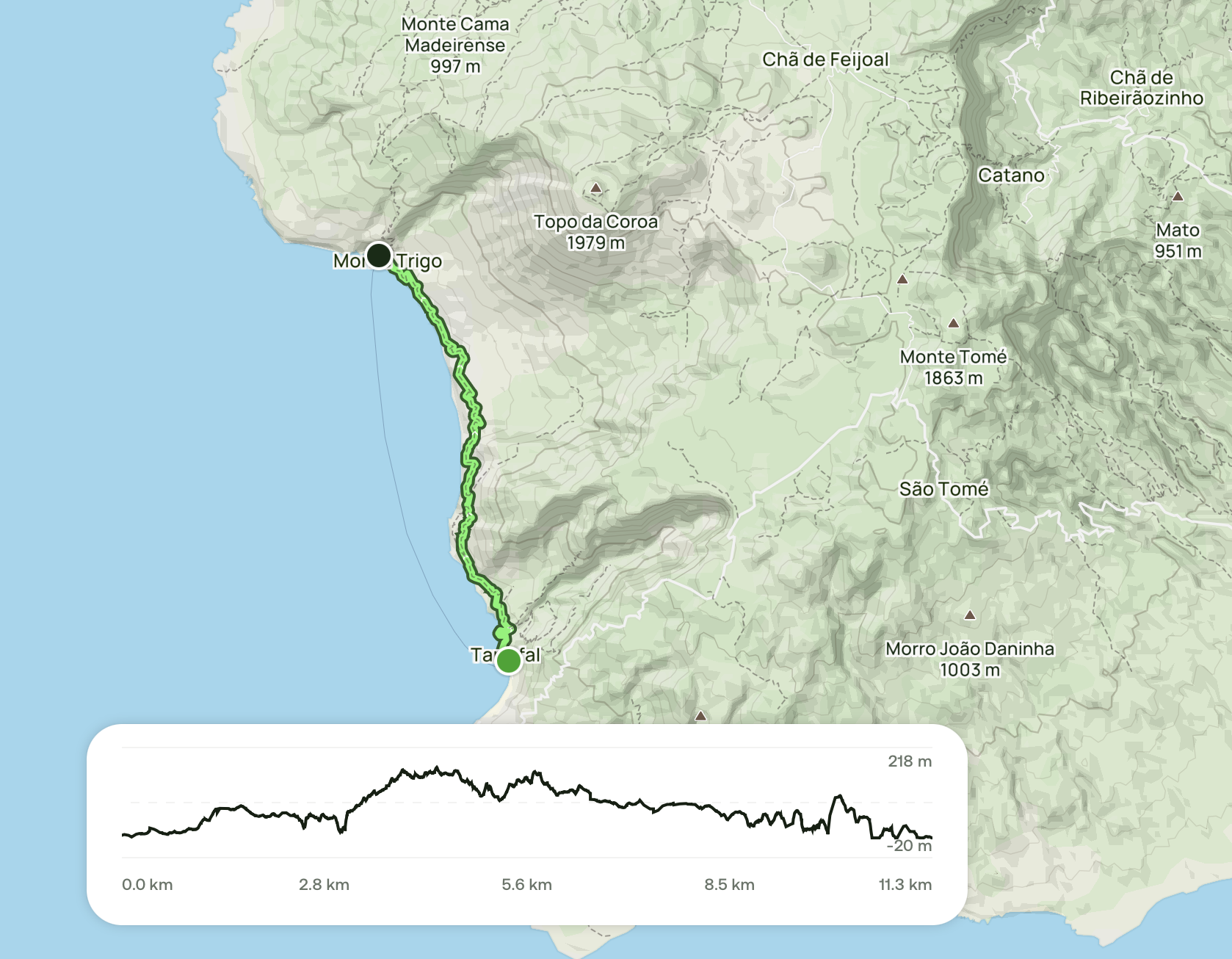
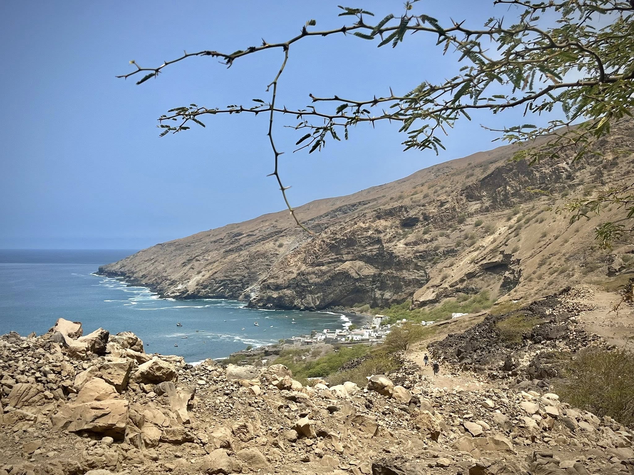
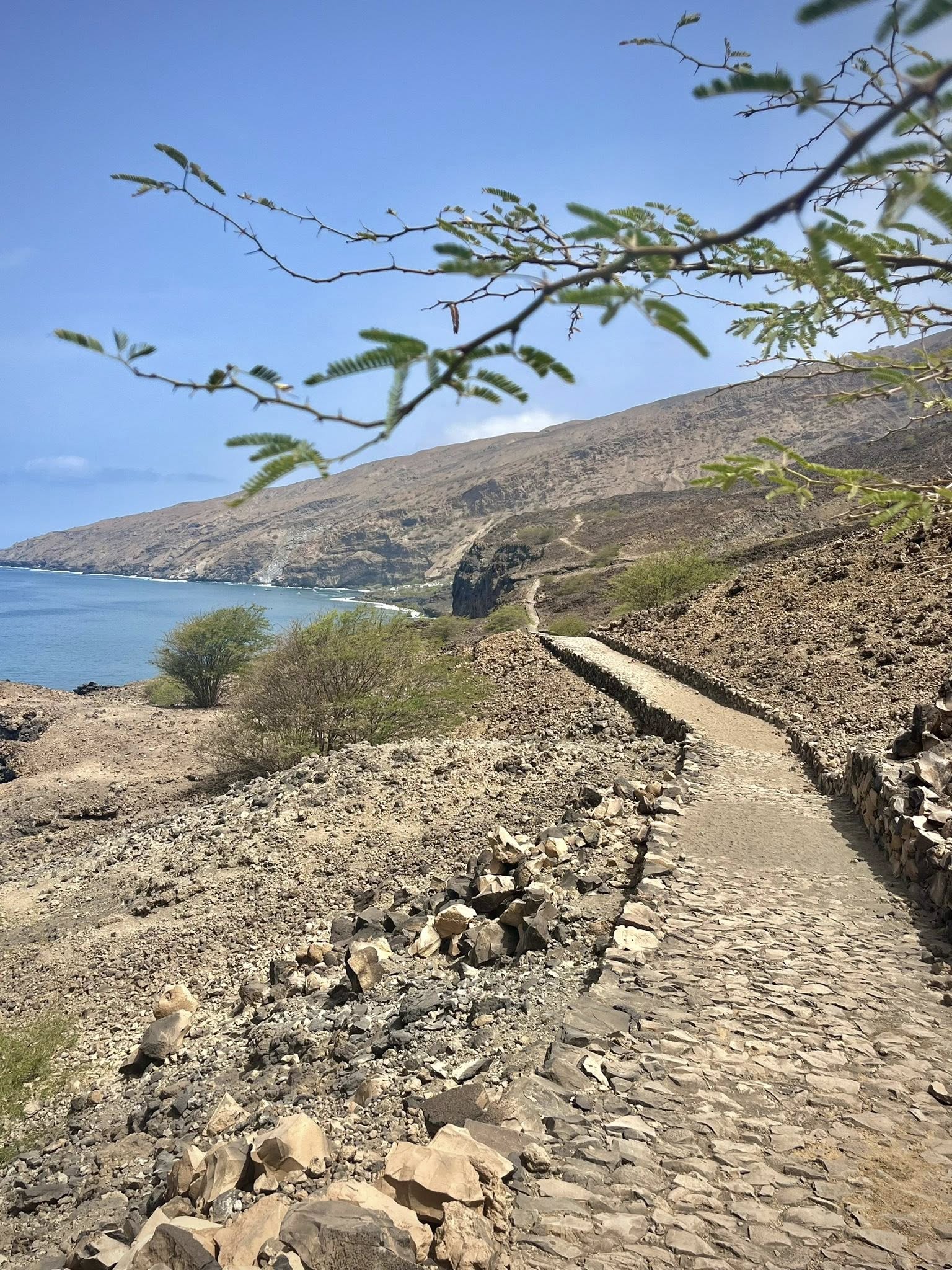
Day 6 – 5th hike – Tarrafal to Monte Trigo
Our final hike of this tour was sensational as we once again walked along a coastline, cliffs, and gorgeous water. This was our second longest hike of the five days, taking us 4-5 hours to complete.
We started early to avoid the hot afternoon heat, reaching the tiny village of Monte Trigo for a breezy lunch by the beach. The elevation gain was again challenging but made enjoyable by the vistas all around.
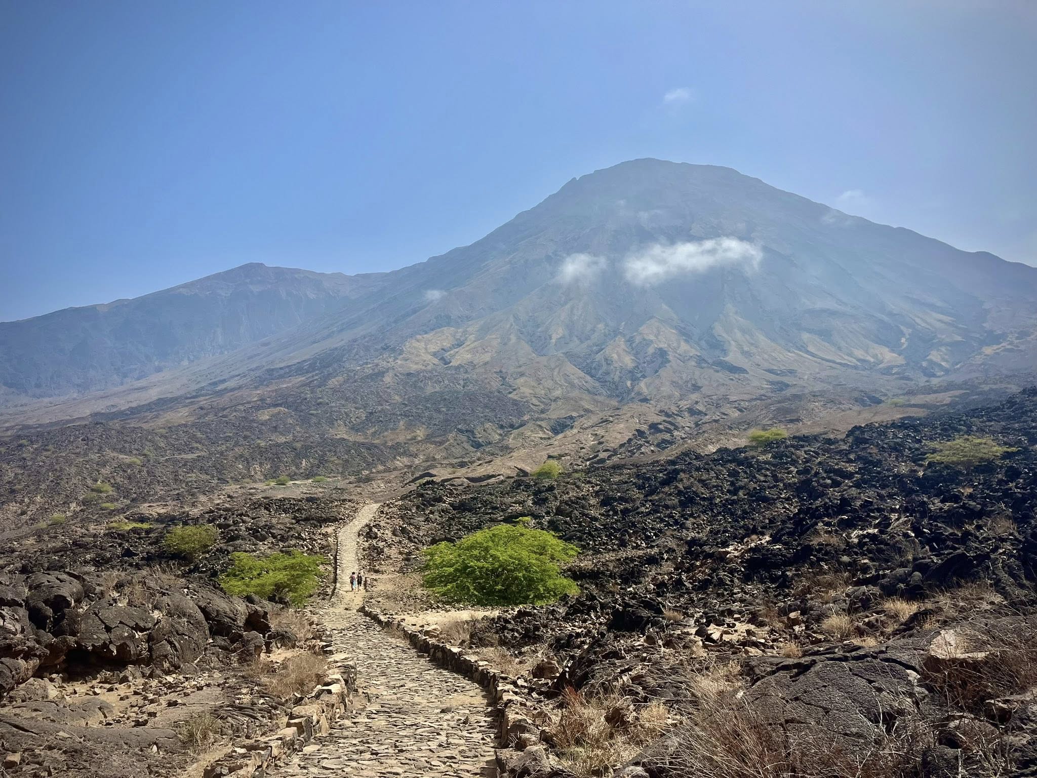
The majority of the hike was in the shade created by the surrounding mountains and the Tope de Coroa volcano. Also known as the Crown Top, the volcano is the highest point on the island at 1,979 meters.
We passed many goats along this path, mothers with their small babies. There were also donkeys, especially as we neared the village of Monte Trigo.
One note worth mentioning is that during all of hikes, the 16 of us would generally spread out along the path. People would sometimes walk alone or with someone else in the group. It was a great way to get to know our fellow-guests and have one-on-one discussions. We were free to go at our own speed, and I never felt pressured to hike faster. Our guide would make sure everyone was in sight and comfortable with the physical activity.
I have to say that after five straight days of hiking 3-4 hours each day, I was feeling the muscles in my legs. Fortunately I didn’t have any blisters or pain that interfered with the experience. There was also some elements of slight fear when walking on narrow slippery paths next to a steep cliff. I used my hiking poles almost everyday which helped a lot.
Our lunch spot in the small village of Monte Trigo was perfect. We were welcomed in this simple hotel with a cold beer and a lovely view from the terrace.
Hiking Stats: 11.3 km, 3 hr 50 minutes, 570 meters up / 570 meters down
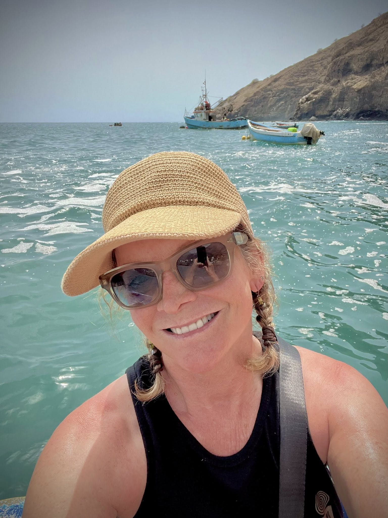
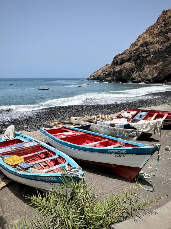
Monte Trigo is a simple village where people primarily live from fishing and agriculture. And fittingly so, we were taken back to Tarrafal on traditional fishing boats. It was a fun experience and a great way to end our week of hiking the Santo Antao island!
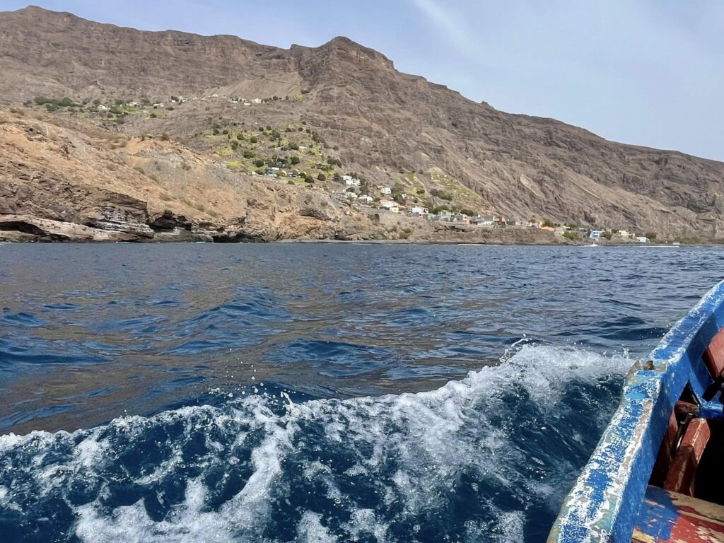
The scenic boat ride lasted 45 minutes. We arrived to the black lava beach in Tarrafal and walked back to our hotel. Some of the group took advantage by swimming in the ocean.
We finished this long day by walking to a nearby beach restaurant where we had cocktails and another delicious dinner.
Day 7 – Ferry from Santo Antao to Sao Vicente
Our final day itinerary was to return to the island where we started, Sao Vicente. We had a 2-hr drive from Tarrafal to Porto Novo where we boarded the ferry once again.
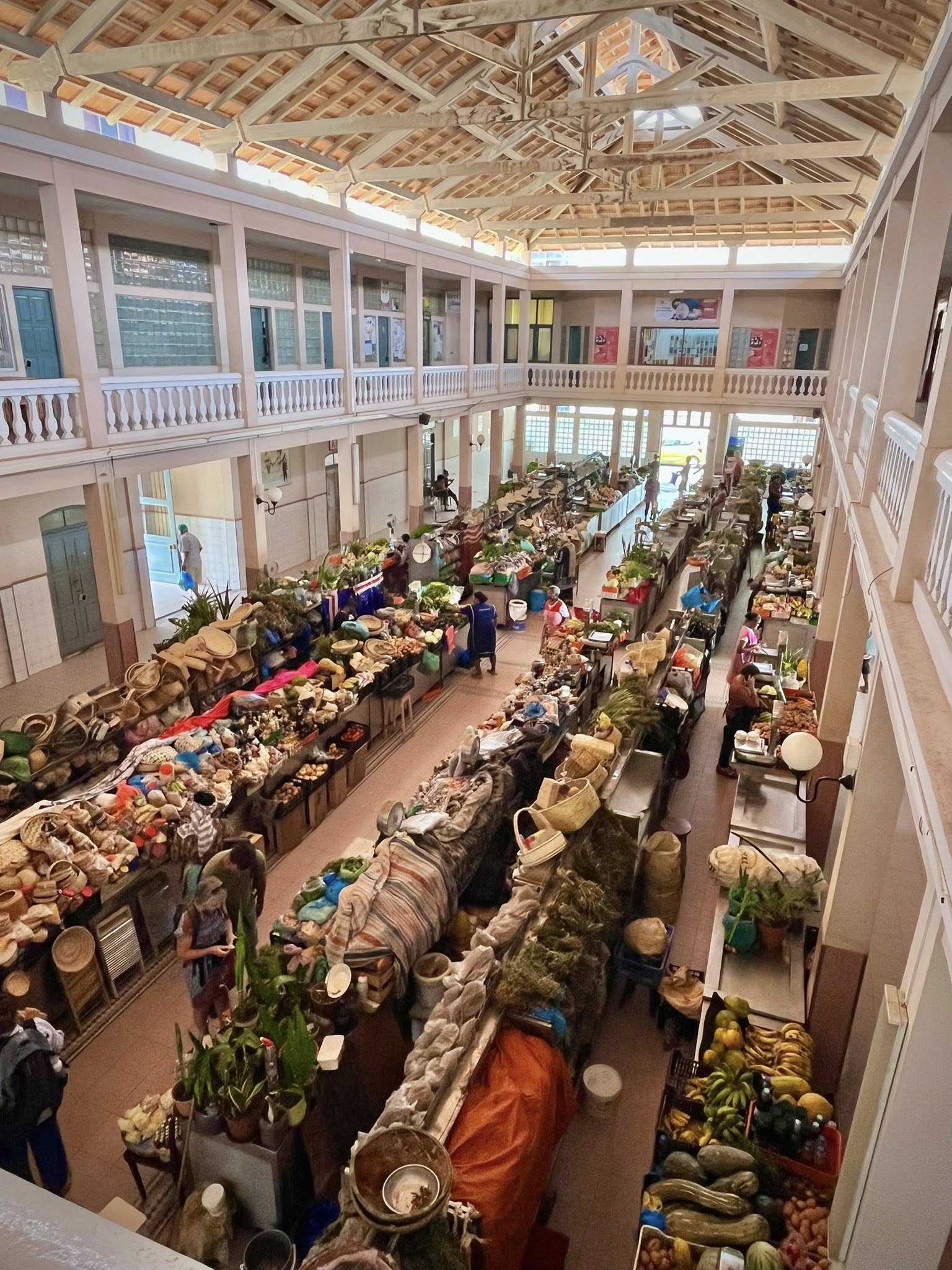
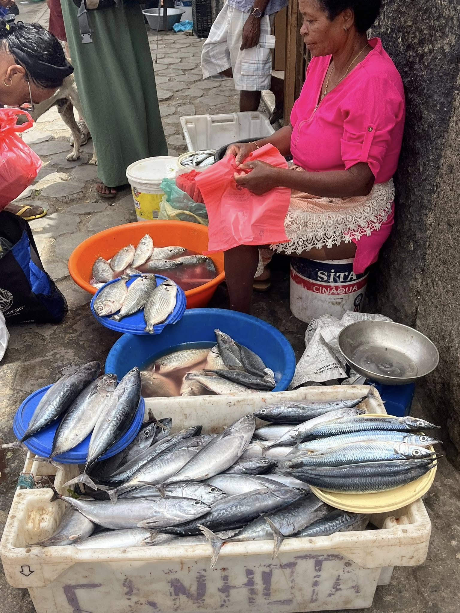
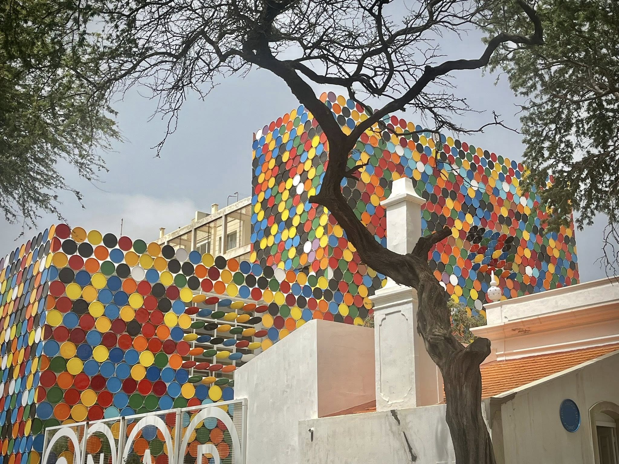
After we reached Mindelo, we went immediately for a city tour with our guide. She showed us the municipal and historical buildings in the center of town. We stopped by several markets to see the locals selling fruit, vegetables, fish, and souvenirs.
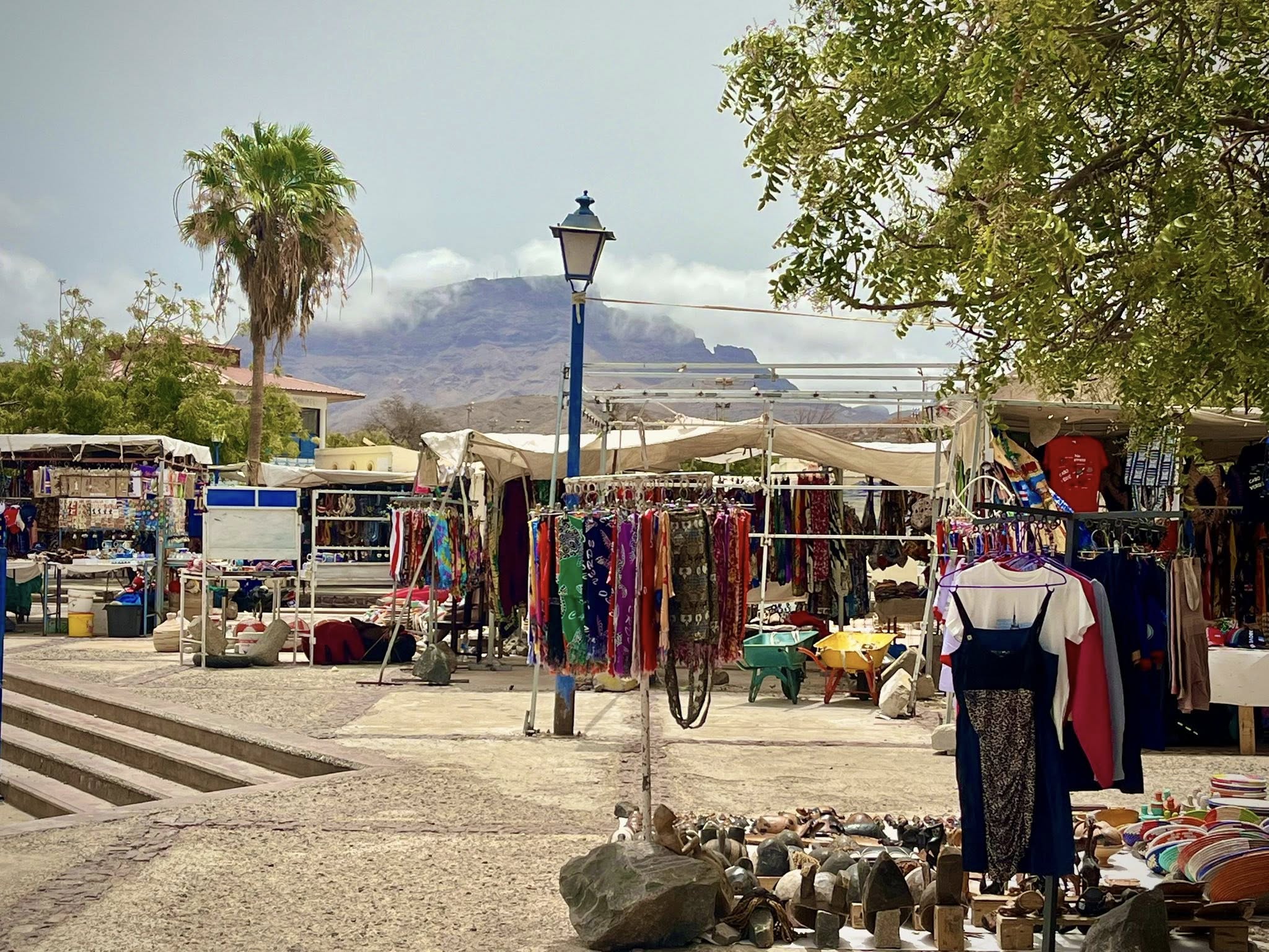
We took a local bus to arrive at a fabulous beach where we had lunch at a lively restaurant called Caravela Mindelo.
Our last night would be spent in the same hotel we were the first night. We were taken to a super cool open air restaurant called Le Metalo where we enjoyed live music and delicious food. It was a bit sad to say goodbye to everyone, but we all came home with wonderful memories of the physical effort we did and the laughter we shared.
Summary of Cabo Verde
I hope you’ve enjoy my blog post on Cape Verde! I took great pleasure to summarize the voyage in this article and share my favorite photos. If you would like to see more of my photos and videos from this amazing trip, feel free to check out my dedicated Facebook Album.
I believe an organized group tour is the best way to experience hiking in Santo Antao. As with any tour, there are pros and cons (refer to my article Tour Packages – Pros and Cons), but our itinerary was perfect (Link to our specific tour)! Although you could drive around the island to see its beauty, I think the best way to experience it is by hiking. I’m already looking forward to my next hiking trip in September 2025 to Albania (also with Terres d’Aventure)!
If you are looking for assistance to plan your next trip, I am here for YOU! I love to plan travel itineraries for myself and others. For more details on how I provide this service, please check out my Itinerary Planning page and drop me a quick email at jan@janadventures.com to get started!


You May Also Like

Bucket List Travel for Retirees
Safe Vacation Ideas for 2020