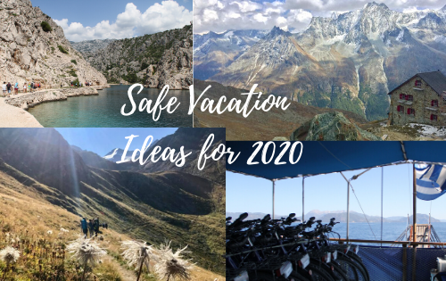
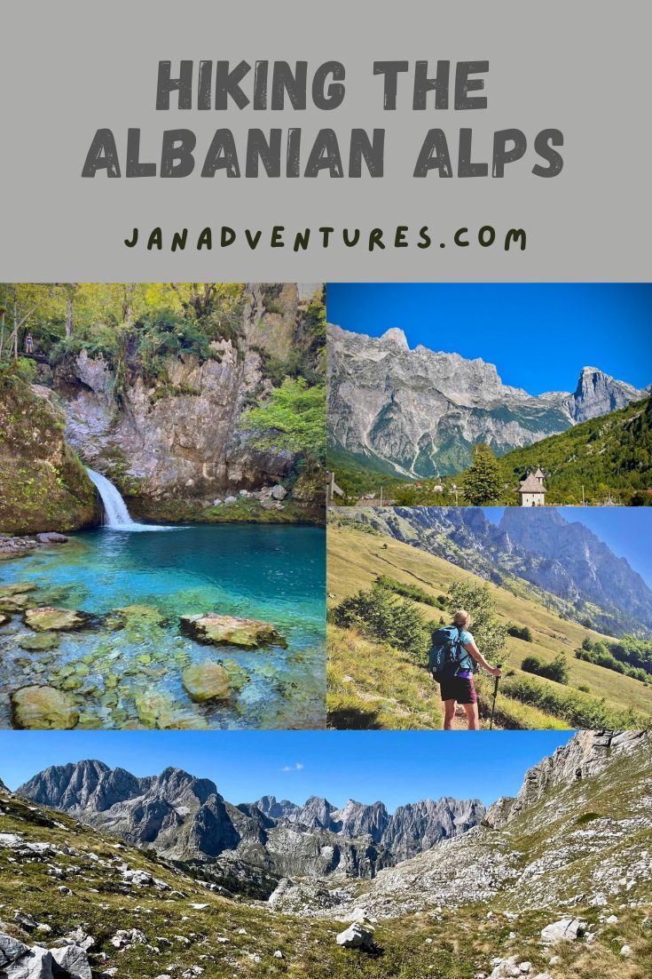
Hiking the Albanian Alps
If you love to hike in the mountains, you will want to read this article on hiking the Albanian Alps! I just returned from the most amazing week in the northern part of Albania. I hiked for six days straight and want to share my experience of this new adventure!
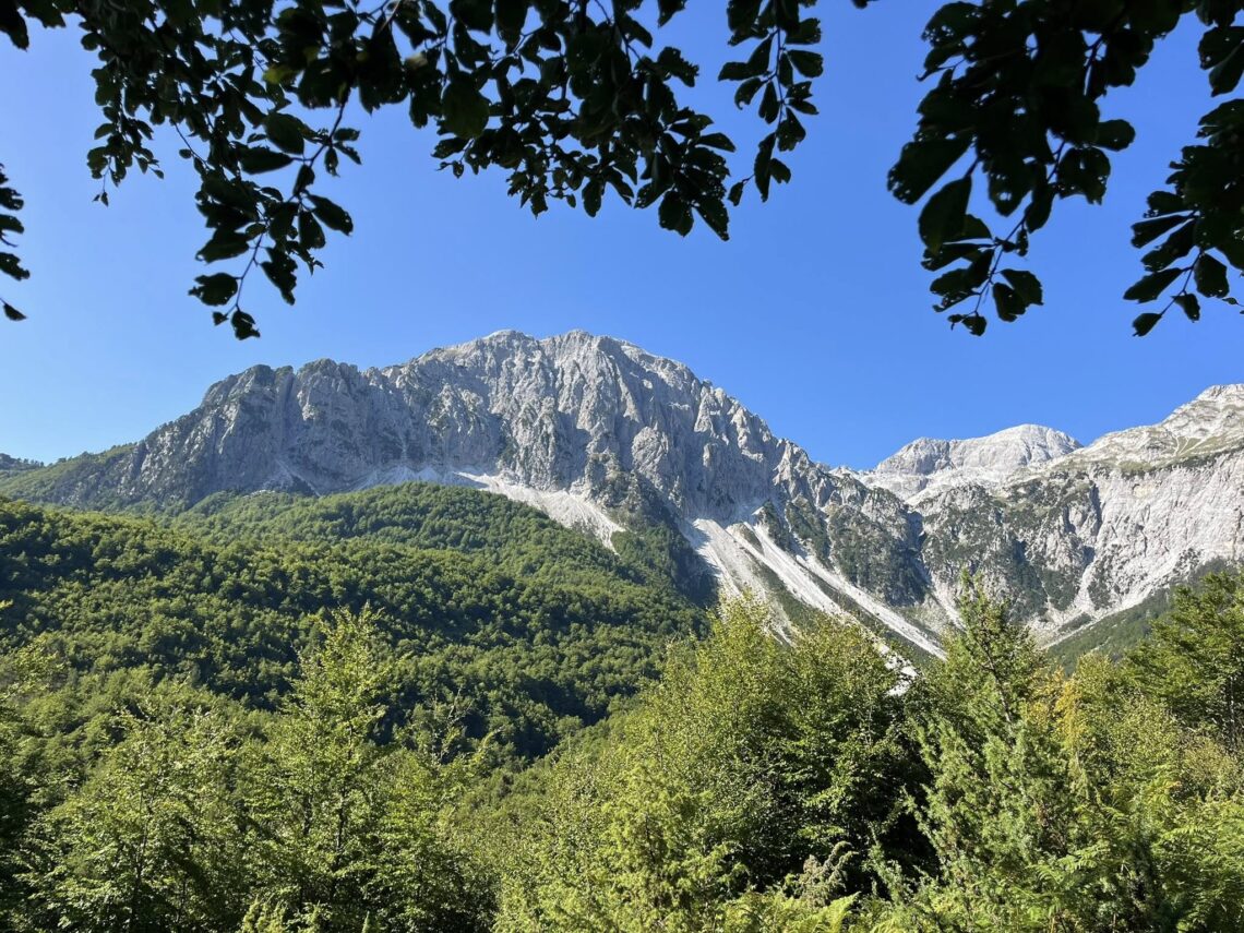
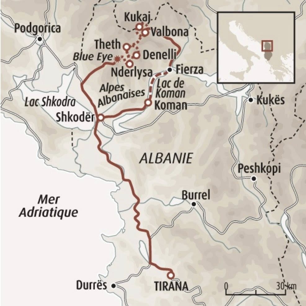
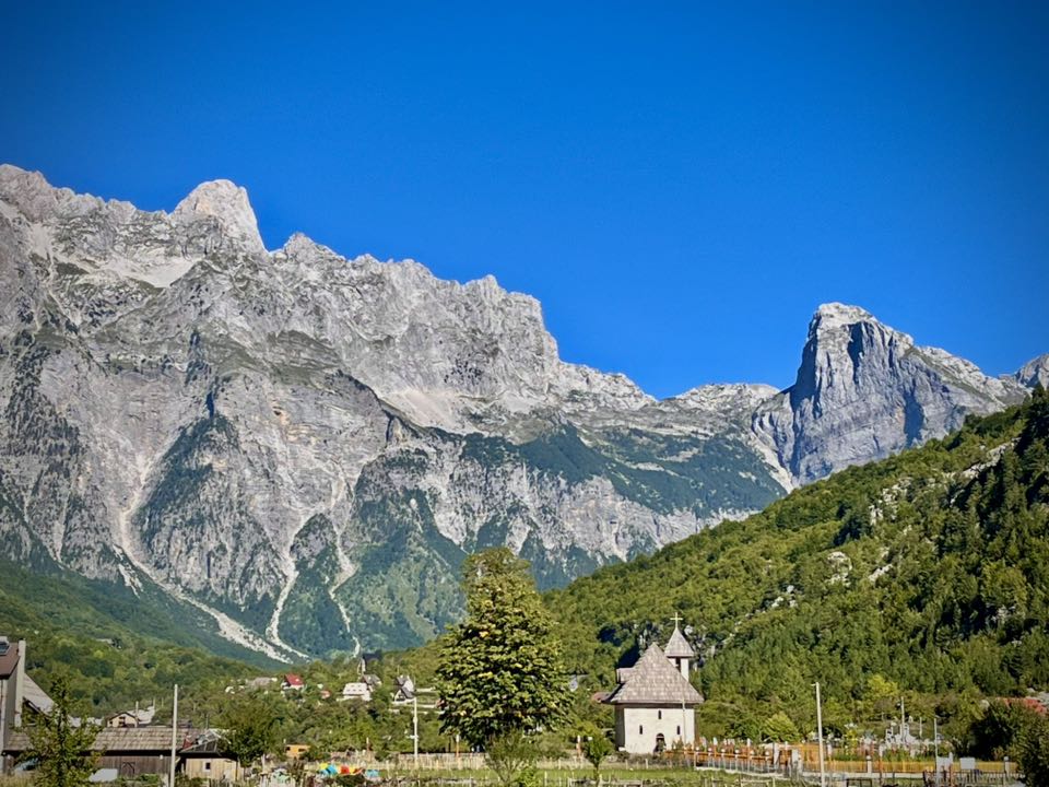
The Albanian Alps is a region in the North of Albania, known for it’s beautiful, dramatic mountain scenery. The valleys of Theth and Valbona (Valbonë) are the most well-known in the region, connected by a popular hiking route.
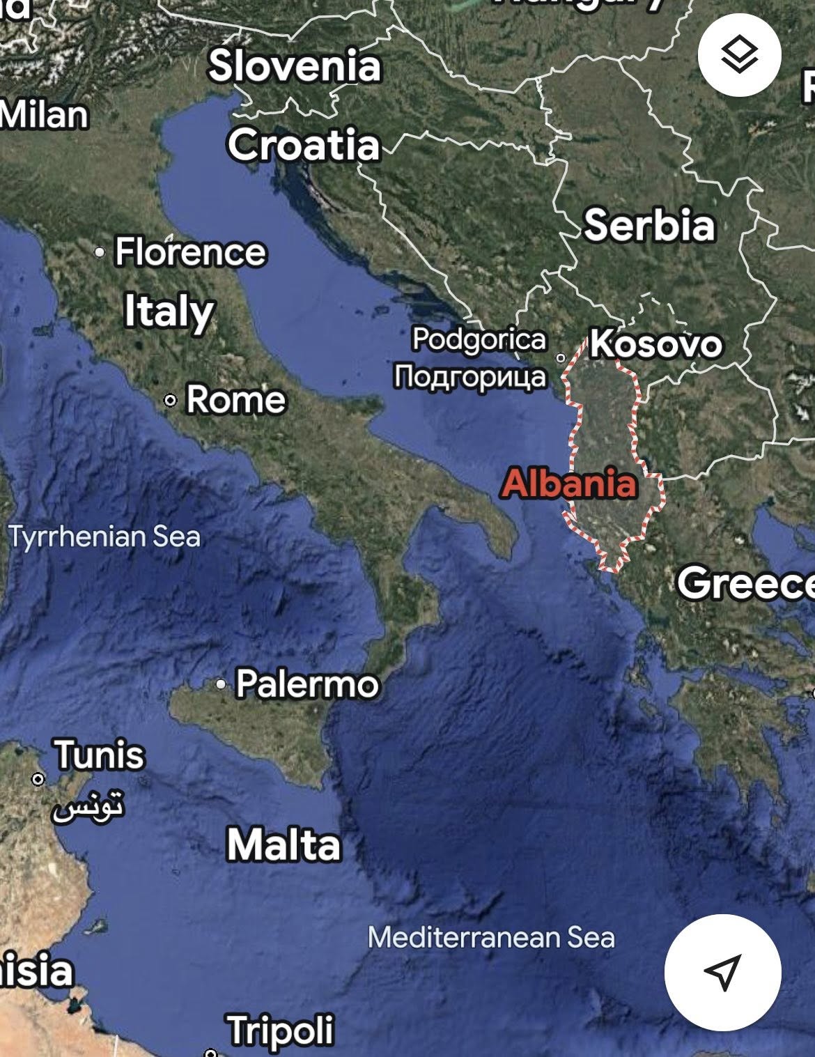
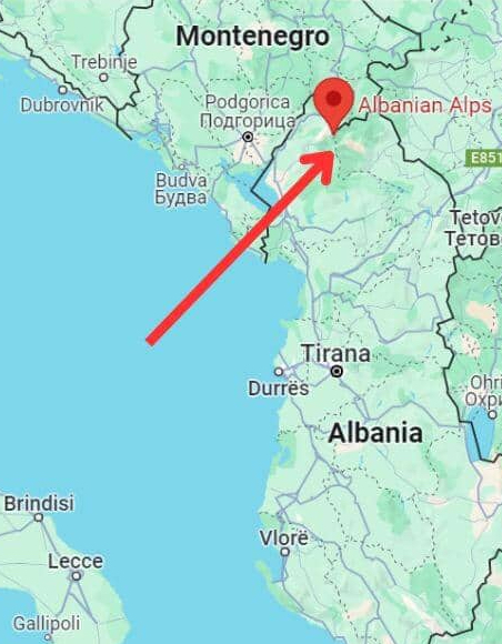
The Accursed Mountains, or Albanian Alps, stretch more than 60 km (40 mi) across northern Albania, Kosovo and Montenegro. They are the southernmost part of the Dinaric Alps and have 19 peaks that are higher than 2,400m (7,874 ft).
Albania was declared independent in 1912. Ruled as a monarchy between the World Wars, Albania emerged from the violence of World War II as a communist state that fiercely protected its sovereignty. With the collapse of other communist regimes beginning in 1989, new social forces and democratic political parties emerged in Albania. Economic hardship in the early 1990s led to a transition to democracy in 1992.
- Albanian Alps Tour Overview
- Day 1 – Tirana Airport to Shkoder
- Day 2 – Shkodër – Lake Koman – Valbona
- Day 3 – Valbona – Kukaj – Rama Hut – Valbona
- Day 4 – Valbona – Valbona Pass – Theth
- Day 5 – Theth – Peja Pass
- Day 6 – Theth – Nderlysa
- Day 7 – Nderlysa – Blue Eye – Shkoder – Tirana
- Summary of Hiking the Albanian Alps
Albanian Alps Tour Overview
My friend and I booked this self-guided hiking tour with Terre d’Adventures, based in France. This was our second trip with this company. The last experience was in May of 2025 when we did a hiking trip to Cabo Verde islands.
I didn’t know much about Albania before this trip, but I had been to the nearby countries of Croatia and Montenegro (see my blog article here). I wanted to experience the inland region of Albania to enjoy my hobby of hiking.
If you’re interested in Croatia, see my two articles: One Week in Split, Croatia and Croatia Islandhopping Bike Tour. For Montenegro, I documented my experience of Sailing the Montenegro Coast.
Our French company used a local tour company called Zbulo. It was this company that handled all the details and organization in Albania.
Prior to leaving for the trip, we were mailed a detailed roadbook with precise instructions for each day of the trip. When we arrived in Albania, Zbulo gave us a Garmin GPS (equipped with waterproof and shockproof protection) and a basic phone with a local SIM card.
Zbulo and Terre d’Adventure provided a customized phone application we could download to follow the daily planned routes. The advantage of this application is that you could use it offline to see the trails and your location. It would warn you if you went off the designated trail. This application was our bible for the whole week and much more useful than the GPS device. We only used the phone a couple of times to call the agency. At the end of the week, we returned the two devices.
The concept of this kind of trip is that you must be able to navigate independently using the roadbook, maps, and GPS. We looked at this tour as a challenge since we had only done guided hiking tours in groups. You can find all the details about our trip booked with Terre d’Adventures.
Day 1 – Tirana Airport to Shkoder
We left on an early flight from Geneva to Tirana (~2hrs) where we were picked up by our tour company and driven 1.5 hrs to Shkoder. After a briefing from the local tour agency representative, we checked into our cute hotel and then headed out on foot to discover the town of Shkoder.
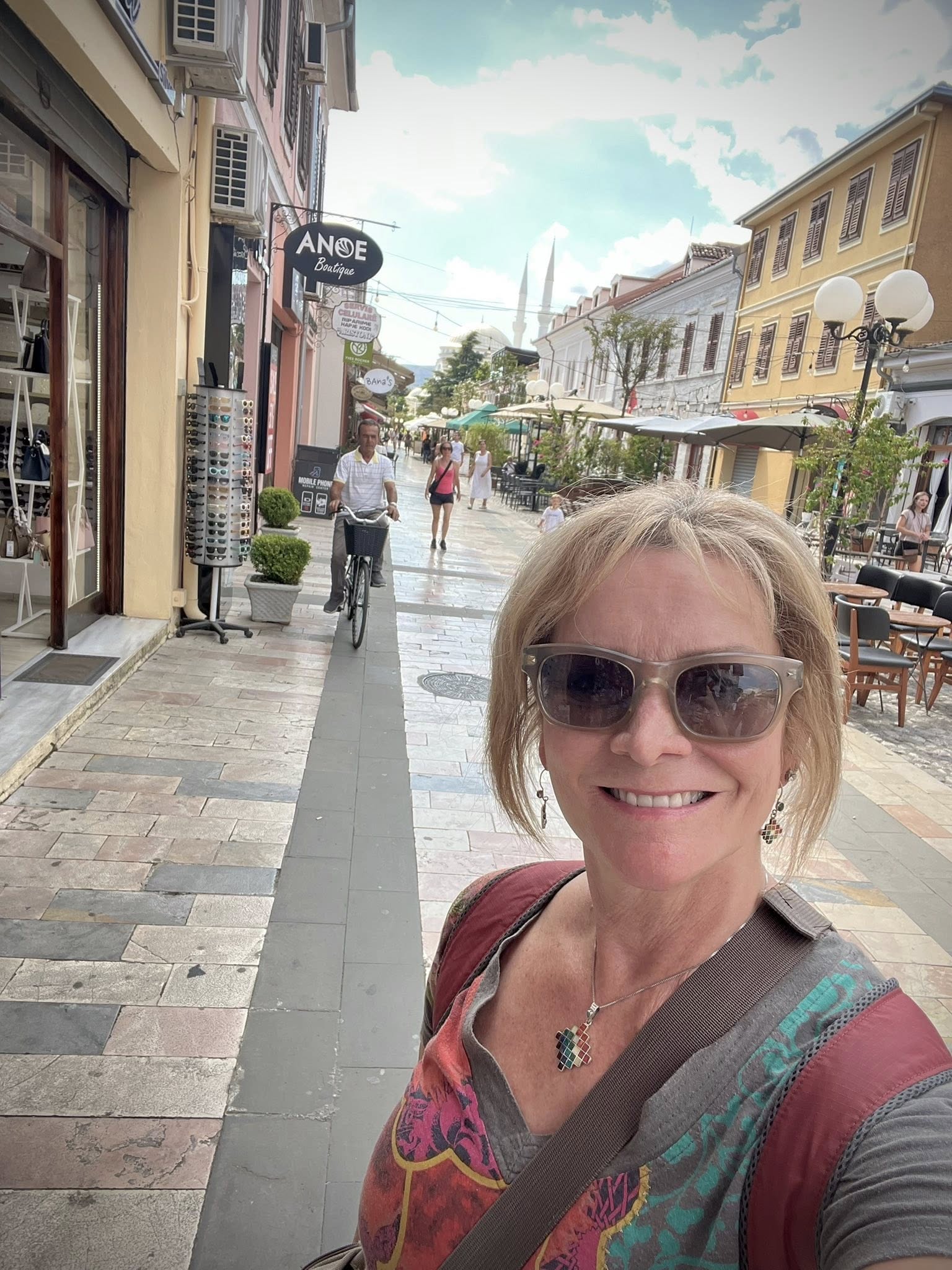
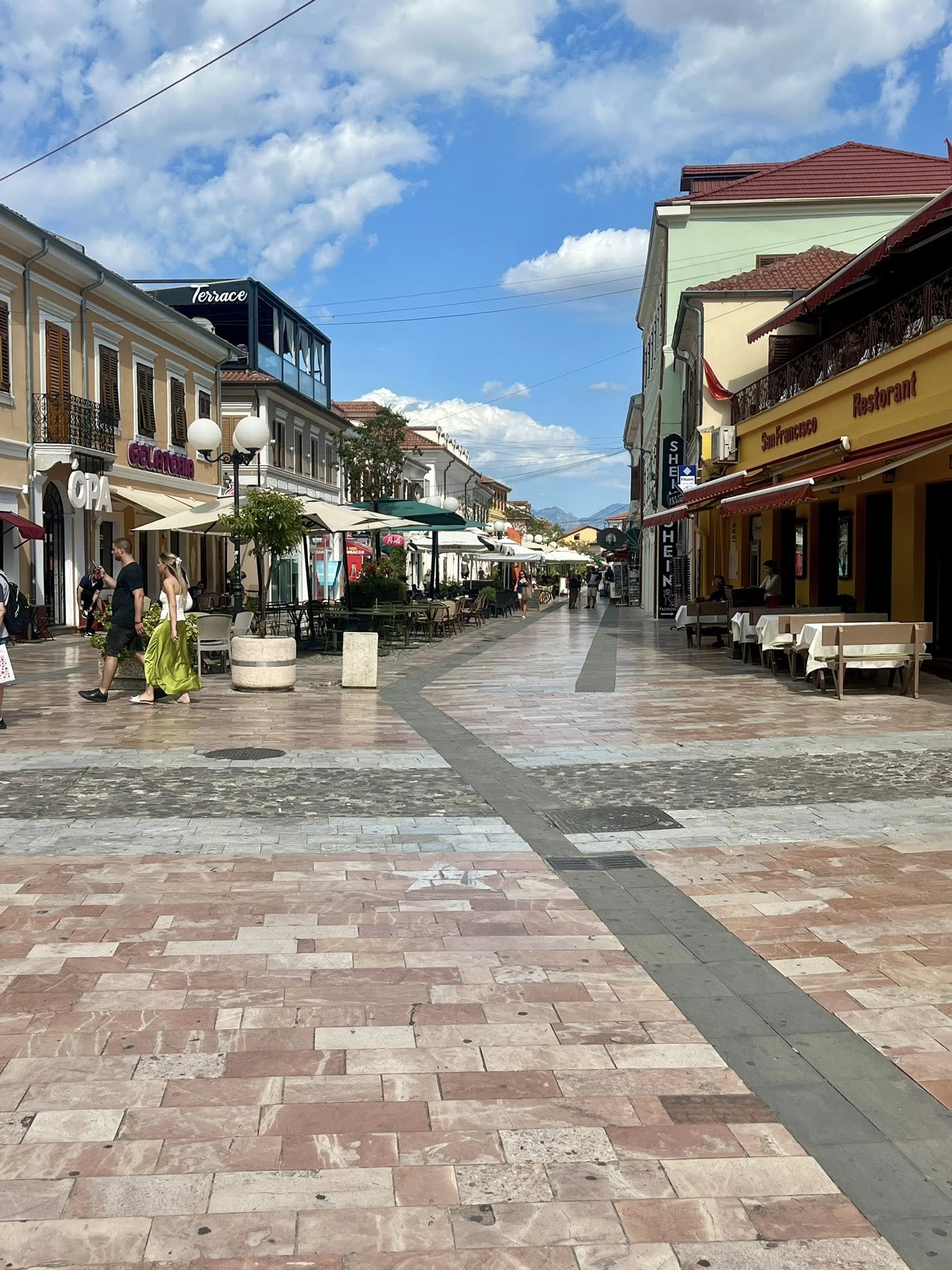
There is a nice pedestrian area of the town with no cars. We saw many shops and outdoor restaurant areas. Before walking around the town, we chose to have a light lunch at Fisi Restaurant. The food was delicious!
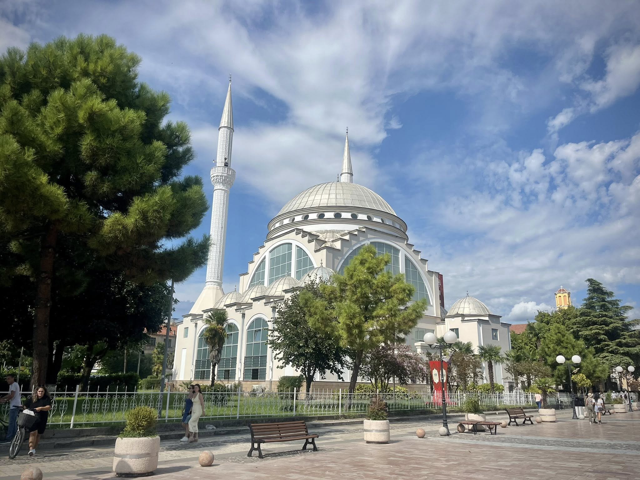
We passed the Ebu Bekr mosque in the center of town. It is a modern structure inspired by Ottoman mosques dating from the 16th century. Albania is religiously diverse, with Muslims making up 45%, Christians 16%, Irreligious/Non-denominational 17%, and approximately 22% undeclared.
Shkoder is one of the oldest cities in the country and founded in the 4th century B.C. It is an important economic and cultural center with around 81,000 inhabitants.
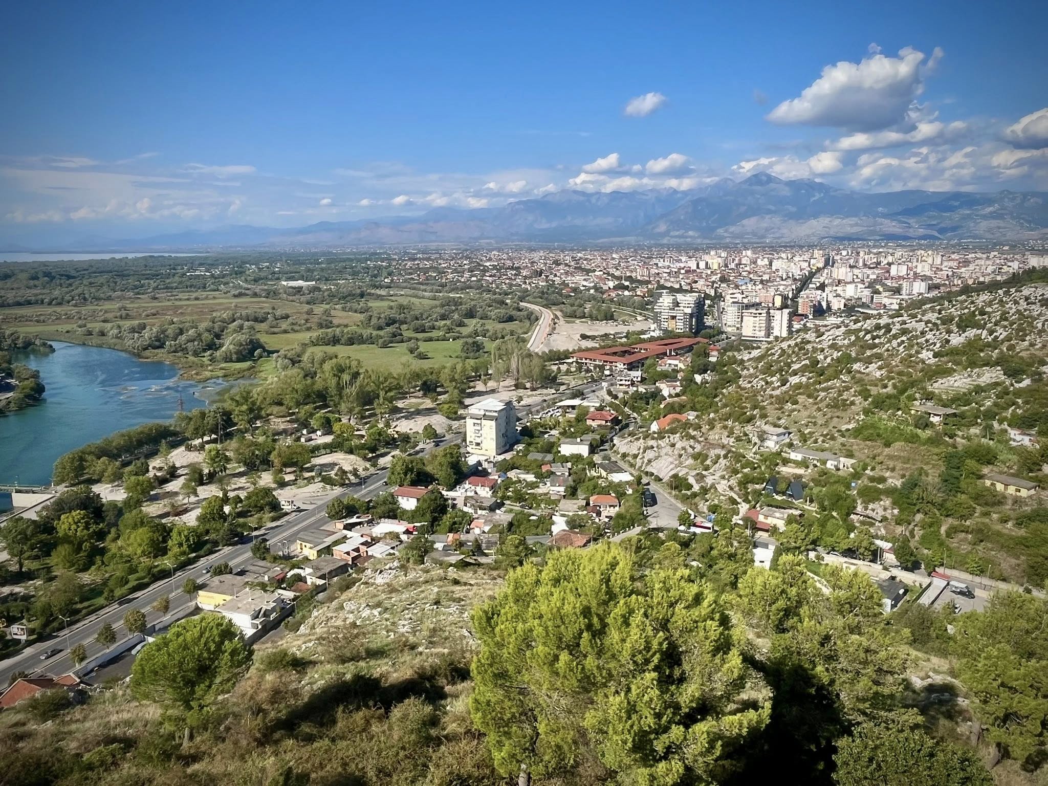
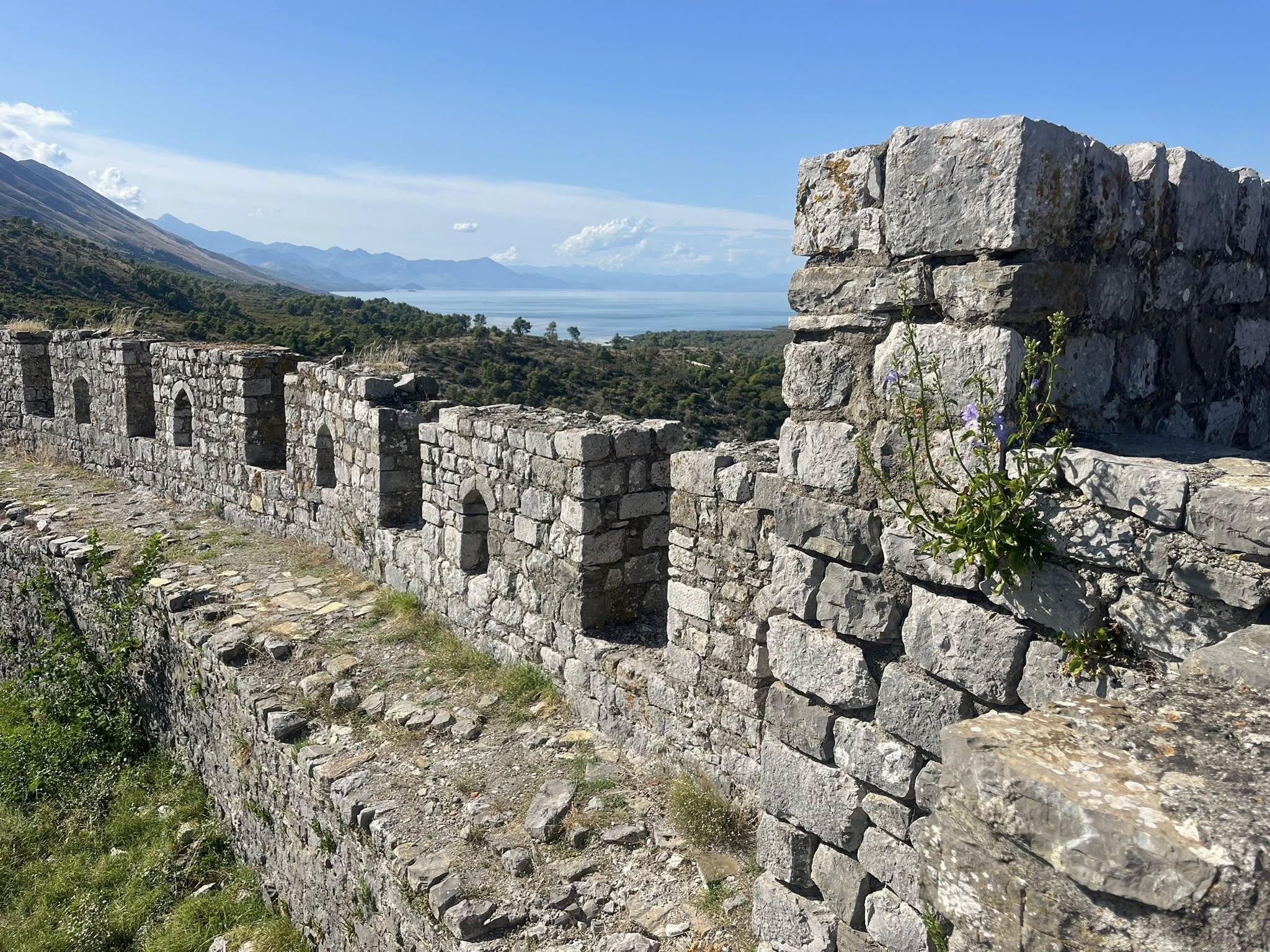
Rozafa Castle
There is a famous castle worth visiting in Shkoder called Rozafa Fortress. It was an hour walk from town, so we took a taxi to get to the top of the castle. The taxi only cost 3 Euros, but you need to negotiate prices to not be taken advantage of.
The castle’s roots date back to the 4th century BCE, when it was established by the Illyrians as a strategic military base. The Romans eventually conquered in 167 AD. Most of the fortifications that are still visible today are Venetian in design. The name of the castle comes from the legend about a girl called Rozafa, who willingly allowed herself to be buried in the walls to prevent them from collapsing.
The entrance to the castle was only 1.50 Euros for an adult. We walked all around the grounds and admired the 360 degree views. You could even see the Albanian Alps where we would spend the rest of the week.
As it was a nice warm day, we decided to walk back from the castle to town (45 min). By this time, we opted for an early dinner at the Marina 4VM restaurant. It was a great place for seafood and perfect for sitting outdoors.
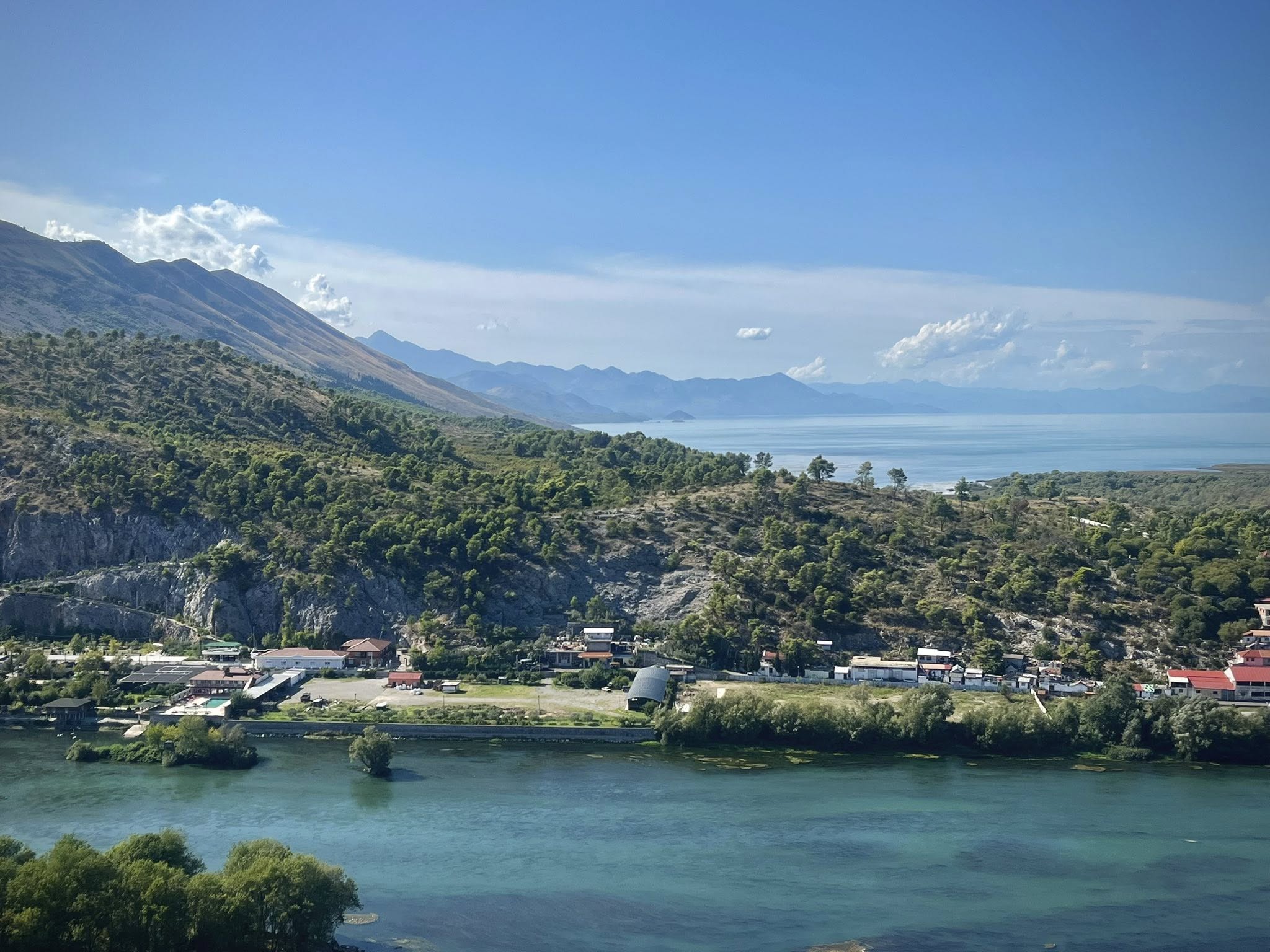
Day 2 – Shkodër – Lake Koman – Valbona
On our second day, we had a 6:30am scheduled pickup at our hotel in Shkoder for a 2 hr scenic drive to the Lake Koman ferry. I have to say it wasn’t the most comfortable ride as we were squeezed into a small public bus. Several locals were using the bus as transportation to places between Shkoder and Lake Koman.
Lake Koman Ferry
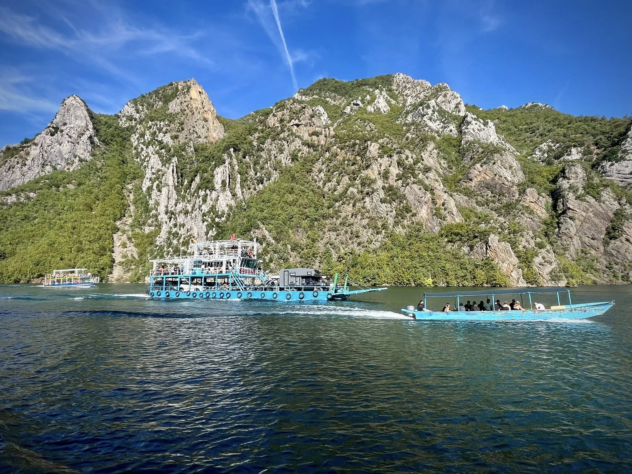
Before we arrived to the ferry landing, we had to pass through a narrow tunnel. There were many busses and cars trying to get through the tunnel, and there was a traffic jam with no way to maneuver. Eventually, we had to exit our bus with our luggage and walk through the rest of the tunnel to find our boat.
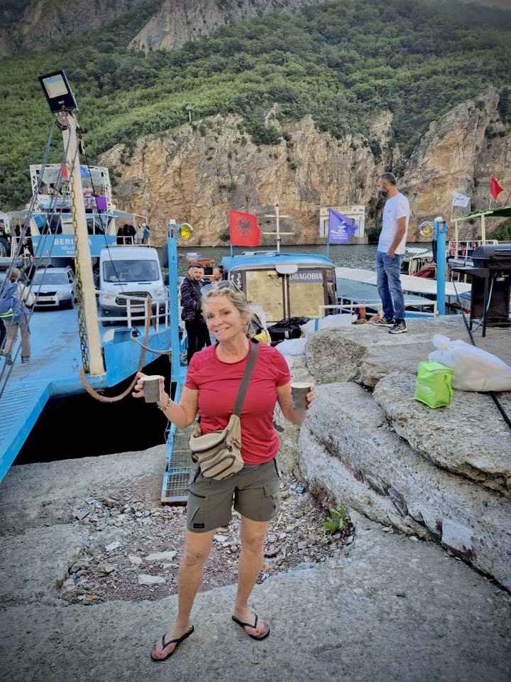
Our ferry was quite small but had seats inside and a narrow outside area to stand. There were many people on our boat, so it was difficult to walk around. There was no option to purchase any drinks or snacks. At least the boat had a toilet for the 3-hour cruise.
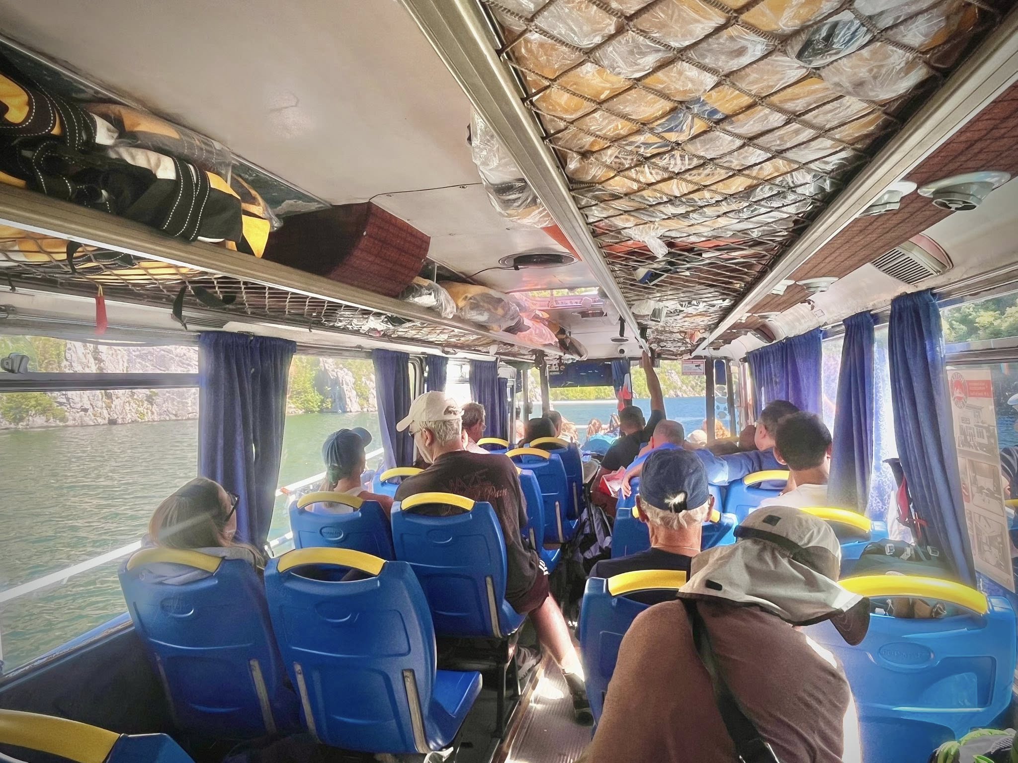
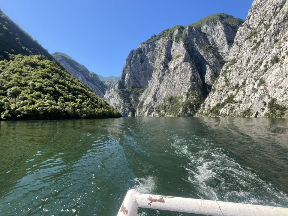
We enjoyed spectacular fjord views on the 46 km boat ride to reach the small town of Fierze. Lake Koman is known for its deep canyons and wooded hills, similar to the Scandinavian fjords. I did a cruise through the Norway fjords and can attest that it is very similar scenery. The time passed quickly because we were so busy looking at the impressive landscape.
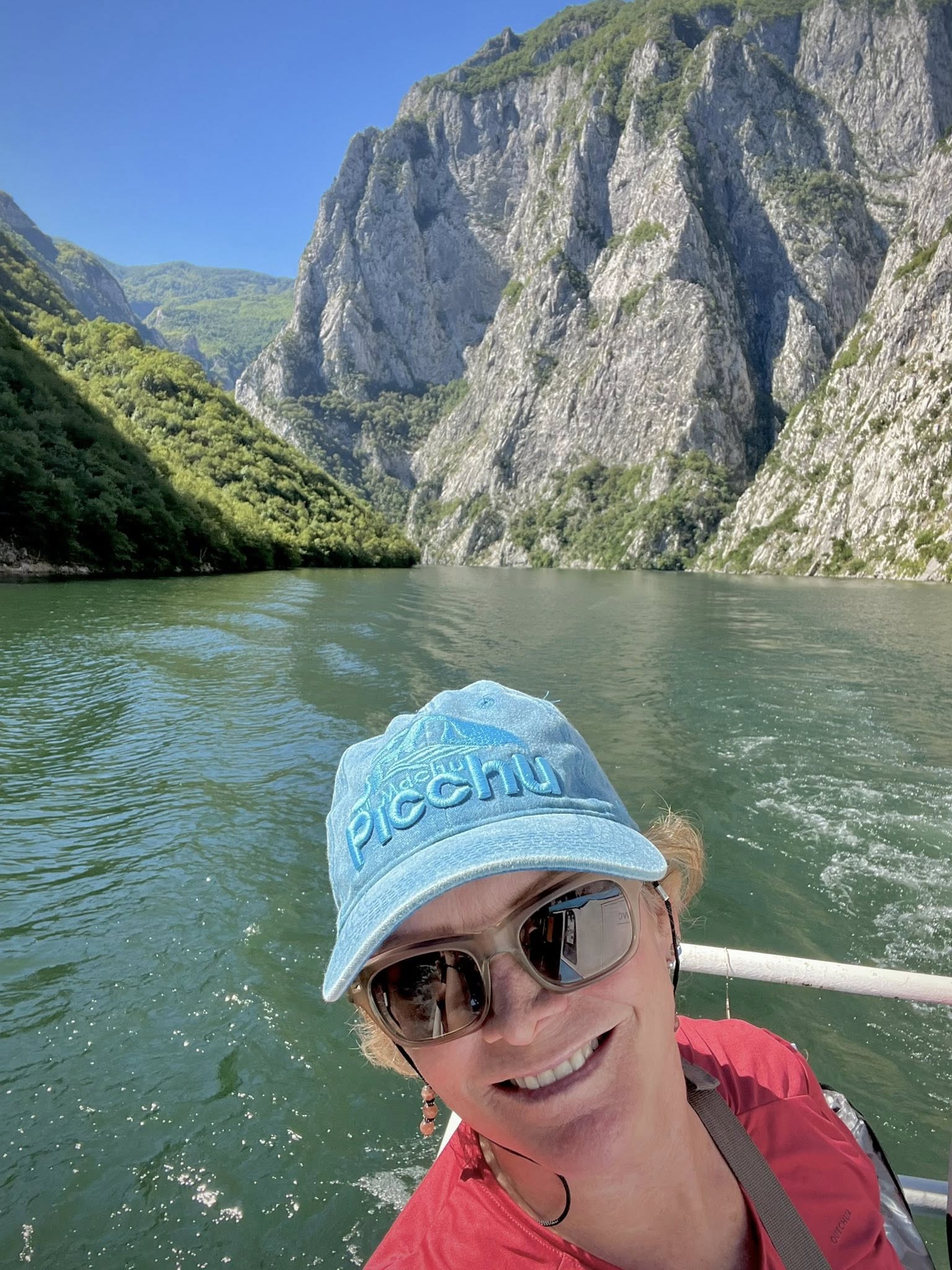
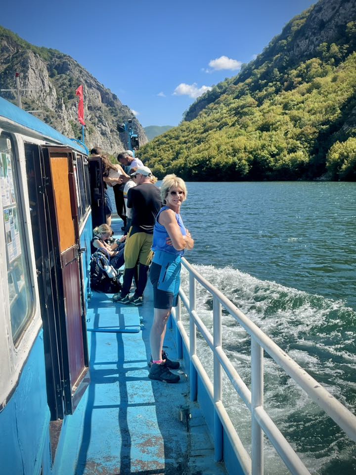
Lake Koman was formed in 1978 by the damming of the Drina River. Along the waterway, small villages have remained cut off from the rest of the world. We were surprised to see that many of the local people on our boat would get off along the way at remote mountainside locations. Some were transporting food supplies, perhaps for their homes or guesthouses.
Valbona Valley Hike
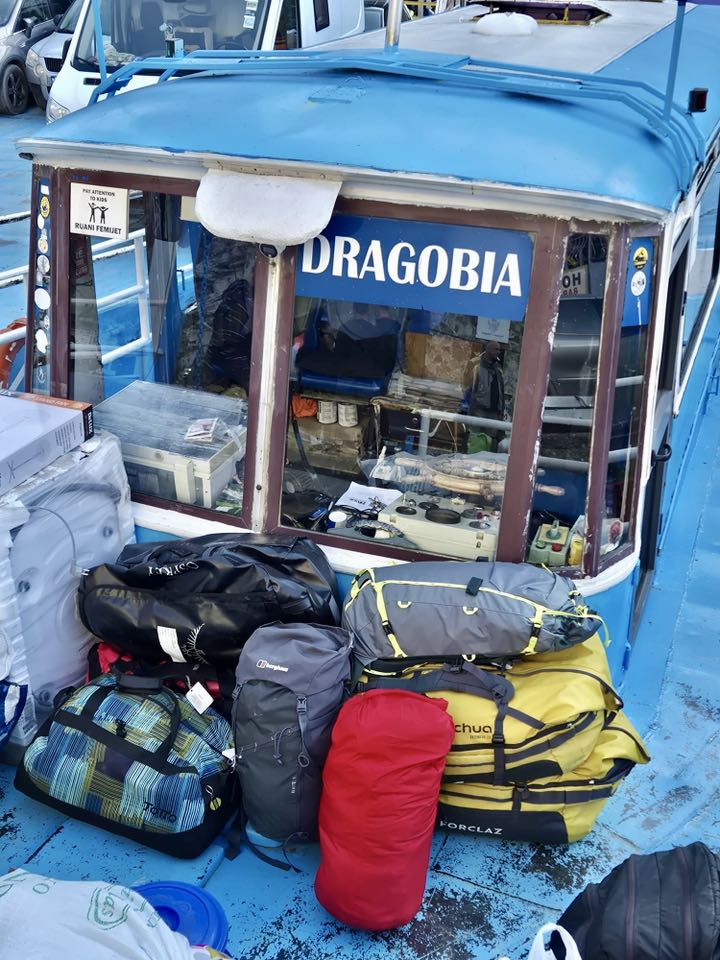
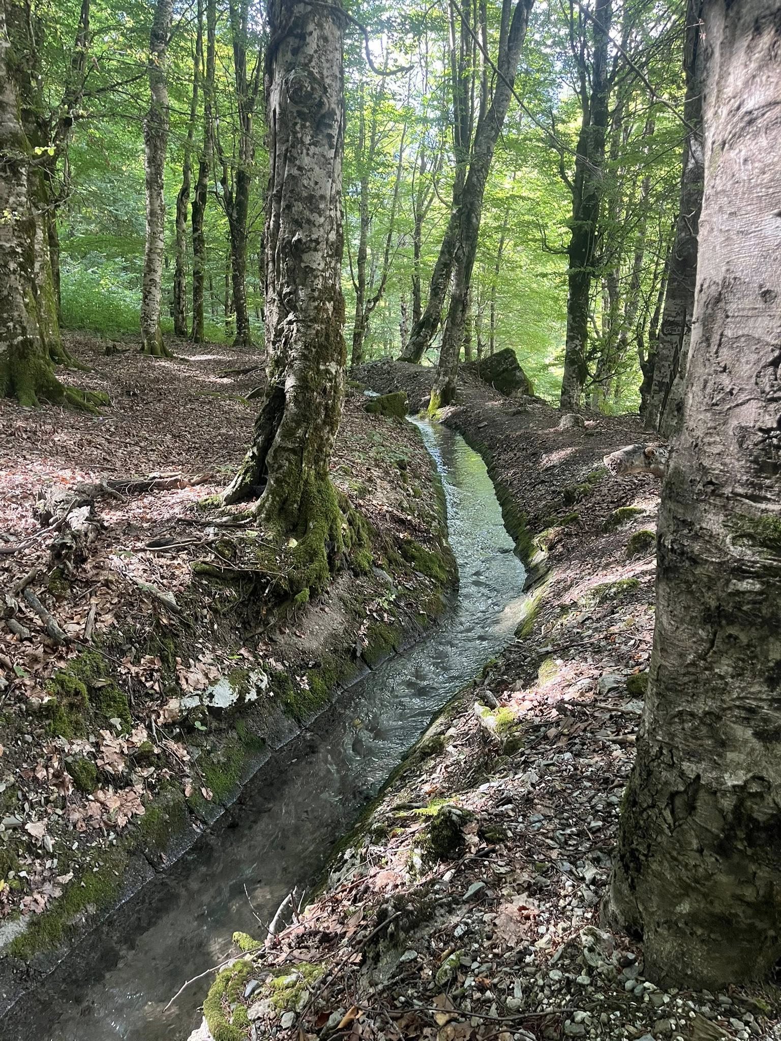
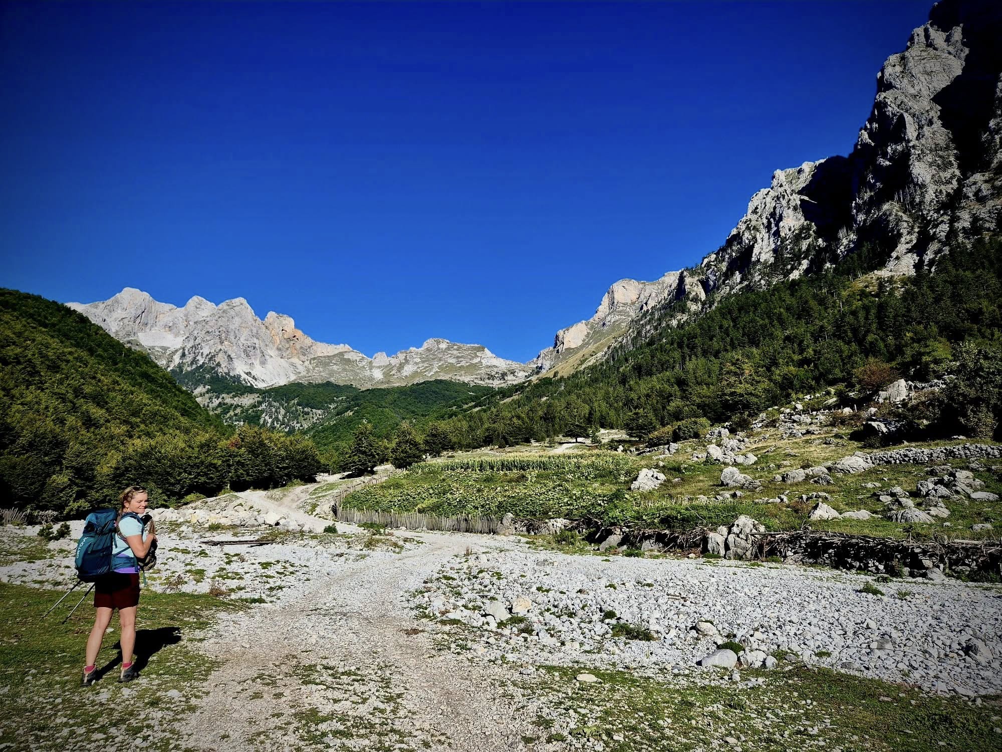
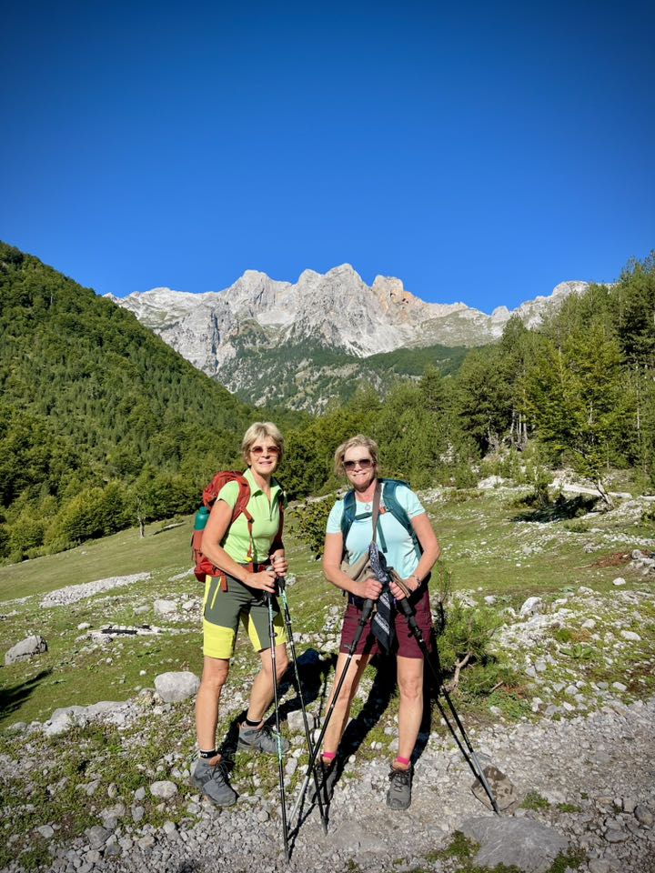
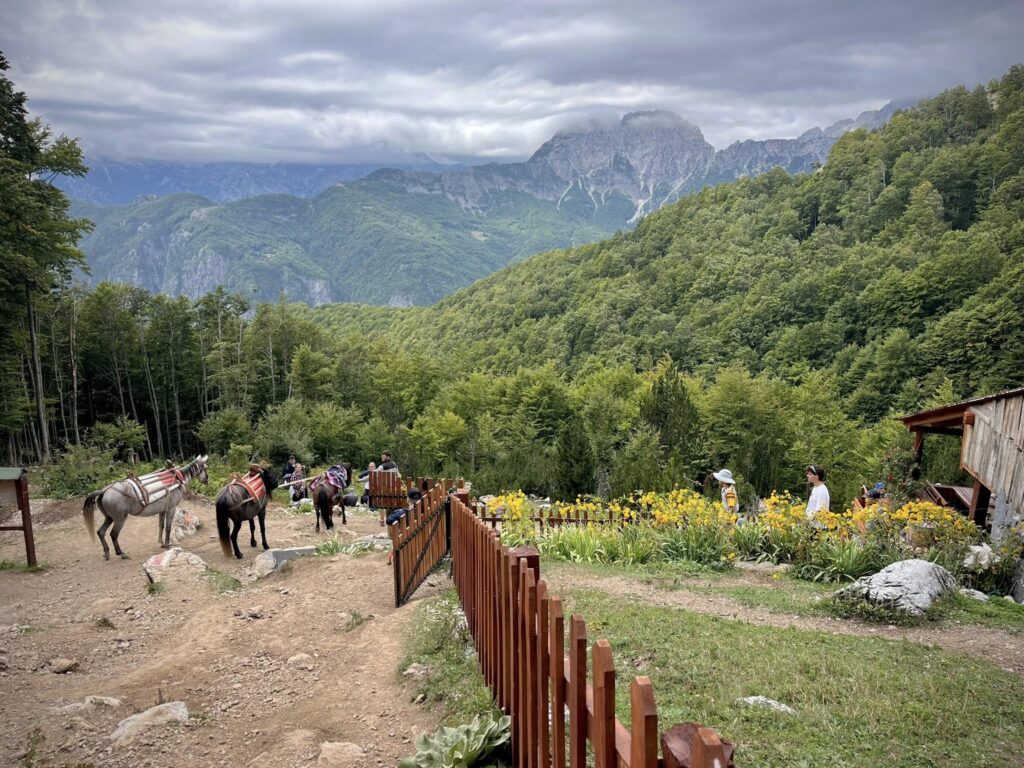
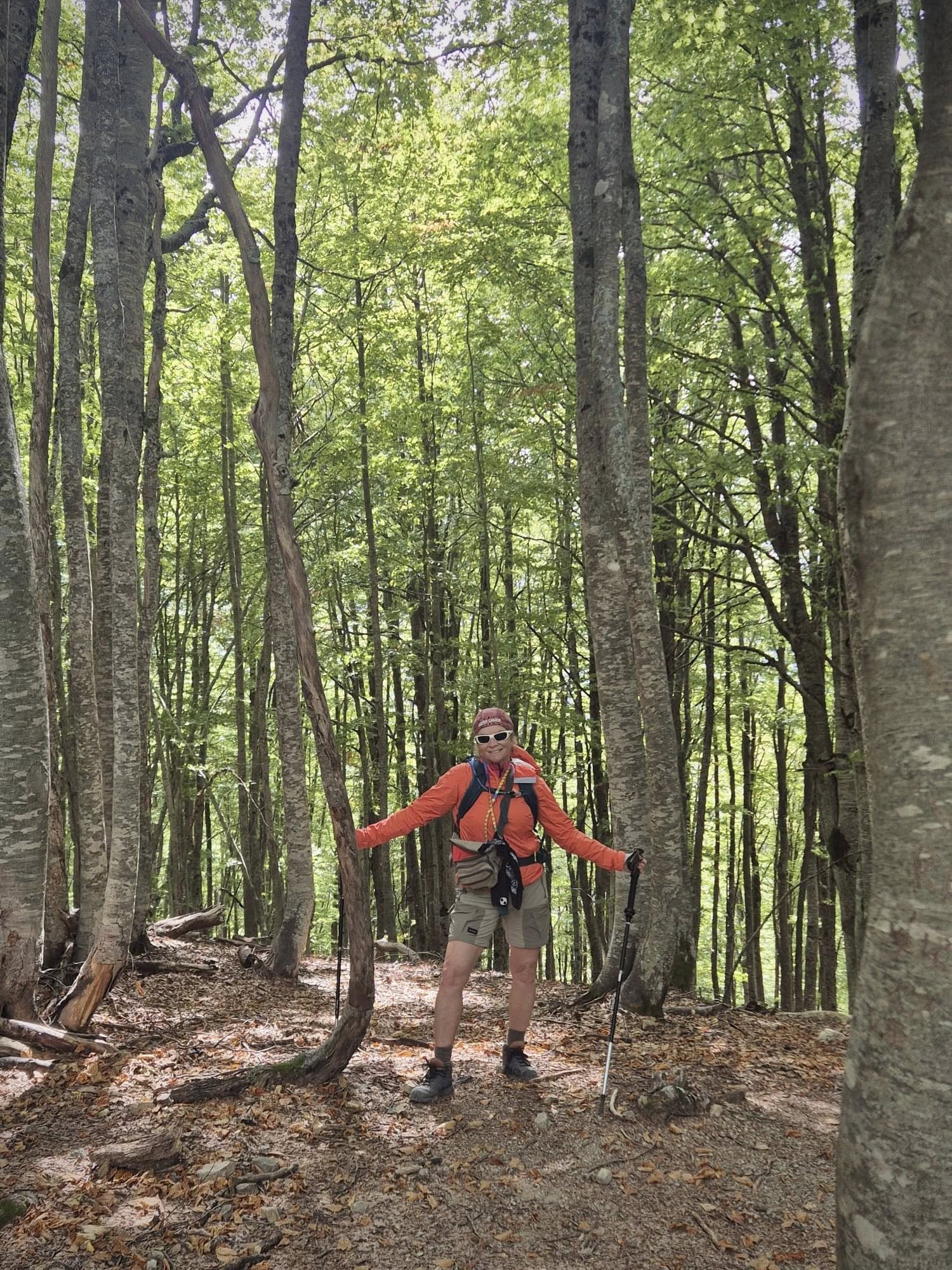
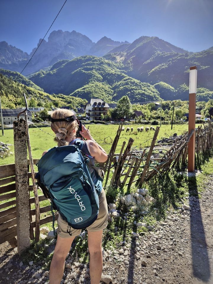
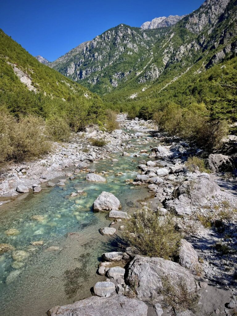
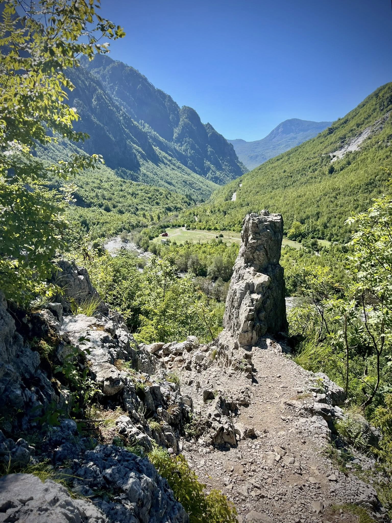
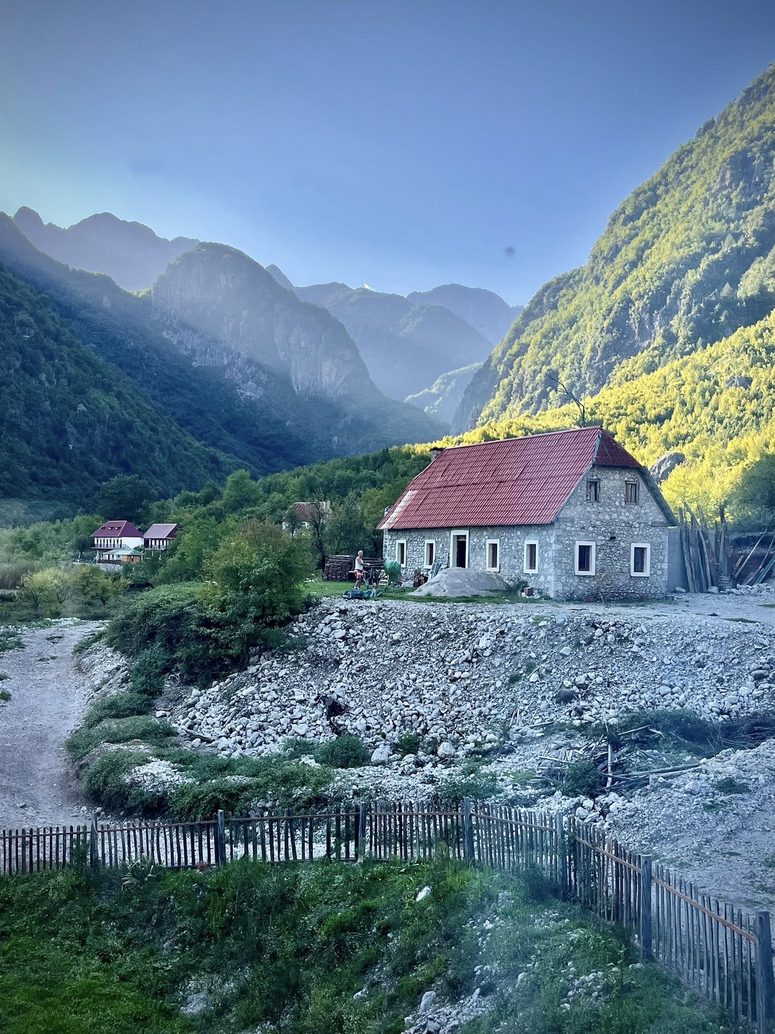
At the end of the ferry ride around 12:30pm, we were driven 30 minutes to the small town of Bajram Curri for a hearty lunch of local specialties. We then headed to the start of our first easy hike of the week in Dragobi located in the Valbona Valley National Park. The national park has an area of 8,000 hectares. Valbona is the name of the river which flows through the Valbona Valley and the village of the same name.
Our luggage was transferred by car to our accommodations that night. We started the self-guided walk through a shady forest along the beautiful river. The mountains around us were stunning. After 2.5 hours and 8km, we arrived at our first guesthouse where we would spend two nights.
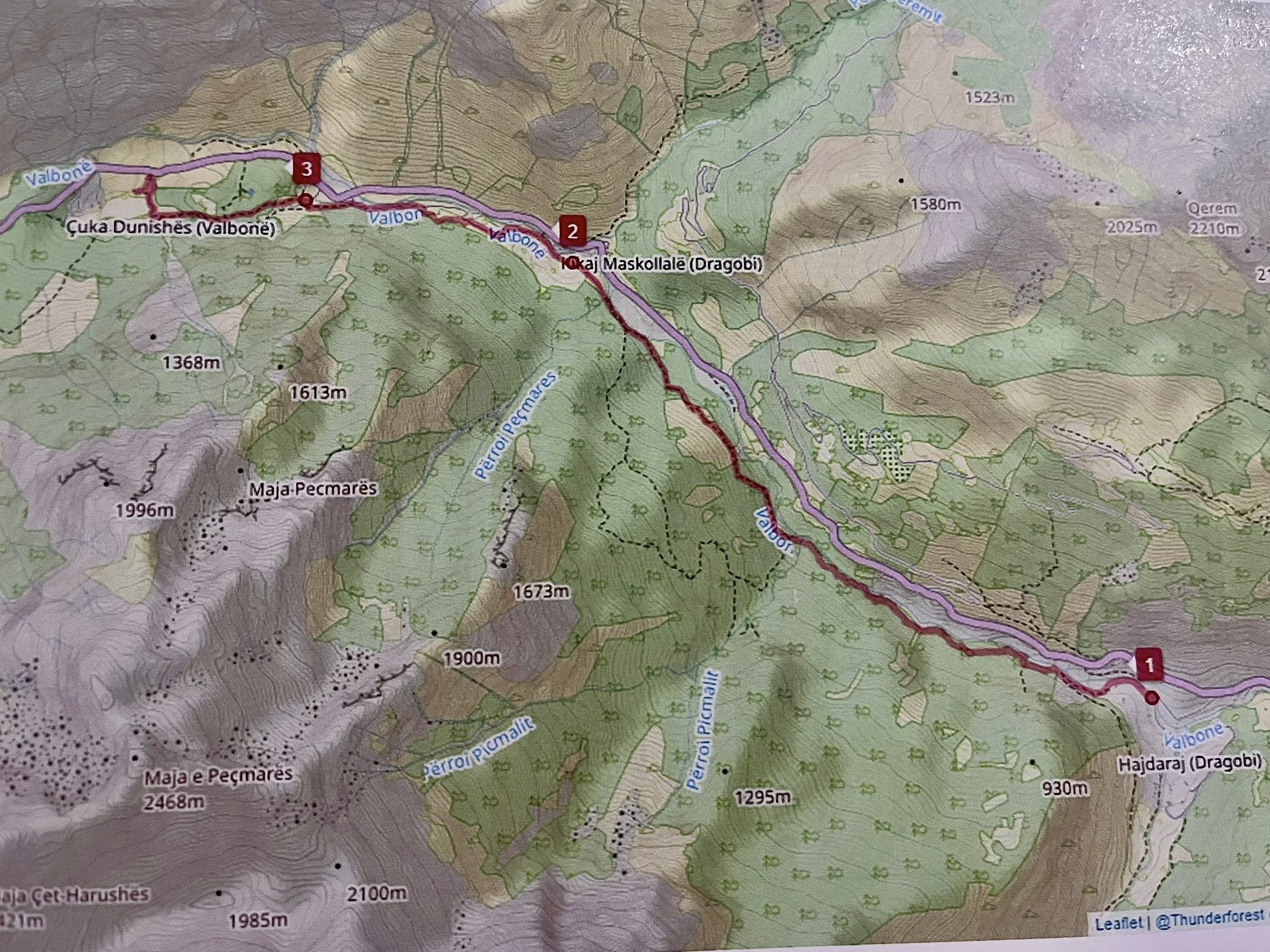
Total stats for Day 2: 8km, 2.5 hours, 12,000 steps, 337m ascent, 80m descent
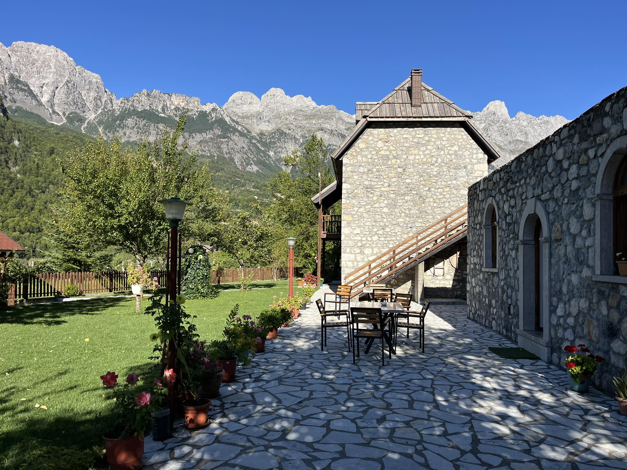
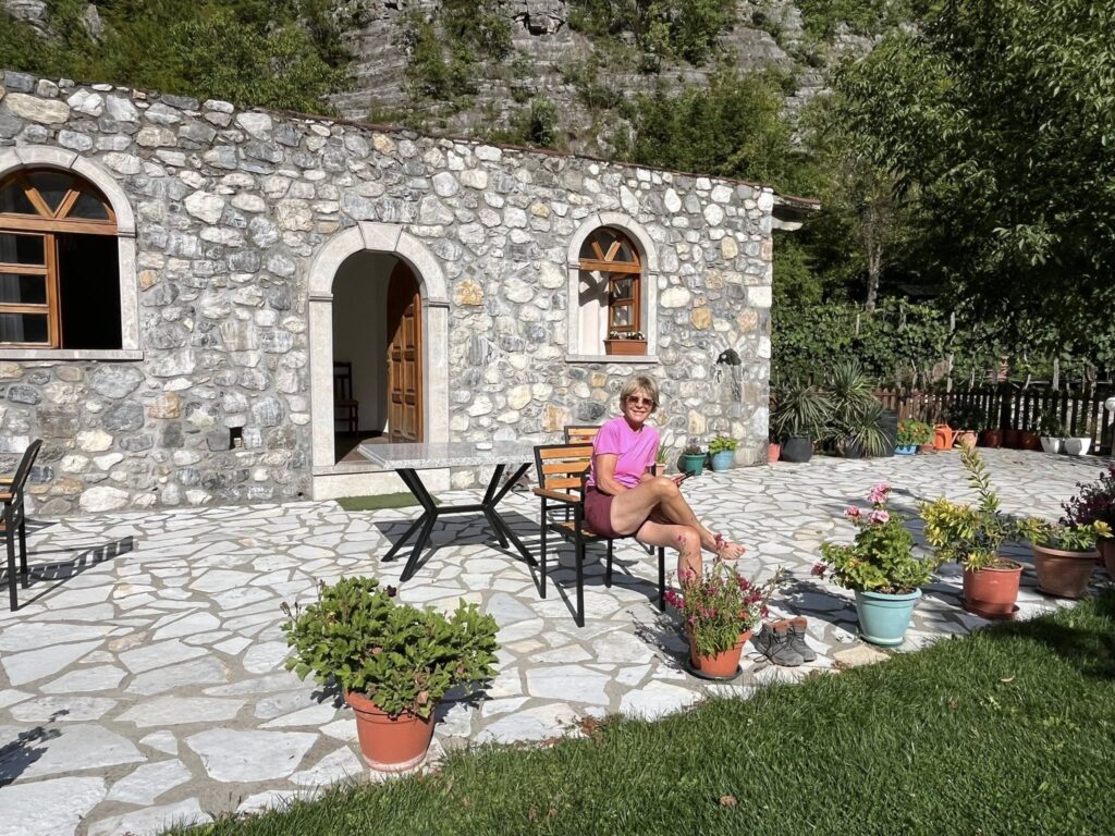
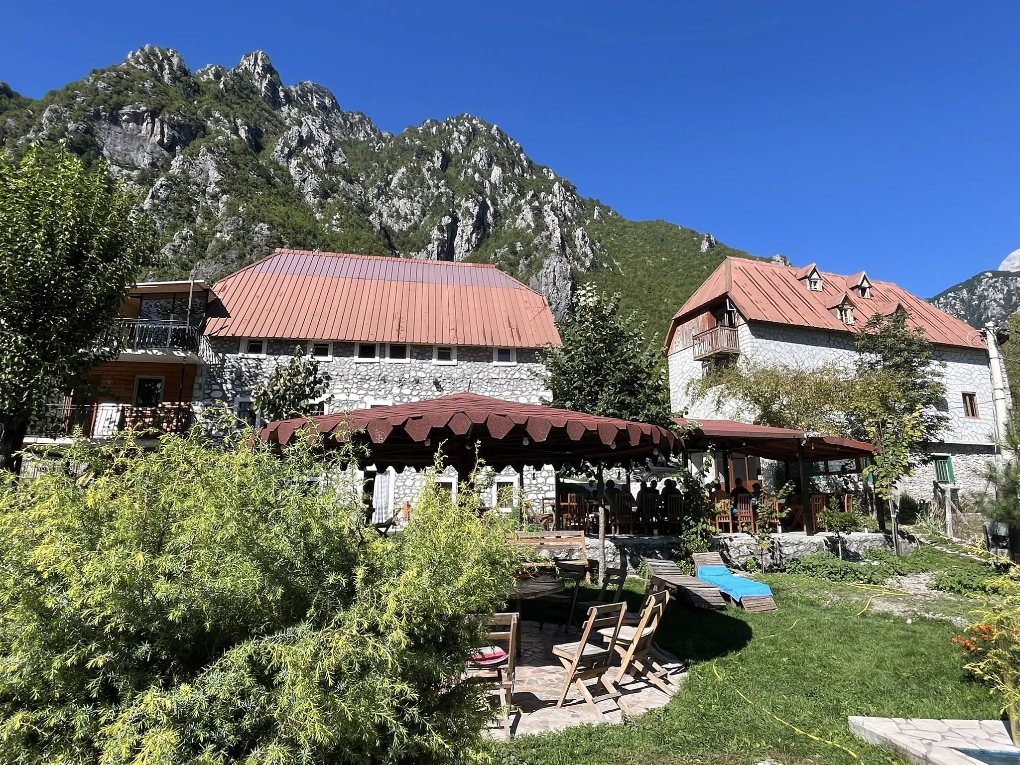
Our Valbona guesthouse was called Mehmeti. The history is that Sadri and Roza Selimaj’s family opened the doors of their old family home to welcome visitors to their beautiful valley. They named the guesthouse after Sadri’s father, Mehmet, who built the house in 1932, the second building ever constructed in the valley.
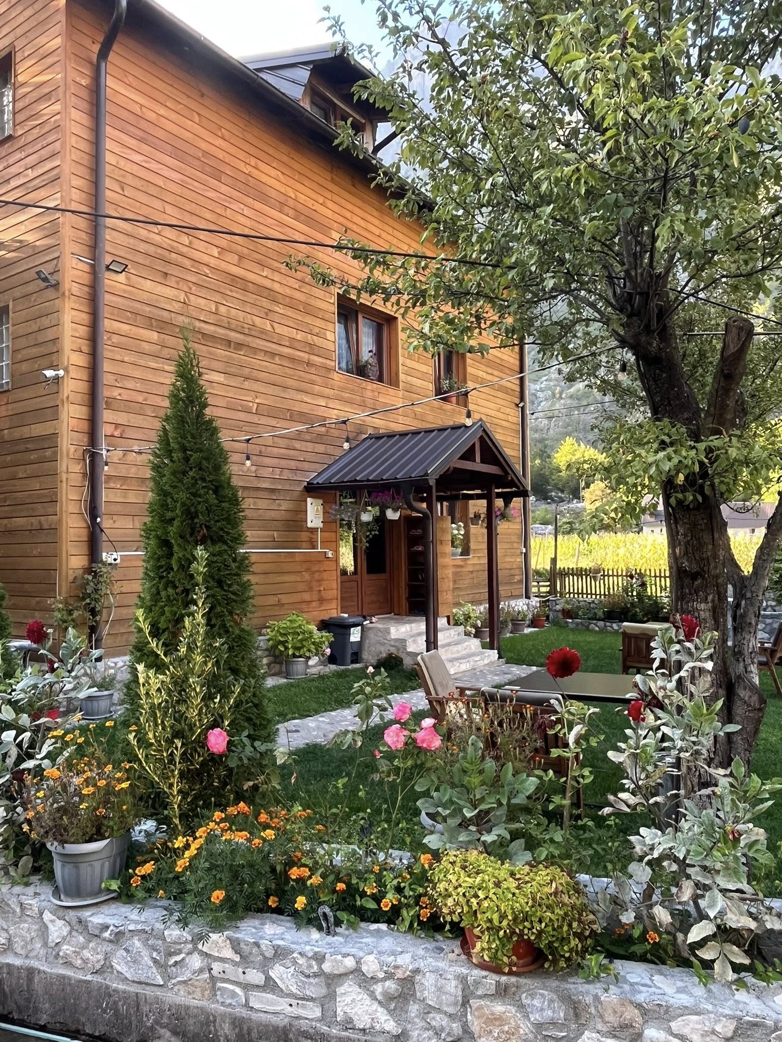
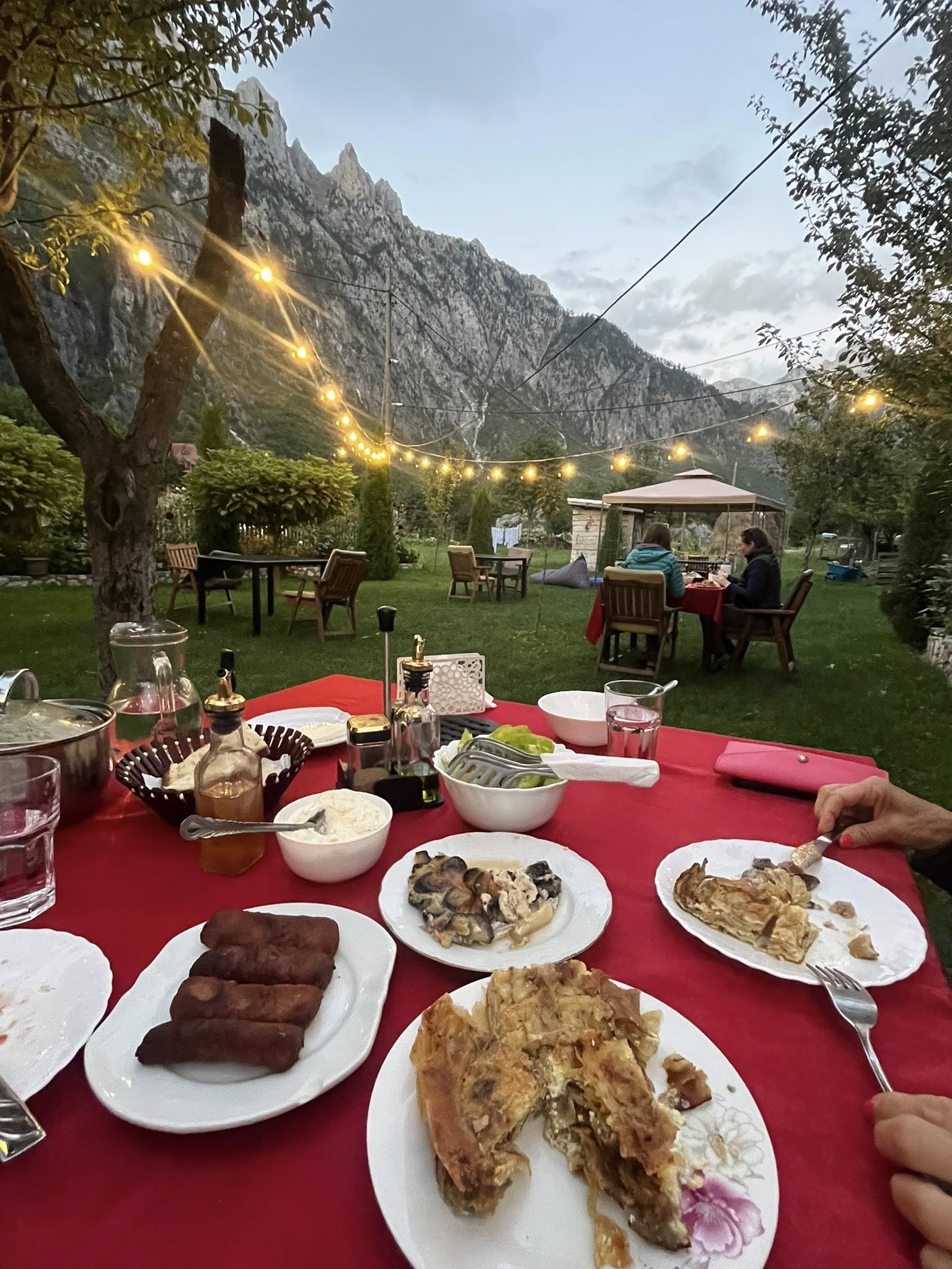
The guesthouse was situated in a peaceful setting with towering mountains all around us. We ate our dinners outside on the grassy lawn. There were cows, chickens, and many cats. The room was spacious but basic and decorated in an old fashioned style. The bathroom was tiny but adequate. For the tour package we selected, we did not expect luxurious accommodations.
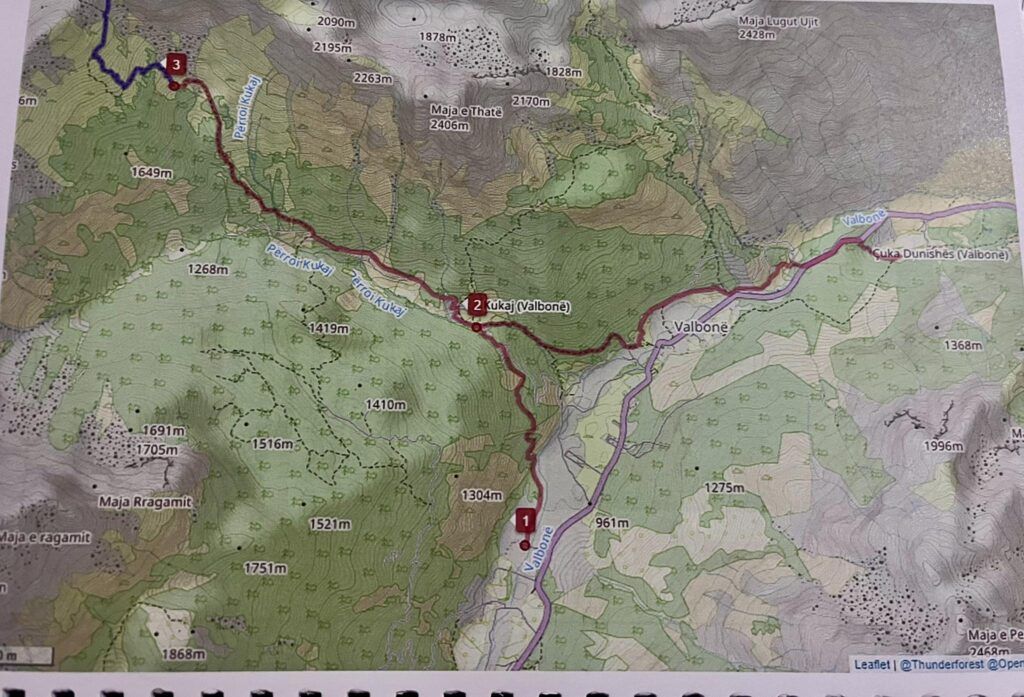
Day 3 – Valbona – Kukaj – Rama Hut – Valbona
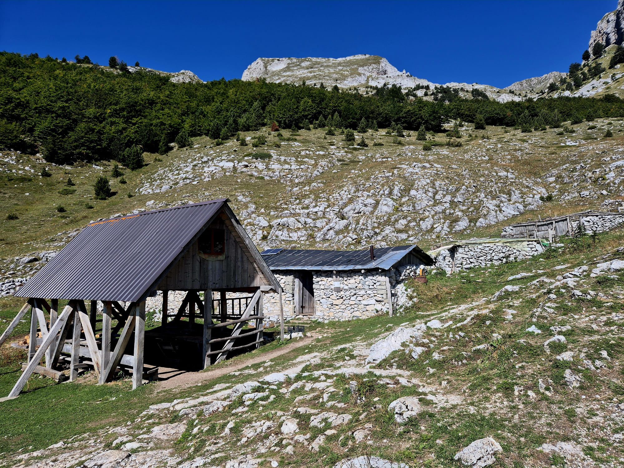
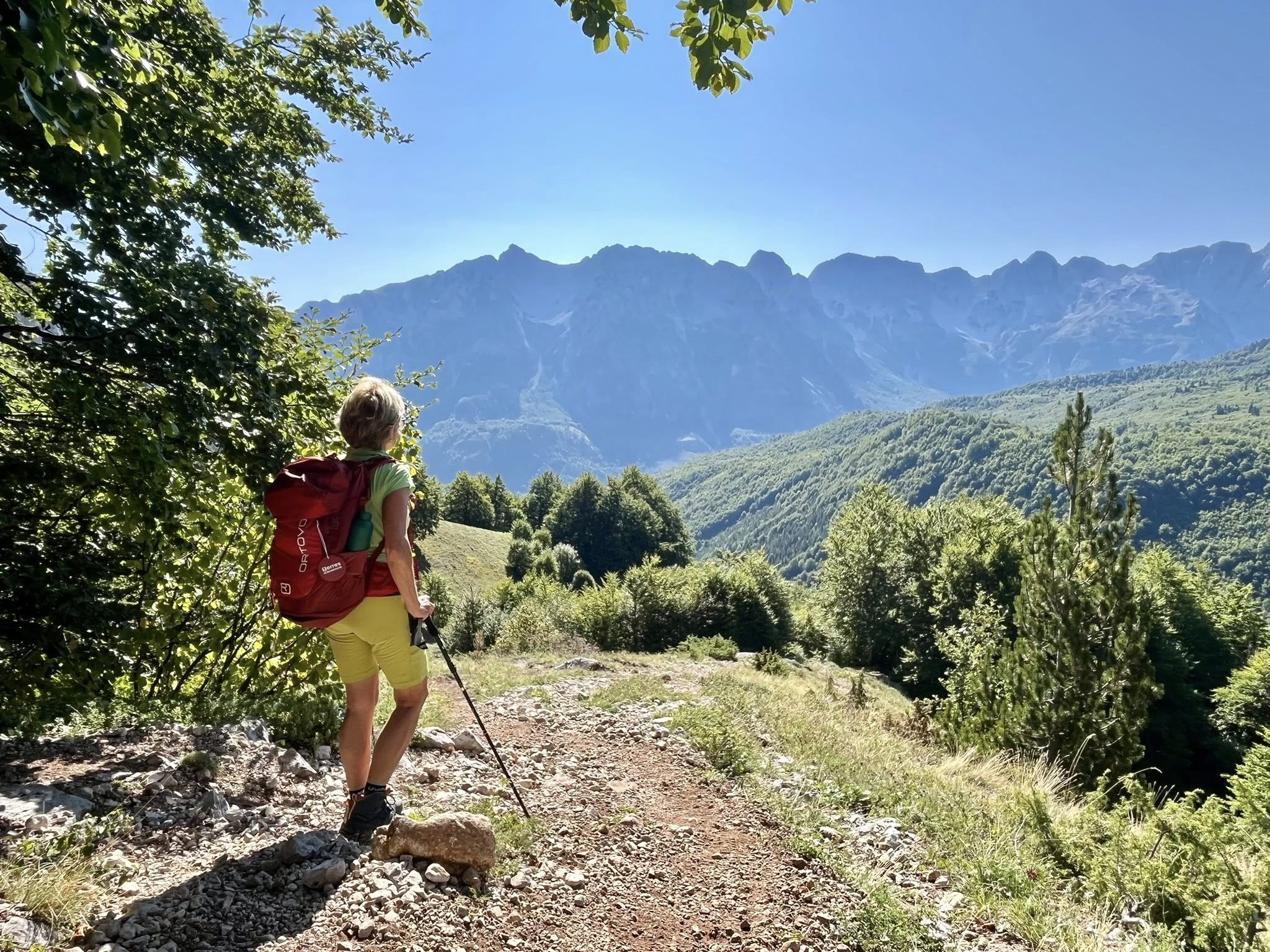
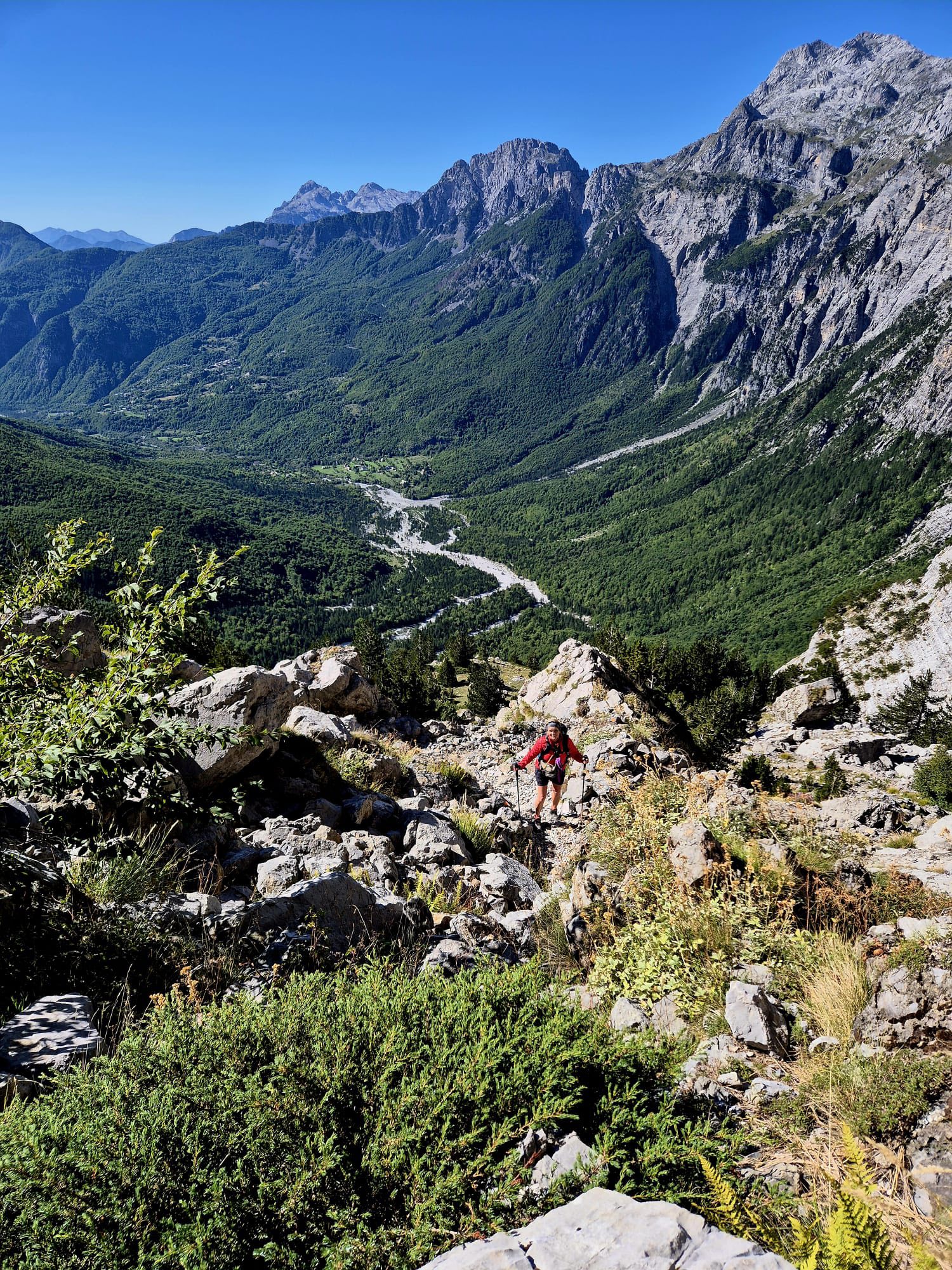
Our next day (Tuesday September 16, 2025) was the first big hike of the week from Kukaj in Valbona valley up to Rama hut. We were picked up at the guesthouse by a van with other occupants and taken into town to start the hike at 8am. We reached the hut by 10:30am after a 700m ascent on rocky terrain.
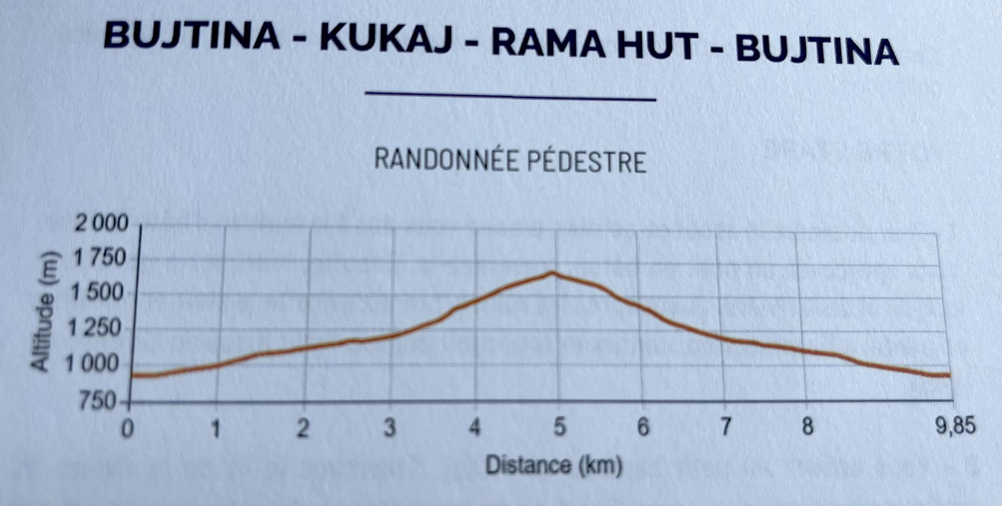
We took a short break at the hut (1,650 meter altitude) and admired the views. There was an older man sitting in the hut selling drinks and most likely the local shepherd as there were many cows in the area. As it was a small rustic hut, they only accepted cash and did not have toilet facilities.
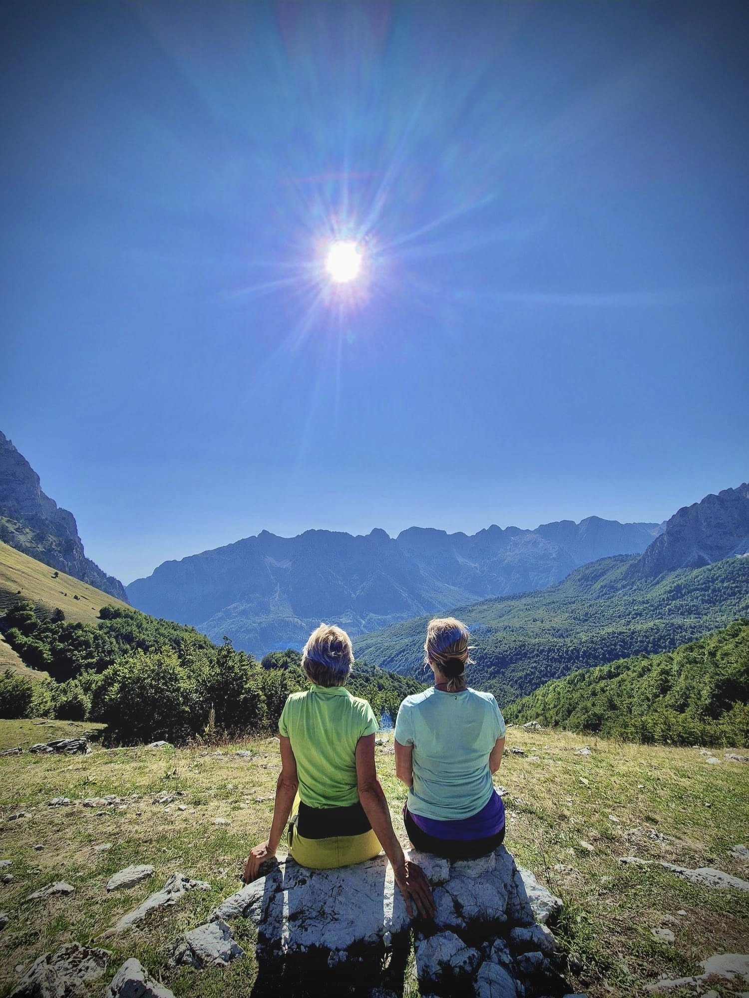
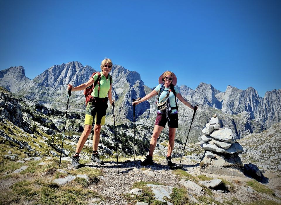
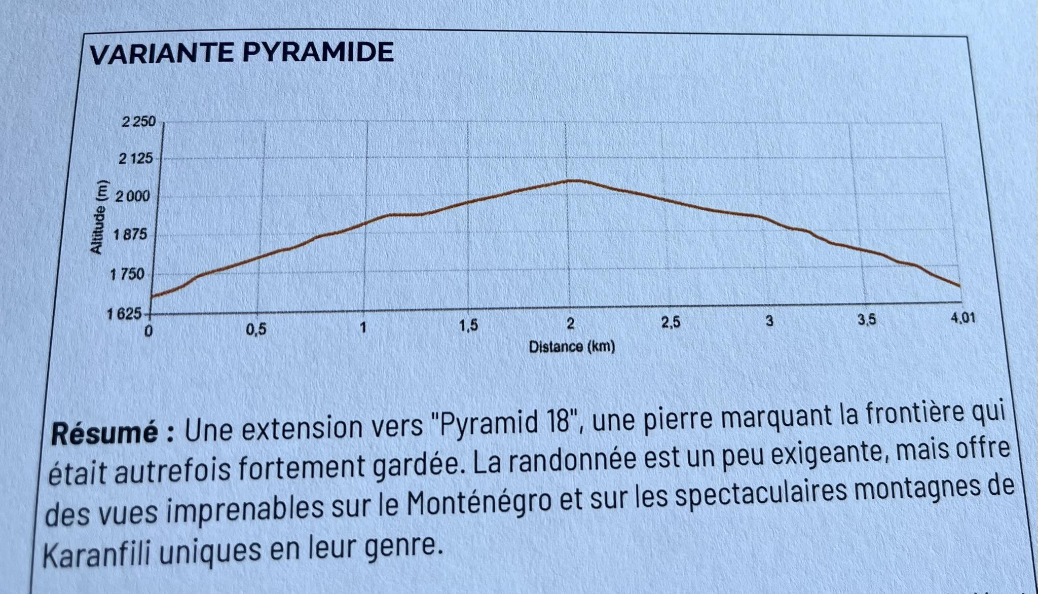
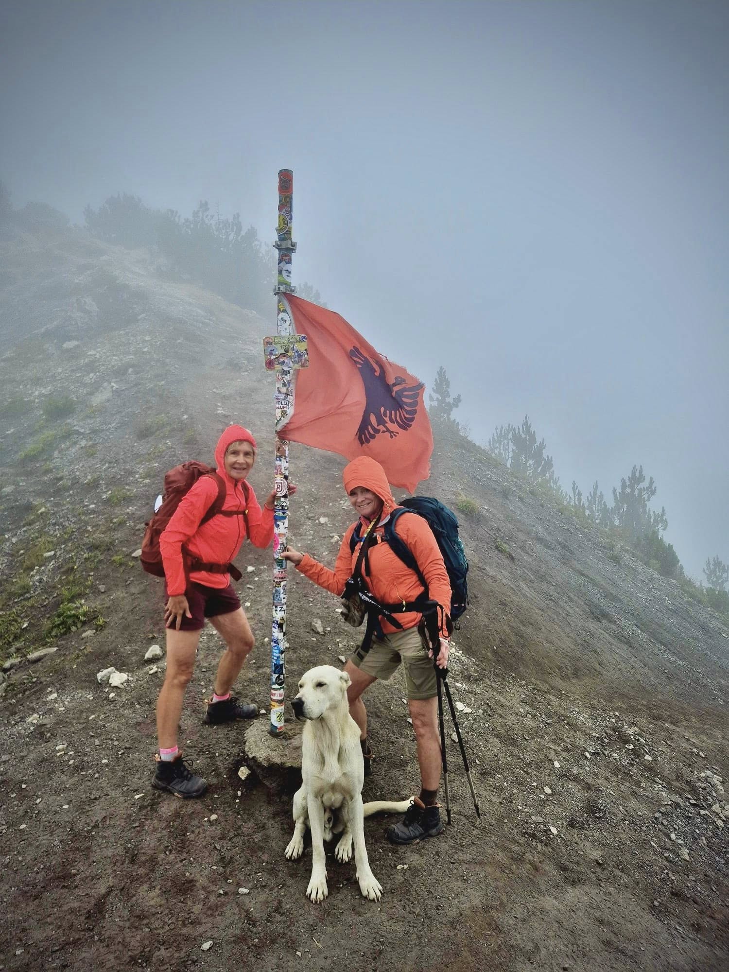
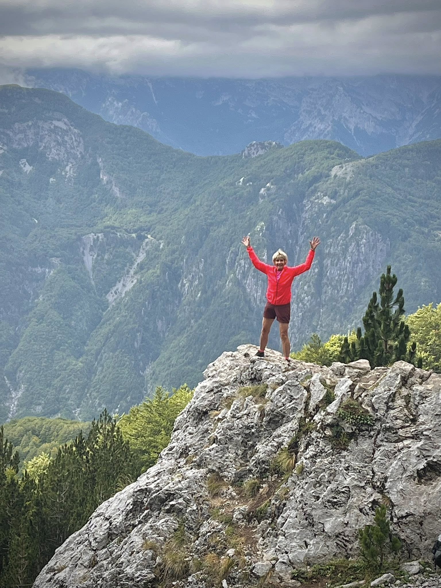
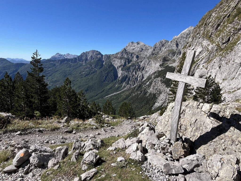
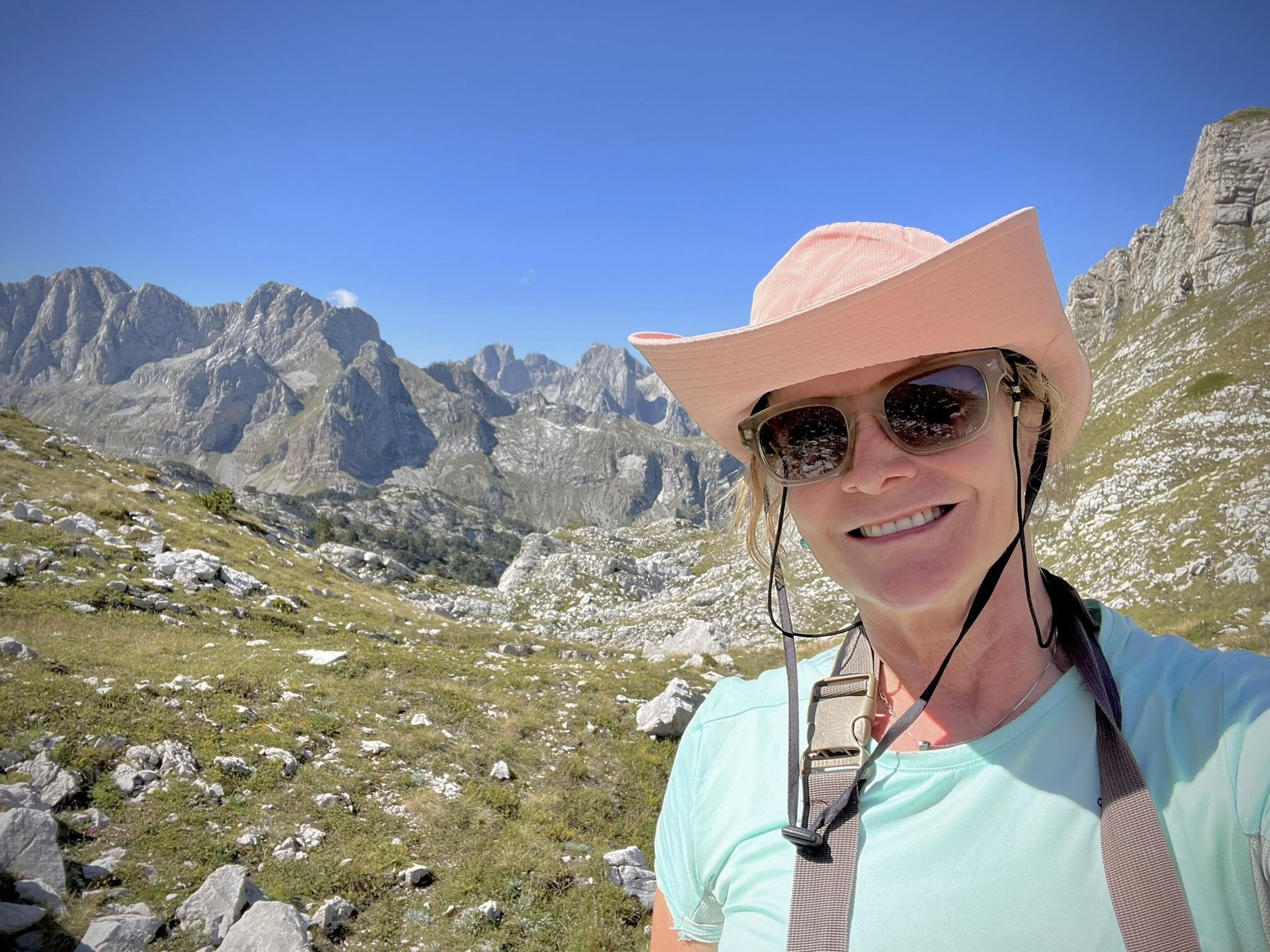
Our daily itinerary had an extension option (referred to as the Pyramid) to hike further up past the hut to a lookout point onto the Montenegrin mountain range called “Prokletije”. There were more people on this leg of the path. After another hour going 400 meters higher, we sat down to have our picnic lunch. The highest peak in the Dinaric Alps could be seen from here, called Jezerca (2,694 meters). The different and impressive view was definitely worth the extra effort!
Total stats for Day 3: 20.4 km, 6.5 hrs walking time (total time with breaks was 8.5hrs), 35,000 steps, 1154m ascent, 1282 descent
Day 4 – Valbona – Valbona Pass – Theth
Valbona to Valbona Pass
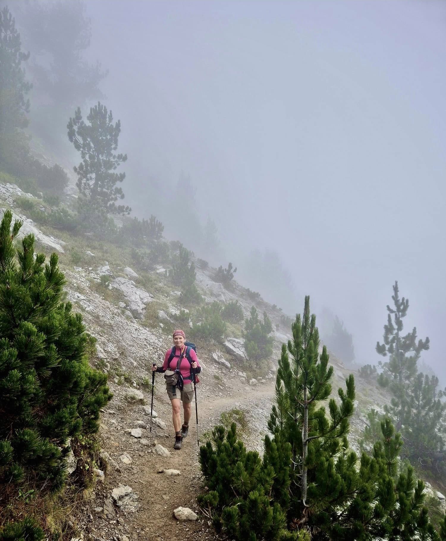
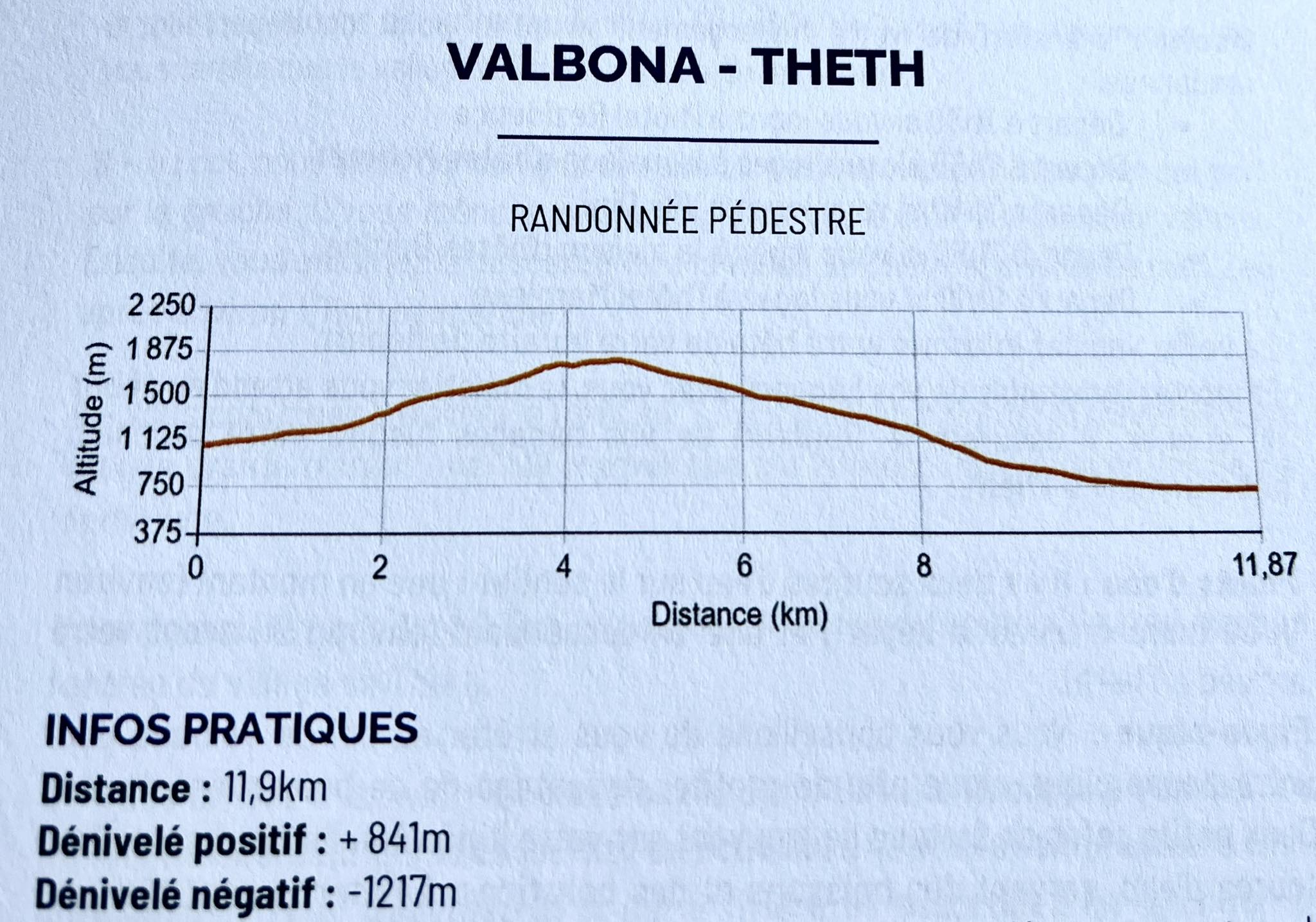
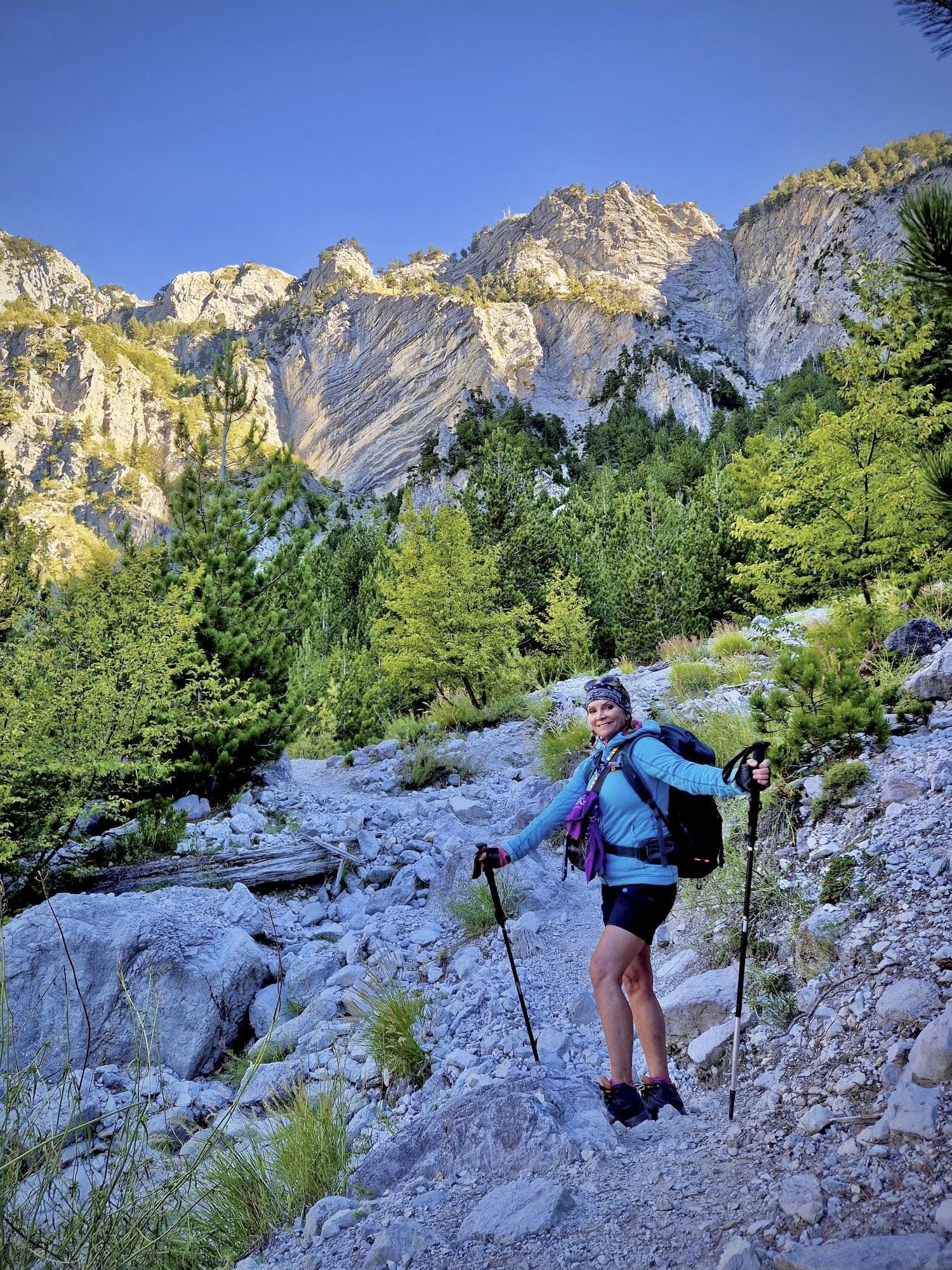
After a good night’s sleep from the previous long hiking day, we were picked up and driven to the start point of this hike in Rragam. The slow steady uphill walk began at 8:15am with cloudy cool conditions (12c). We continued for 5km for an ascent of 841 meters to reach the Valbona Pass (altitude of 1,811 meters) at 11am.
Unfortunately the top of the pass was covered with thick fog, and there was no view of the impressive valley below. We took photos anyway in the windy conditions before quickly heading down the other side of the mountain.
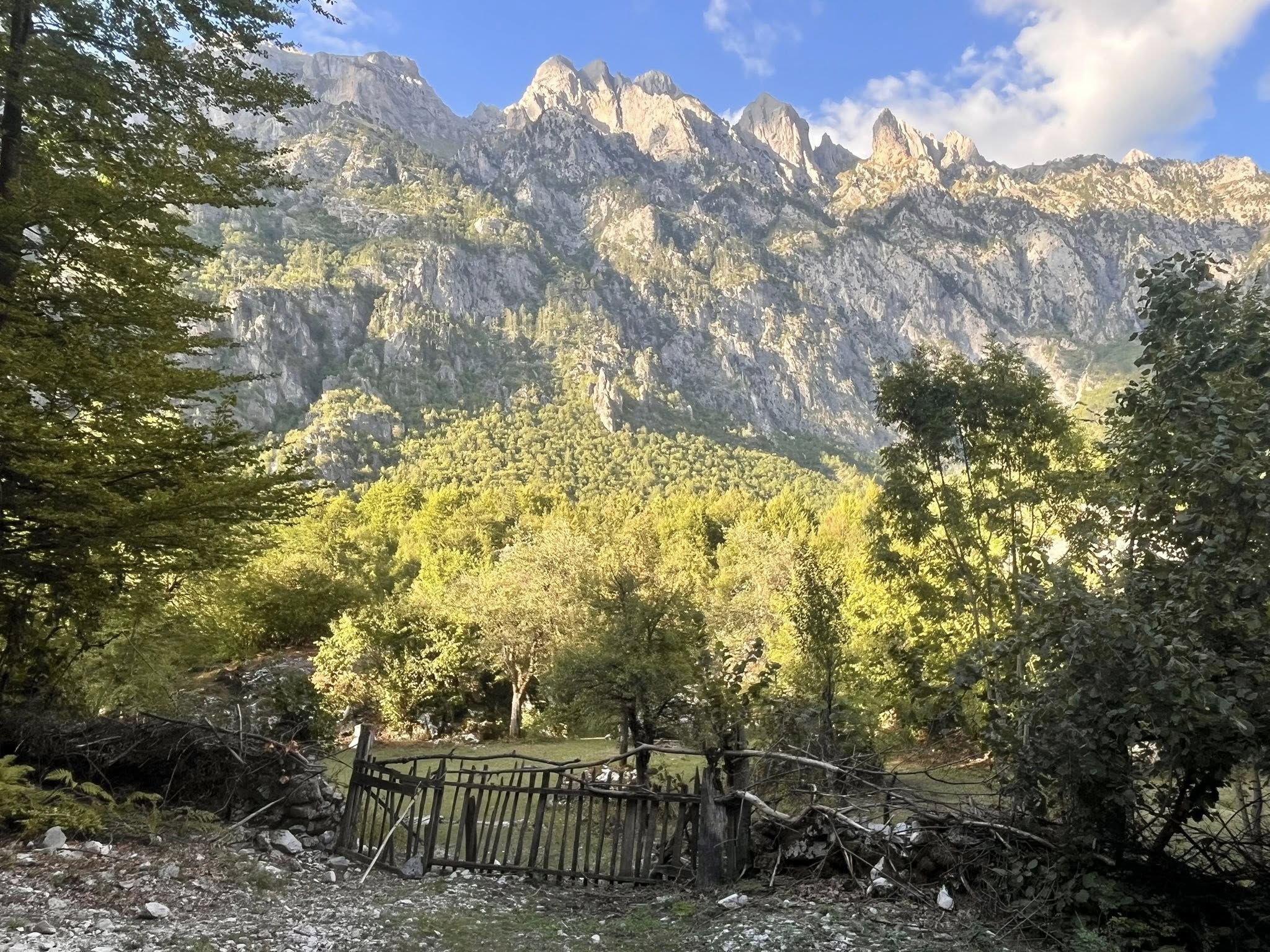
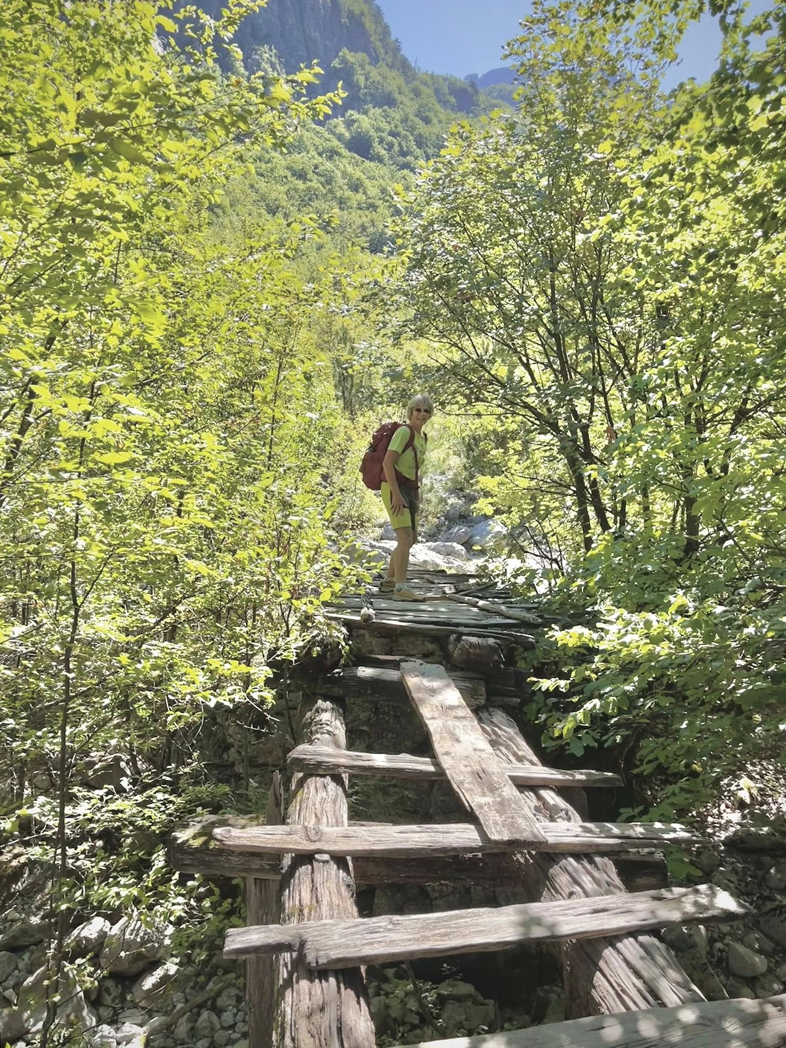
The path from Valbona to Theth was once an old mule trail that traversed the heart of the Accursed Mountains. There are still no roads between the two towns, making the hiking trail the only link between the country’s two most popular mountain villages.
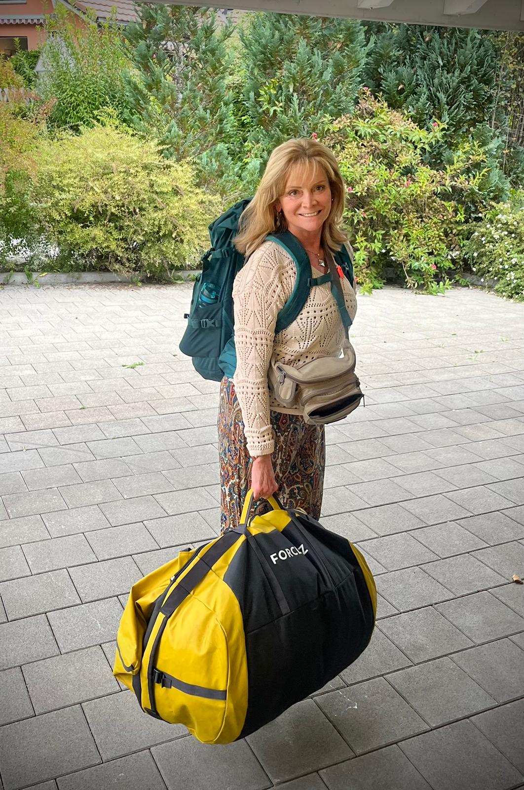
This is why for this day, our luggage was transferred by horse over the mountain pass. For this reason, we were instructed to bring soft luggage bags not exceeding a weight of 15 kg. We didn’t see our actual bags being transported, but there were several horses with bags that passed us as we were coming down the mountain.
Valbona Pass to Theth
We had our lunch stop at a nice cafe on the way down. By this time, the weather was slowly clearing and we could see the surrounding mountains on the Theth side.
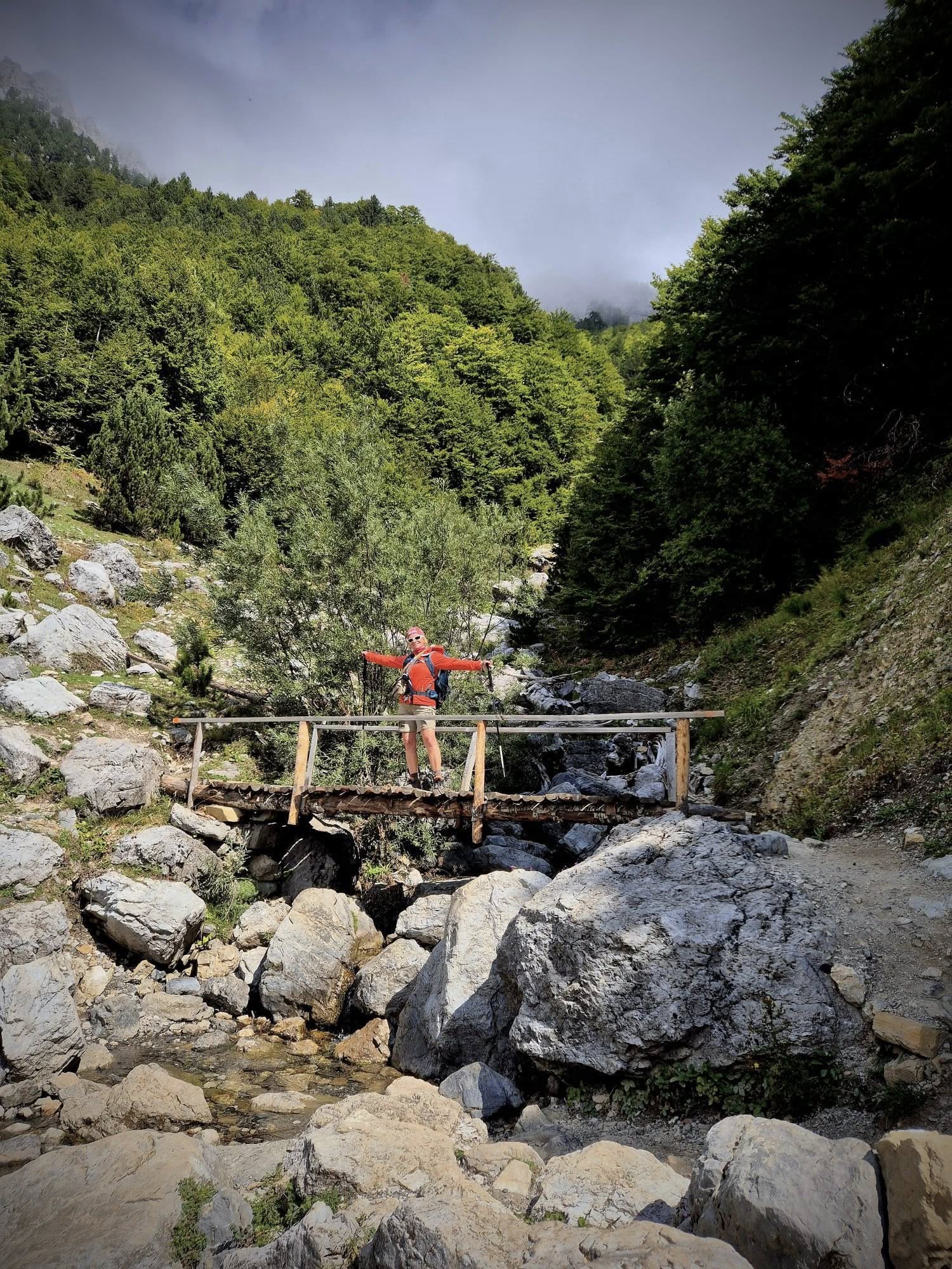
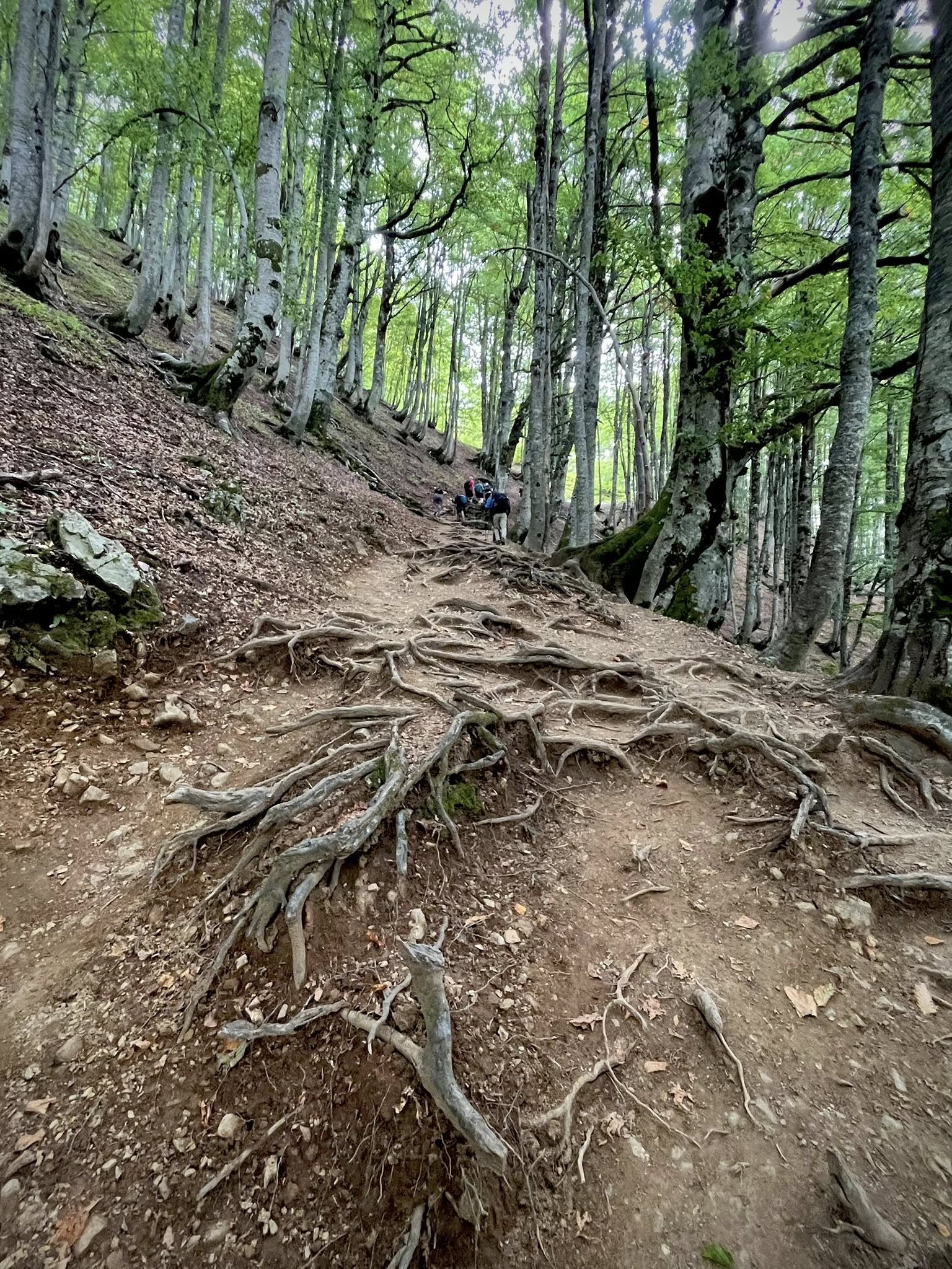
The second half of the hike was 9km downhill for a 1,217 meter descent. We passed through beautiful shady beech forests. We crossed probably 100 people coming up this side of the mountain. Some people only do one half of the hike to the pass and back down as they are staying in the village of Theth or Valbona. We were happy to do the full journey from Valbona to Theth.
They say that the Valbona/Theth hike takes 6-10 hours to complete, depending on hiking speed, starting point, and number of stops. We had 5 hrs of actual walking time.
Total stats for Day 4: 14km total, 5 hours, 26,000 steps, 841m ascent, 1217m descent
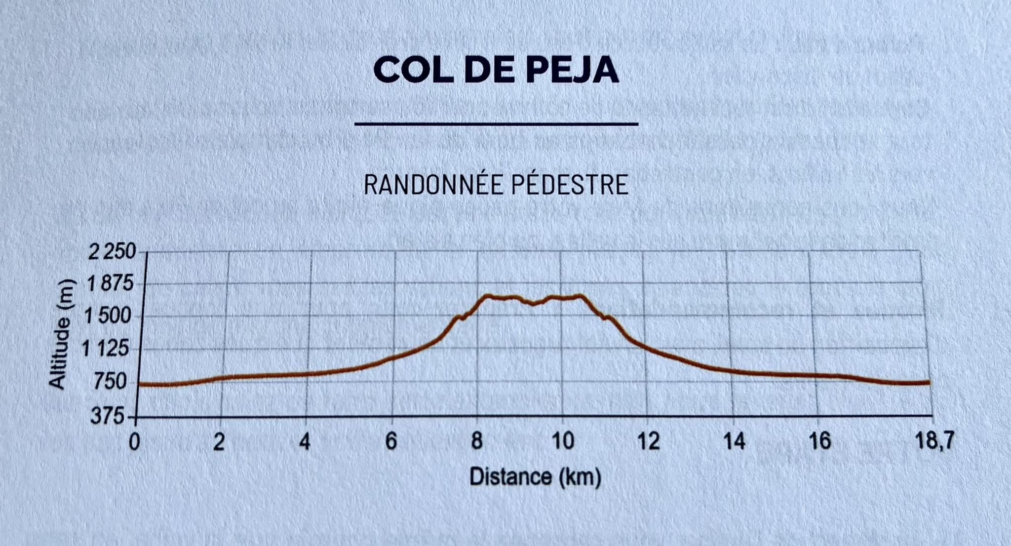
Day 5 – Theth – Peja Pass
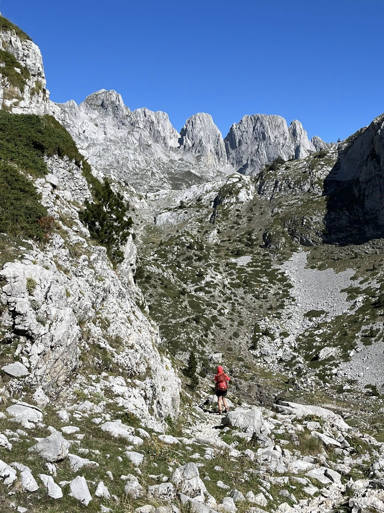
This day was our last big hike of the week, starting from Theth and up to Peja Pass (1,711 meters). We took a taxi (paid ourselves) from our guesthouse up to Kroni bar to save 1 hour of walking along a boring gravel road. We started the uphill climb at 8am for 2.5 hrs. It was a sunny day but windy in some areas.
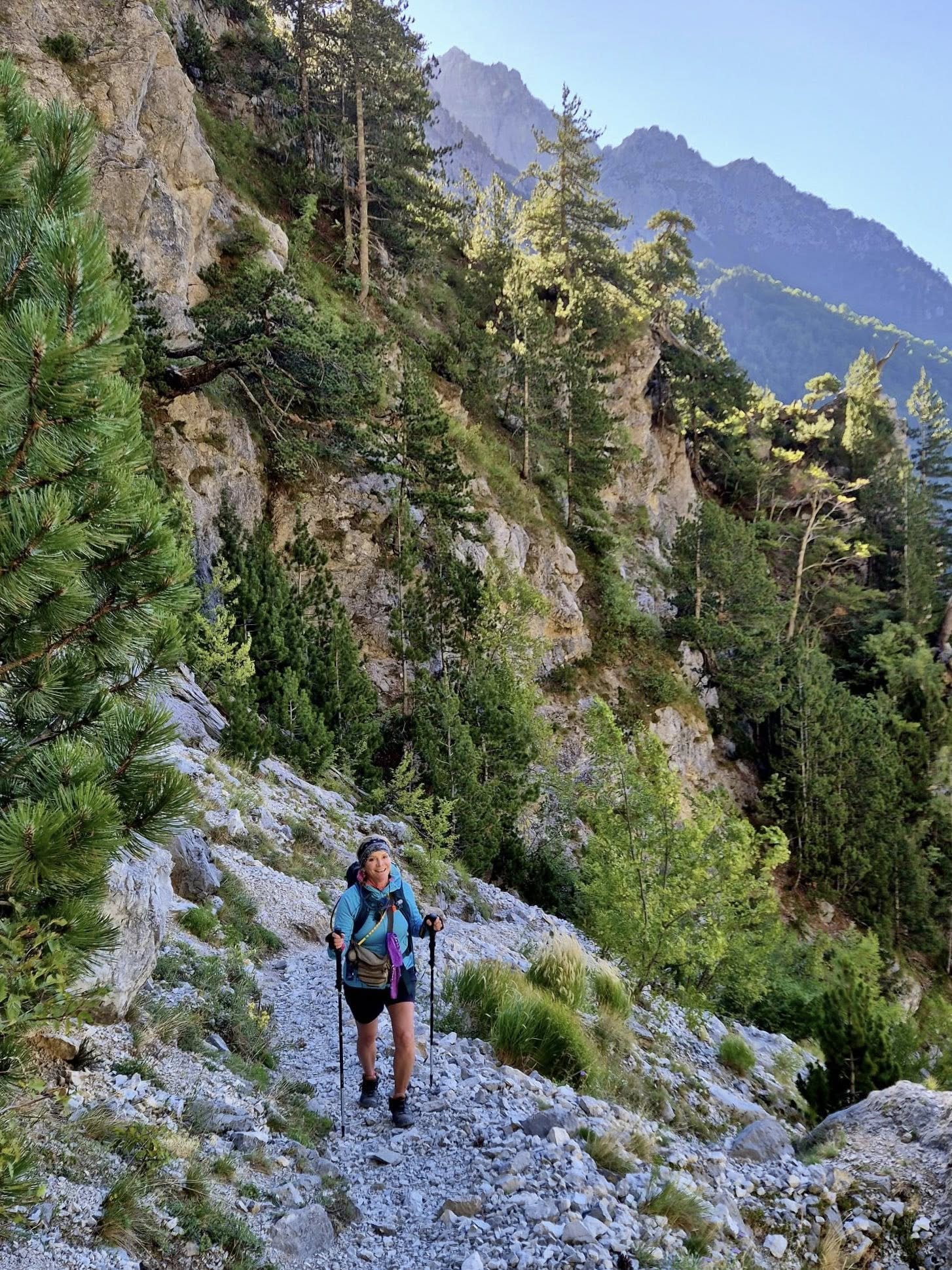
On the route to the Peja Pass, we had a clear view of what they call the Albanian Matterhorn, Mount Arapi (2,217 m).
Once to the col, we found a protected spot out of the wind to have our picnic. There were two small lakes below but we didn’t hike down the hill to see them closer. There was also an extension option to hike 2 more hrs at the top, but we decided not to do it. We headed back down the same way (very slippery with small rocks but no accidents).
When we reached the Kroni bar, we stopped for a refreshing drink and then decided to walk the 1-hour gravel road back to Theth. It was another great day!
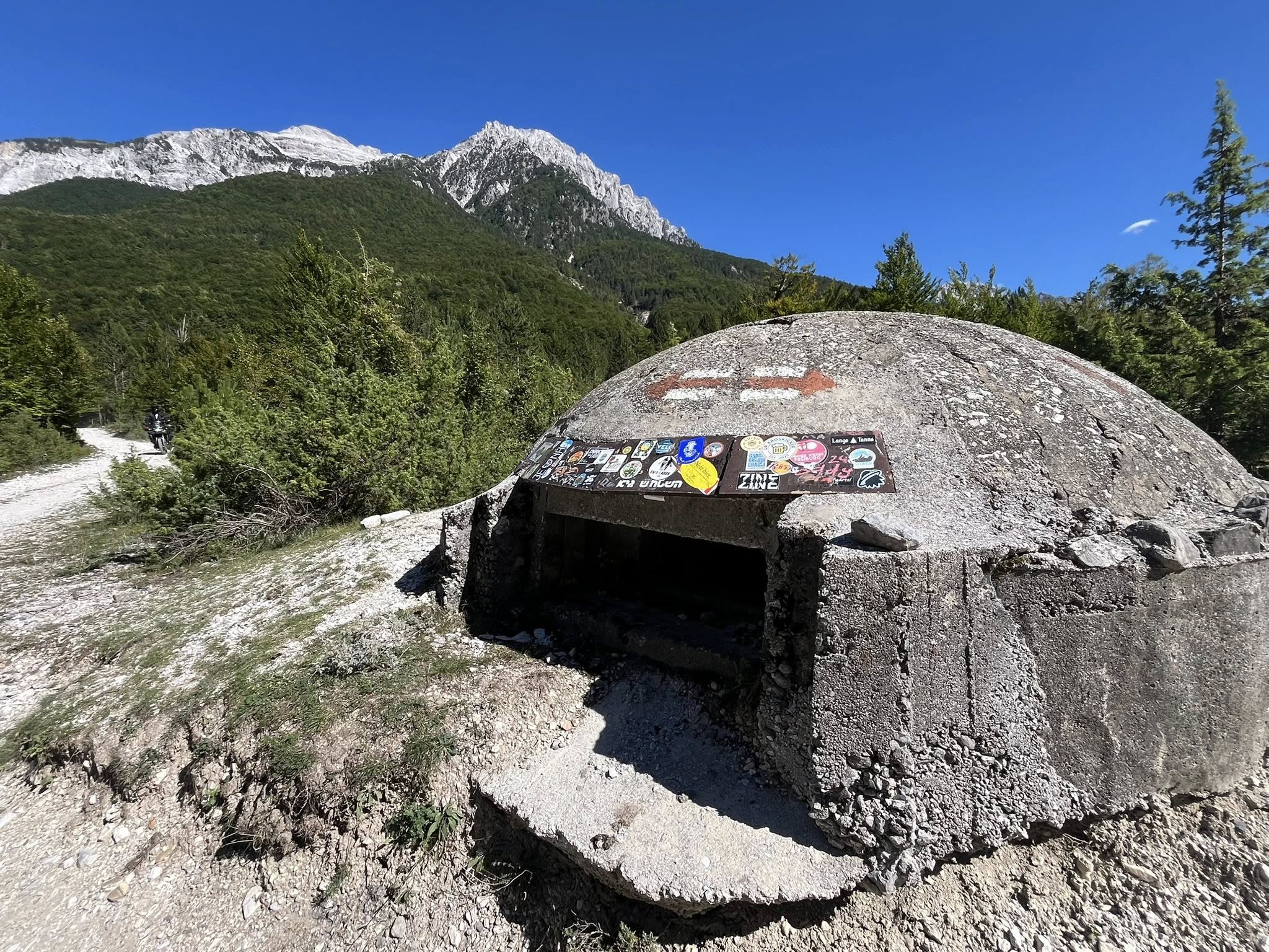
During our week, we saw a few old bunkers. The country underwent a massive “bunkerisation” project from the 1960s to 1980s and built over 175,000 concrete structures to prepare for various attacks. It is estimated that 750,000 Albanian bunkers once dotted the landscape of Albania.
Total stats for Day 5: 14.2km, 5.5 hours, 27,500 steps, 750m ascent, 1186m descent
Day 6 – Theth – Nderlysa
After three days of long intense hikes, we had an easy hike on this day from Theth to our next guesthouse in Nderlysa. We enjoyed the setting of our guesthouse (called Kompleksi Zorgji) in Theth for two nights.
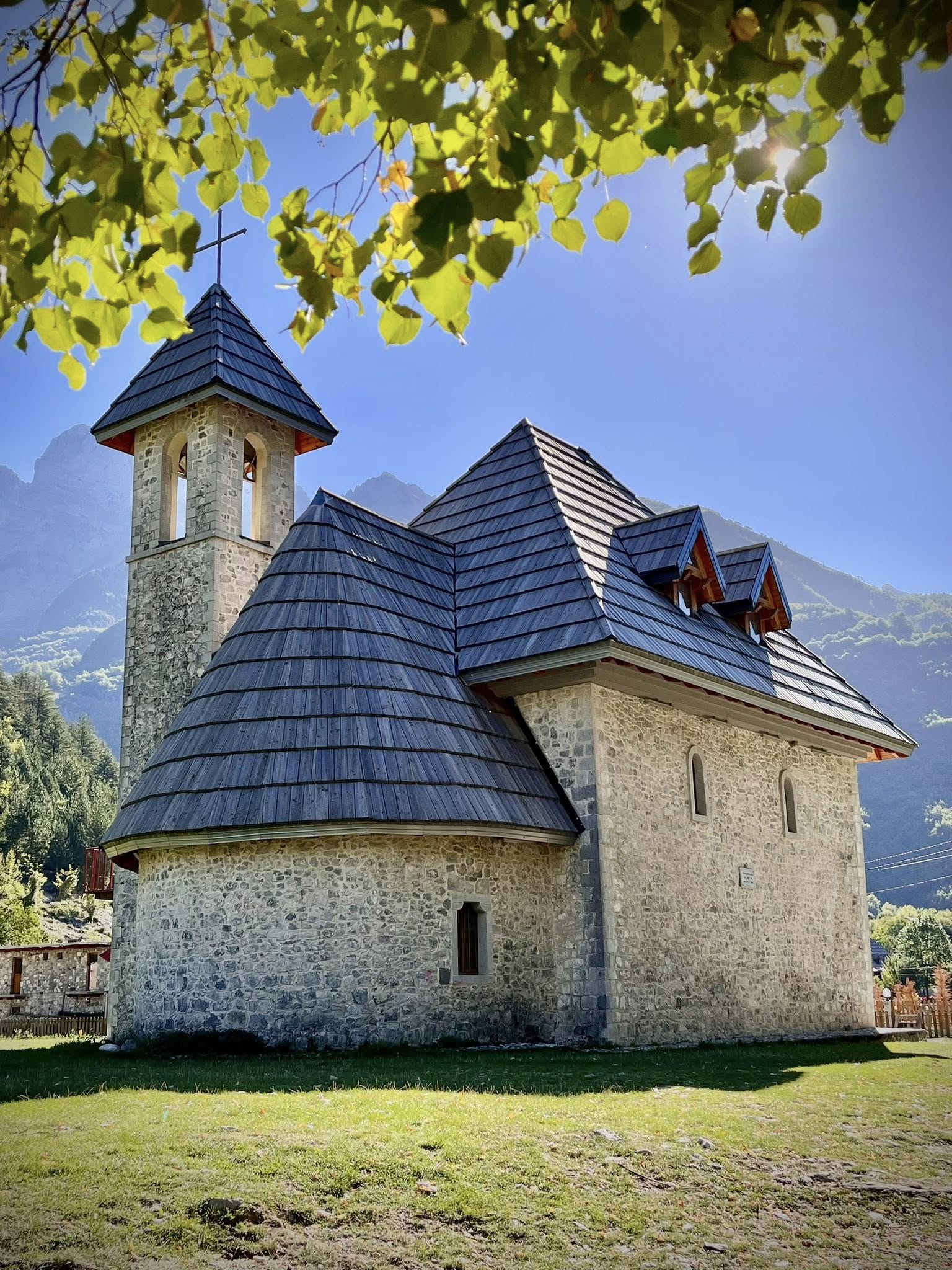
Today’s hike started by passing the famous church in Theth built in 1892 and the Reconciliation Tower.
We saw many more tourists and hikers on this day because Theth is a popular area not only for hikers. I think some hikers leave Theth in the morning to walk to both the Grunas waterfall and the Blue Eye and return back. We were happy to have an easy one-way hike from Theth to the next town and then see the Blue Eye the following day.
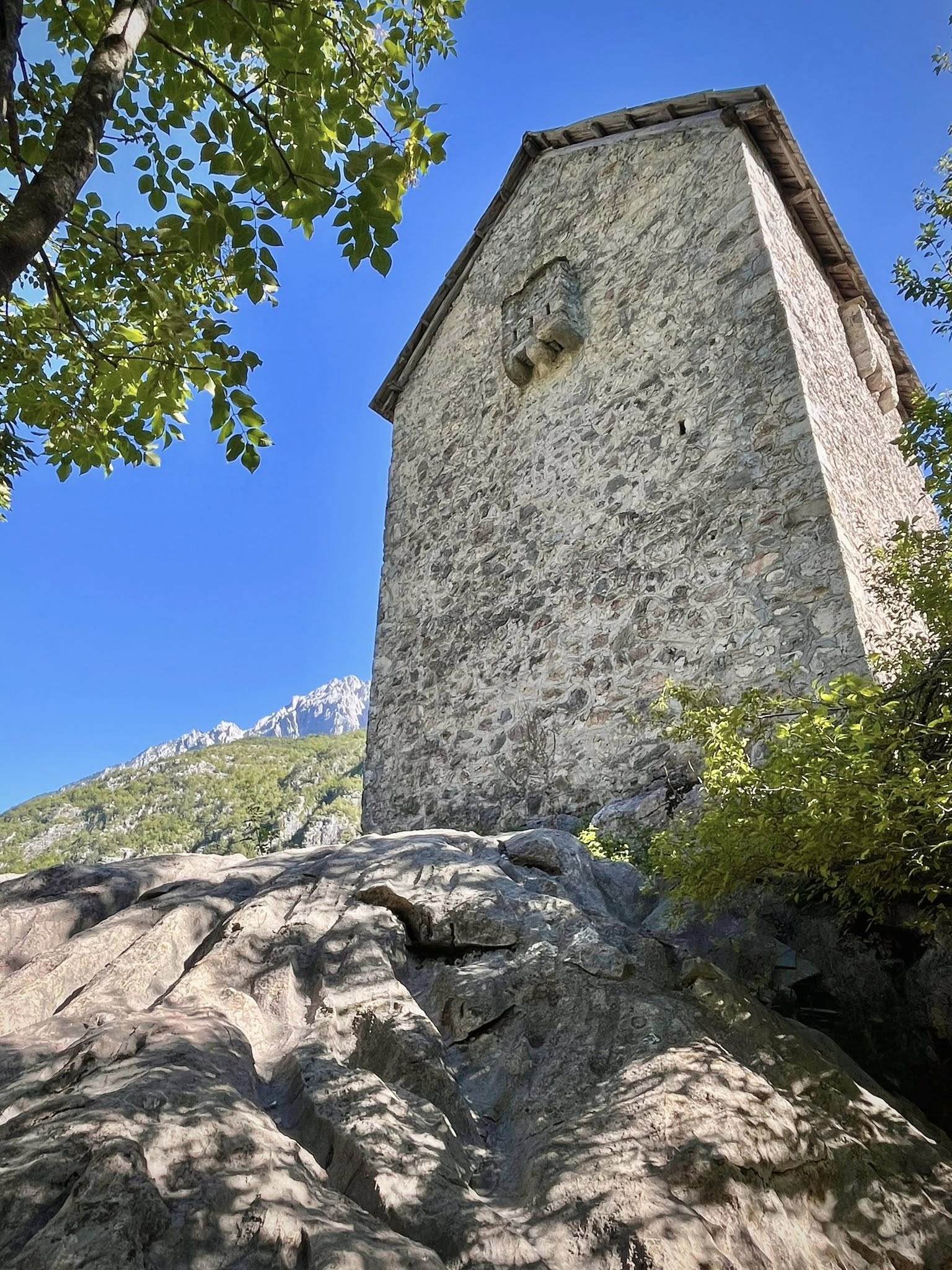
The primary purpose of the Reconciliation Tower was to provide a neutral ground for resolving conflicts and disputes within the community. It played a role in maintaining order and peace in accordance with the local customs and traditions.
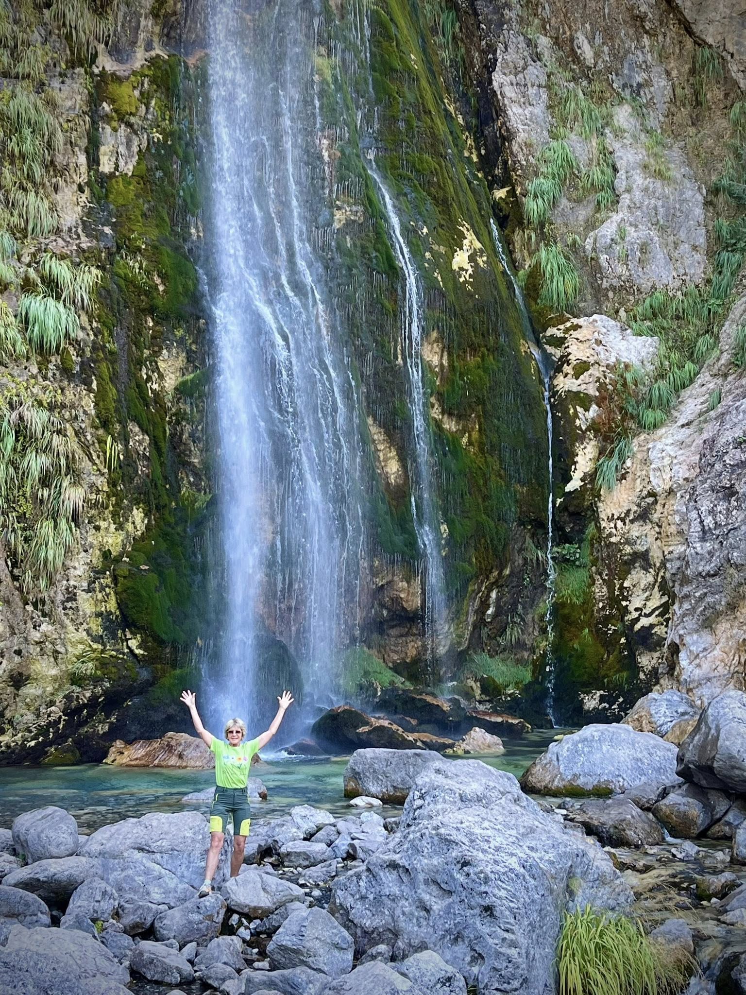
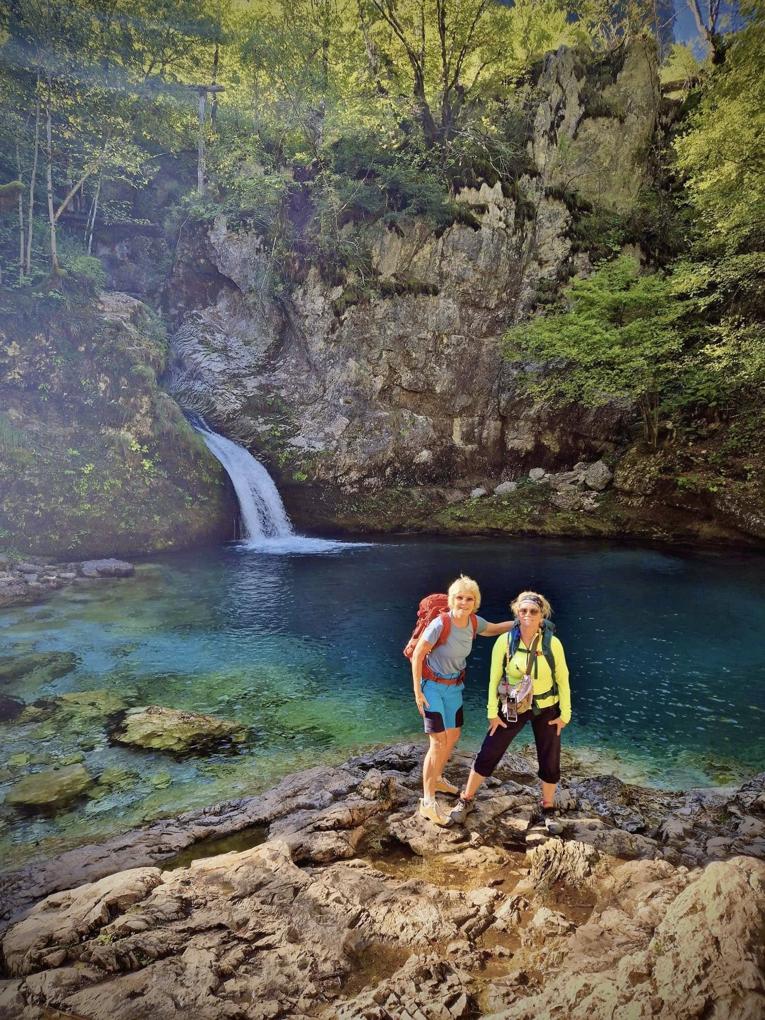
Grunas Waterfall
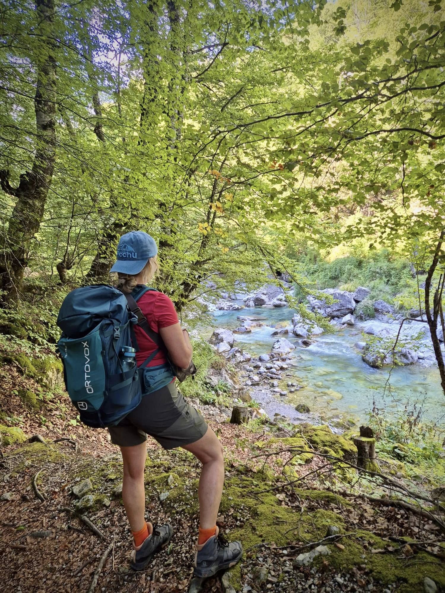
After walking along a nice path next to a rocky canyon, we took a sharp left and climbed up a rocky hill to get to the Grunas Waterfall (25 meters height). There were many people going up and down on the same path. I was surprised by the steep terrain, especially for older people and young children that were there.
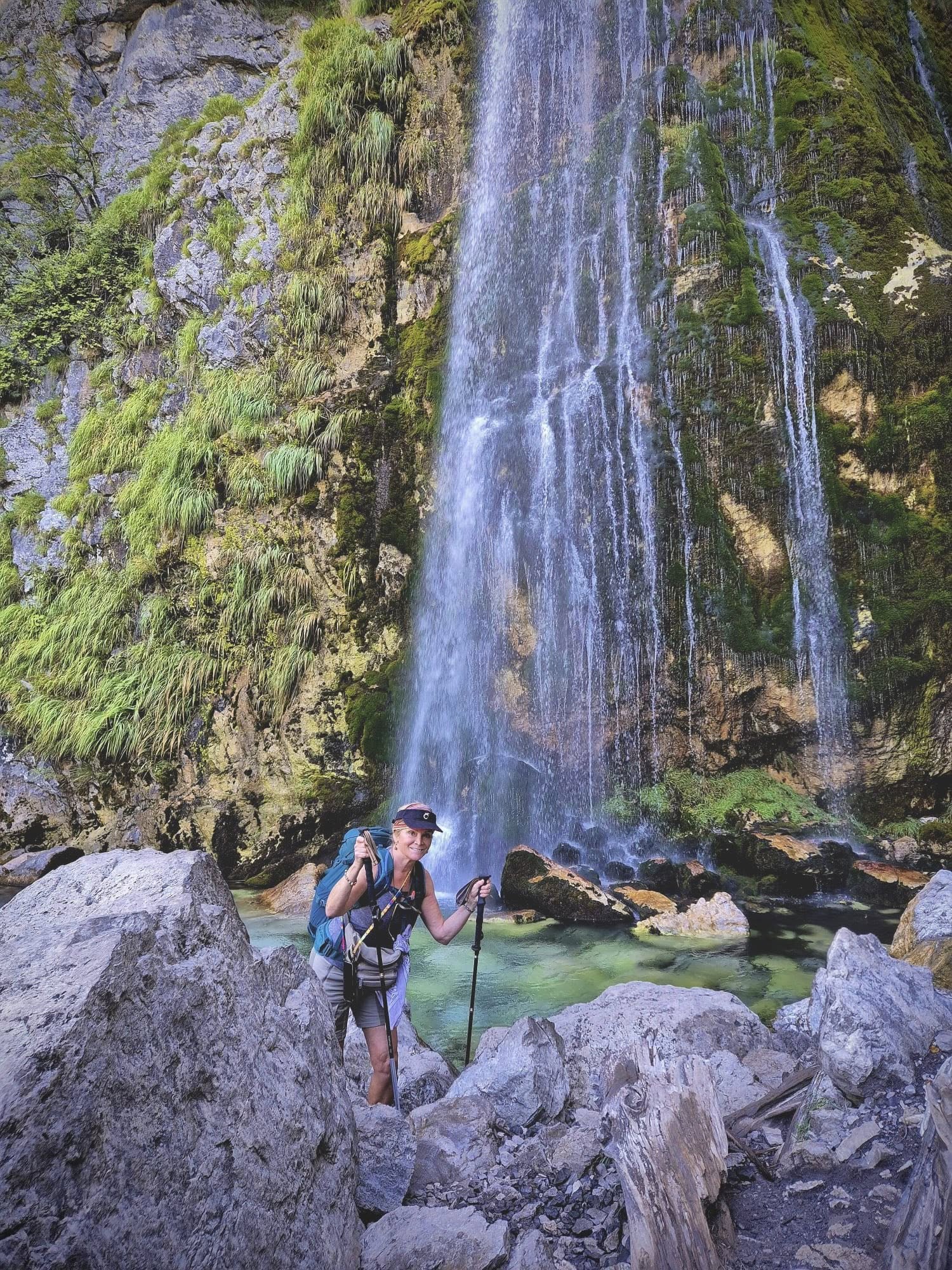
After crossing over the waterfall rocks, we started the steep descent. We were not 100% certain of the path as it wasn’t well marked. We managed to find the canyon again and continued until we crossed the big bridge at Nderlysa. As we hadn’t made time to eat our picnic lunch, we stopped at a nice outdoor restaurant for a big salad.
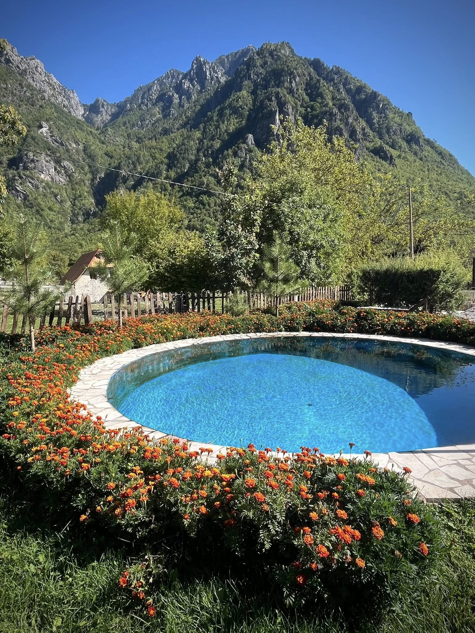
We spent our last night in the Albanian alps in a cute guesthouse in Nderlysa (Prek Bjeshka). All of the places we stayed during the week were family run houses. The adults didn’t speak much English but the younger people working there did. We tried to take a dip in their small pool, but it was too cold.
Total stats for Day 6: 8.8km, 2.5 hrs, 15,000 steps, 160m ascent, 370m descent
Day 7 – Nderlysa – Blue Eye – Shkoder – Tirana
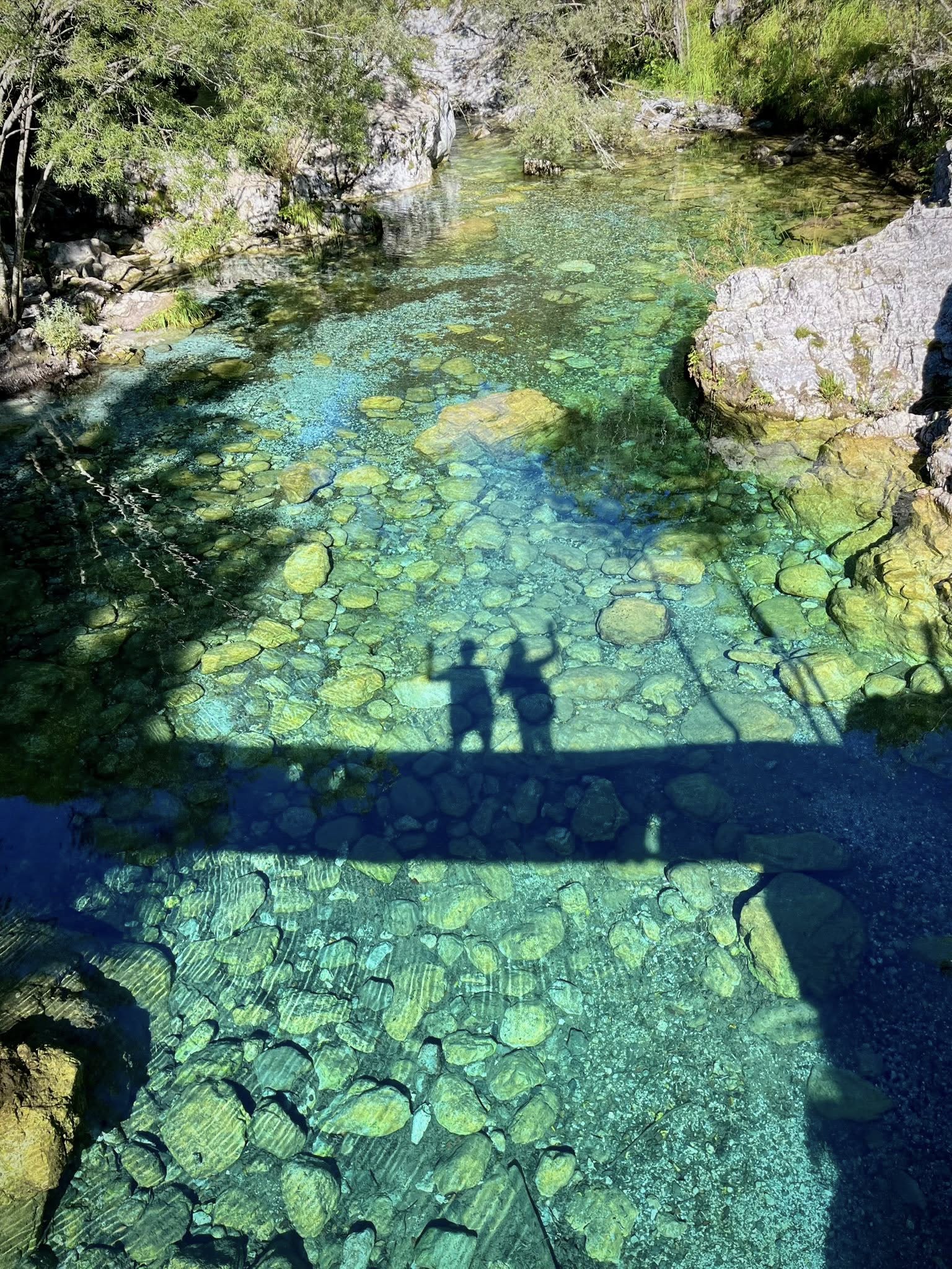
This was our final full day in Albania and the sixth hike we would do. We left our guesthouse at 8am in Nderlysa headed to the Blue Eye. It was an easy 1-hour hike but we were determined to get there early before the crowds showed up. The last thing I wanted was to have many people in the photos of this beautiful place.
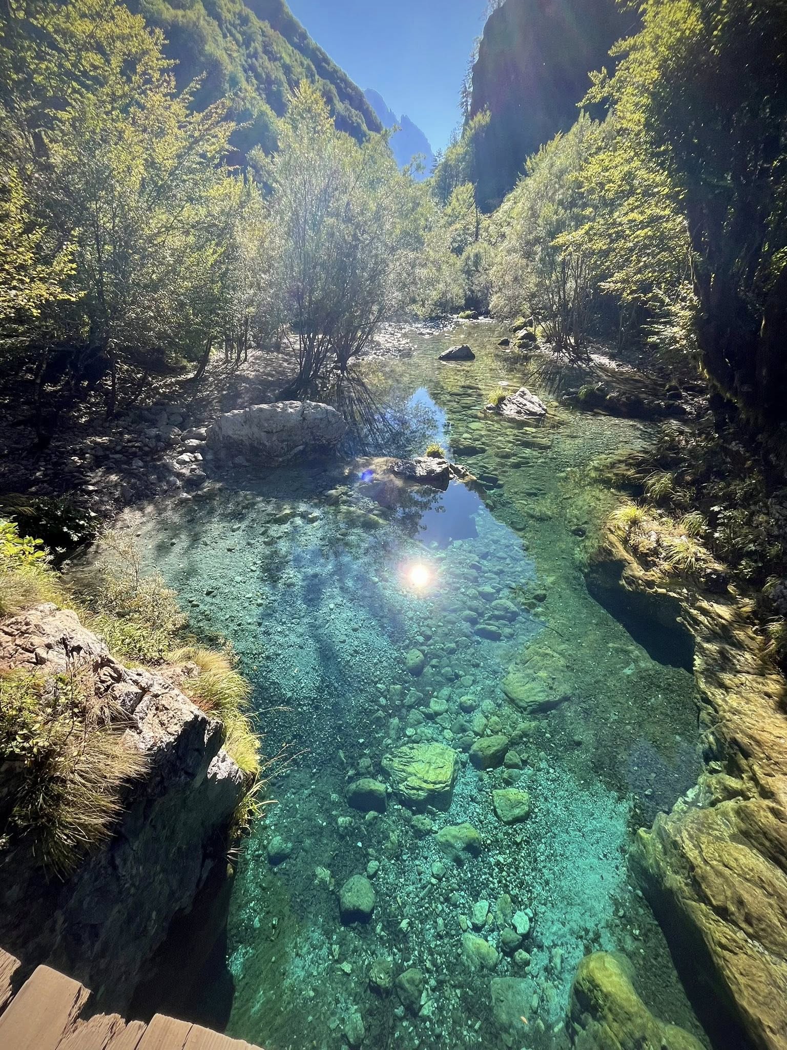
We walked uphill along a canyon cliff path that finally reached the small pools of clear turquoise water. We were very happy to arrive around 9am and only see a handful of people.
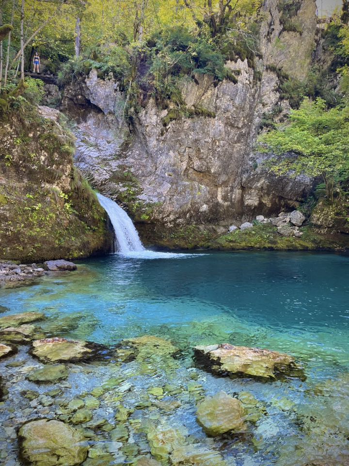
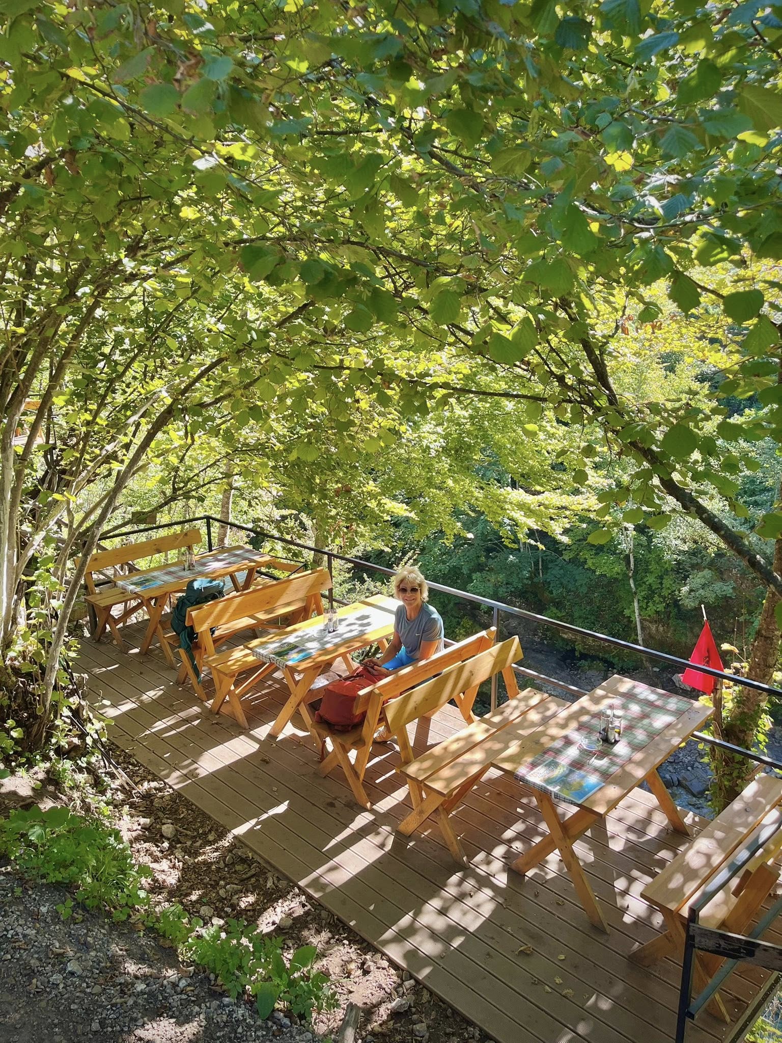
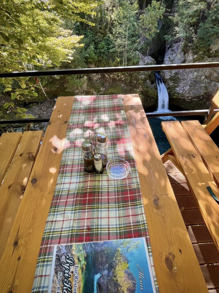
After a refreshing drink at the cliffside restaurant overlooking the Blue Eye pool, we returned on the same path to have lunch at our guesthouse. We passed many people who were heading toward the Blue Eye and were glad we left early to have a peaceful visit.
We were picked up at 1:30pm for our 3-hour transfer back to Shkoder and then onto Tirana for 2.5 hours. The drive to Shkoder was very scenic but difficult to see out of the small minibus windows.
Total stats for Day 7: 6.9km, 2 hours, 12,000 steps, 245m ascent, 245m descent
Summary of Hiking the Albanian Alps
Our tour company provided a sample packing list but I took the below items in my 15kg soft luggage bag and large backpack. I would have to say I used 95% of the clothing and items I brought. I marked an asterisk (*) on the items I did not need.
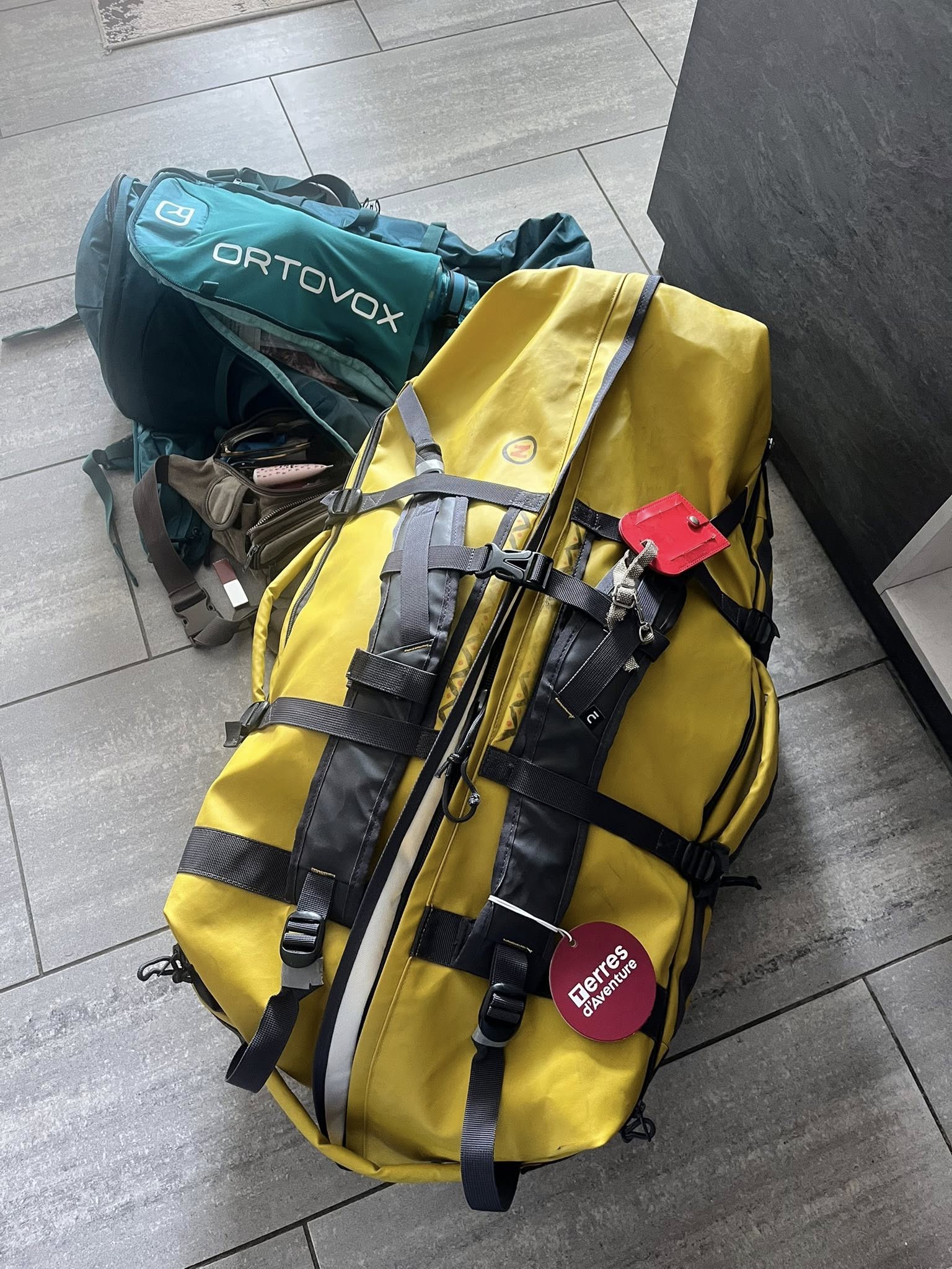
Albanian Alps 1-week Hiking Packing List
- 4 sport tank tops
- 3 lightweight short sleeve tops
- 3 hiking shorts
- 2 hiking pants
- 2 legging pants
- 4 long sleeve sport shirts
- 2 casual pants for airplane/cities/evenings
- 2 casual tops
- 1 casual short
- 4 sport bras
- 5 pair hiking socks
- 4 pair footie socks (to wear with sandals in evenings)
- 8 panties
- lightweight cotton zip up jacket
- warm zip-up jacket
- lightweight puffy jacket
- rain/wind jacket
- rain poncho *
- high ankle hiking boots
- low angle hiking shoes
- sandals & flip-flops
- short bathrobe
- pajama long pants / short sleeve
- wide-brimmed sun hat
- cap / visor
- knee brace cover *
- foldable small backpack (for city walks)
- shoulder fanny pack (for money, phone, passport)
- first aid kit with bandages, tape, scissors, ointment
- foldable hiking poles
- sunglasses
- fingerless gloves *
- bathing suit
- plastic lunch box *
- extra plastic bags (dirty clothes, misc)
- disinfectant gel
- warm neck scarf *
- casual scarfs (for evenings)
- eye mask for sleeping *
- bandanas for hike sweat
- headbands / hair accessories
- sunscreen
- mosquito spray *
- voltaren for muscles
- lotion/shampoo/toothpaste/etc
- electrolytes/protein snacks
- vitamins/ibuprofen
- water camelback
- portable charger
- plugs / charger
- roadbook and trip info
- passport, ID cards, Euros
Weather
As weather can change quite quickly in the mountains, it was necessary to wear layers and be prepared for cold, windy, or rainy weather. Our tour was from September 14-21 and thus had milder temps than the summer months. We were fortunate to only have one morning that was cloudy and foggy. The other days were sunny, and temperatures were between 20 and 25 celsius.
Albanian Alps Guesthouses
We stayed in 3 different guesthouses, 2 of them for 2 nights each. I appreciated not having to pack up my bags everyday. Our package included double rooms with our own bathroom. After a long day of hiking, you wouldn’t want to sleep in a room with others and have to share shower facilities.
Most of our food was included with only exceptions of the first and last days. The guesthouses would prepare a picnic lunch for us to take on the hike. The picnic was quite simple but enough to have a bite up on the mountains. We were told we could drink the water at the guesthouses, which we did and never got sick. In the cities of Shkoder and Tirana, it was advised to buy bottled water.
Our accommodations:
- Hotel Rose Garden (Shkoder)
- Mehmeti (Valbona) – 2 nights
- Kompleksi Zorgii (Theth) – 2 nights
- Prek Bjeshka (Nderlyse)
- Hotel Vila 60 (Tirana)
Self-guided Tour
As I mentioned in the beginning of this article, this is a special type of tour where you are on your own. There is no tour guide or group to rely on. We had a schedule of pick-ups and transportation but the drivers were always someone different and spoke very little English.
Fortunately we met a group of four English-speaking people on the first day who were doing the same itinerary as us and using the same local tour company (Zbulo). Although we were hiking alone everyday, we would cross this group in the van transfers or on the hikes. You can always meet and talk to other hikers on the trail. At no time was I afraid or felt in danger. Funny fact is that we both had cans of pepper spray but never had to use them, on bears or people!
Total Hiking Statistics
My friend and I were quite satisfied with our six days of hiking the Albanian Alps. The total stats were 65km(40 miles), 24 hours walking time, 138,000 steps, 3500m (11,482ft) ascent, 4400m (14,436ft) descent. We never had sore muscles but I did suffer from heel blisters. I was happy that I brought plenty of special bandages to ease the pain!
My friend and I were both 63 years old at the time of this trip. As avid hikers where we live in Switzerland, we were quite prepared for this challenging week. Although I had never done continuous days with high ascents/descents, we survived just fine. We are already planning hiking trips for next year!
Final comments
My trip to Albania increased my total countries to 76. Although we only saw a small part of the country, I was impressed with the scenery and landscapes. I’ve seen they have very nice beaches along the coastline, so maybe I will return one day to experience a different side of Albania.
I hope this article motivated you to hike the Albanian Alps! Depending on the country or area, choosing an organized self-guided hiking tour is an excellent option. If you have any questions about this trip, just leave a comment below or reach out to me by email!
If you are looking for assistance to plan your next trip, I am here for YOU! I love to plan travel itineraries for myself and others. For more details on how I provide this service, please check out my Itinerary Planning page and drop me a quick email at jan@janadventures.com to get started!


You May Also Like
Bucket List Travel for Retirees
5 Lakes Walk in Zermatt Switzerland, a Must-Do!